
Area 2,481 sq mi | ||
 | ||
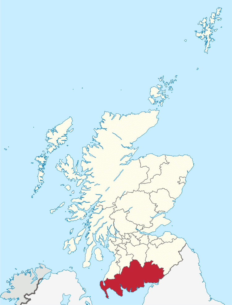
Map of Dumfries and Galloway
Dumfries and Galloway (Scots: Dumfries an Gallowa, Scottish Gaelic: Dùn Phrìs is Gall-Ghaidhealaibh) is one of 32 unitary council areas of Scotland and is located in the western Southern Uplands. It comprises the historic counties of Dumfriesshire, Stewartry of Kirkcudbright and Wigtownshire, the latter two of which are collectively known as Galloway. The administrative centre is the town of Dumfries.
Contents
- Map of Dumfries and Galloway
- Geography
- Water systems and transport routes through the Southern Uplands
- National Scenic Areas
- Governance and Place names
- Transport
- Railway
- Bus and coach
- Sea
- Air
- Roads
- The Port Line
- Emergency services
- Education
- Alternative Schools
- Nurseries and primary schools
- Secondary schools
- Wildlife
- Outdoor activities
- Arts and culture
- Towns and villages
- Places of interest
- Council political composition
- 20032007
- 20072011
- 20122017
- 20172022
- Current Councillors
- Conservative and Unionist
- Labour
- Scottish National Party SNP
- Independent
- Liberal Democrat
- Non Aligned
- References
Following the 1975 reorganisation of local government in Scotland, the three counties were joined to form a single region of Dumfries and Galloway, with four districts within it. Since the Local Government etc. (Scotland) Act 1994, however, it has become a unitary local authority. For lieutenancy purposes, the historic counties are largely maintained with its three lieutenancy areas being Dumfries, Wigtown and the Stewartry of Kirkcudbright.
To the north, Dumfries and Galloway borders East Ayrshire, South Ayrshire and South Lanarkshire; in the east the Borders; and to the south the county of Cumbria in England and the Solway Firth. To the west lies the Irish Sea.
Geography
The Dumfries and Galloway Council region is composed of counties and their sub-areas. From west to east:
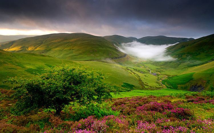
The term 'Dumfries and Galloway' has been used since at latest the 19th century - by 1911 the three counties had a united Sheriffdom under that name. Dumfries and Galloway covers the majority of the Western area of the Southern Uplands, it also hosts Scotland's most Southerly point, at the Mull of Galloway in the west of the region.
Water systems and transport routes through the Southern Uplands
The region has a number of south running water systems which break through the Southern Uplands creating the main road, and rail, arteries north/south through the region and breaking the hills up into a number of ranges.
The A701 branches off the M74 at Beattock, goes through the town of Moffat, climbs to Annanhead above the Devil's Beef Tub (at the source of the River Annan) before passing the source of the River Tweed and carrying on to Edinburgh. Until fairly recent times the ancient route to Edinburgh travelled right up Annandale to the Beef Tub before climbing steeply to Annanhead. The present road ascends northward on a ridge parallel to Annandale but to the west of it which makes for a much easier ascent.
From Moffat the A708 heads north east along the valley of Moffat Water (Moffatdale) on its way to Selkirk. Moffatdale separates the Moffat hills (to the north) from the Ettrick hills to the south.
National Scenic Areas
There are three National Scenic Areas within this region.
Governance and Place-names
The region was created in 1975, by merging the counties of Wigtownshire, Kirkcudbrightshire and Dumfriesshire as a two-tier region with the districts of Wigtownshire, Stewartry, Nithsdale, and Annandale and Eskdale within it. After 1996 the unitary authority became known as Dumfries and Galloway Council still with Wigtownshire, Stewartry, Nithsdale, Annandale and Esdale within it.
County councils as administrative authorities were created in 1889. The present-day, "Dumfries and Galloway Council Area" exist for administrative purposes.
The historic counties of Britain, at least most of them, have existed for around 1,000 years or more and are often logical geographical entities in themselves. In Scotland they originated as Sheriffdoms consisting of a group of parishes over which the sheriff had jurisdiction, replacing native "Celtic" forms of government with Norman feudal structures.
Transport
Transport in the region is operated by bus companies Huston's, McEwan's, Stagecoach Western and McCall's coaches, and train operators Abellio ScotRail, TransPennine Express, Virgin Trains and Nothern.
Railway
The region has seven working railway stations. All are on the Glasgow South Western Line, except Lockerbie which is on the West Coast Main Line.
Bus and coach
The area is served by buses which connect the main population centres. Express bus services link the main towns with Glasgow, Ayr, Edinburgh and Carlisle. Local bus services are also operated across the region.
Sea
Dumfries and Galloway is home to two ports which have services to Northern Ireland, both are in the West of the region. Stena Line and P&O Irish Sea both have a port in the village of Cairnryan.
Air
The region also has no commercial airports; the nearest are Glasgow Prestwick Airport and Carlisle Lake District Airport. The region does host a number of private airfields. The town of Lockerbie was the scene of the Pan Am Flight 103 terrorist attack on December 21, 1988.
Roads
The main roads to and from the region are:
The Port Line
The mainline from Dumfries railway station via Newton Stewart to Stranraer Harbour railway station, was closed under the Beeching Axe. The line previously connected London Euston and the West Coast Main Line with the ferries to Larne Harbour railway station and the Port of Belfast.
The Port Road to Stranraer being the last to go in June 1965 leaving only the original G&SWR main line open to serve the Stranraer. The Beeching Axe cutting the Castle Douglas and Dumfries Railway and Portpatrick and Wigtownshire Railway has resulted in adverse mileage to connect Stranraer with a longer line via Kilmarnock and Ayr.
Emergency services
The Dumfries and Galloway Constabulary (Dissolved 2013 and now Police Scotland) is the police force for the region, and is the smallest in the United Kingdom. Dumfries and Galloway Fire and Rescue Service provide firefighting services across the region. The Coastguard, Lifeboats, Moffat mountain rescue and Galloway Mountain Rescue also offer emergency services across Dumfries and Galloway.
Nith Inshore Rescue is based at Glencaple. This an independent lifeboat providing water rescue cover for the River Nith, surrounding rivers and inland water. Nith Inshore Rescue is a declared facility for HM Coastguard who are the control centre and overseeing authority responsible for call outs.
NHS Dumfries and Galloway provide healthcare services across the region. The two main hospitals are the Dumfries and Galloway Royal Infirmary in Dumfries and Galloway Community Hospital in Stranraer.
Education
Dumfries & Galloway Council provides nursery, primary and secondary education across the region.
Alternative Schools
Nurseries and primary schools
For a list of nurseries and primary schools see this page.
Secondary schools
Wildlife
The region is known as a stronghold for several rare and protected species of amphibian, such as the Natterjack toad and the Great crested newt. There are also RSPB Nature Reserves at the Mull of Galloway, Wood of Cree (Galloway Forest Park), Ken Dee Marshes (near Loch Ken) and Mereshead (near Dalbeattie on the Solway Firth)
Outdoor activities
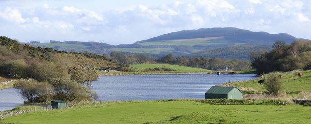
There are five of the world class 7Stanes mountain biking centres in Dumfries and Galloway at Dalbeattie, Mabie, Ae, Glentrool and Kirroughtree. The Sustrans Route 7 long distance cycle route also runs through the region. There is excellent hill walking in the Moffat Hills, Lowther Hills the Carsphairn and Scaur Hills and Galloway Hills. The Southern Upland Way coast to coast walk passes through Dumfries and Galloway and the 53 mile long Annandale Way travels from the Solway Firth into the Moffat hills near the Devil's Beef Tub. There is also fresh water sailing on Castle Loch at Lochmaben and at various places on Loch Ken Loch Ken also offers waterskiing and wakeboarding. The Solway Firth coastline offers endless fishing, caravaning and camping, walking and sailing opportunities.
Arts and culture
Dumfries and Galloway is well known for its arts and cultural activities as well as its natural beauty.
The major festivals including the region-wide Dumfries & Galloway Arts Festival and Spring Fling Open Studios. Other festivals include Big Burns Supper in Dumfries and the Wigtown Book Festival in Wigtown - Scotland's national book town.
Towns and villages
Main settlements in bold text.
Places of interest
Council political composition
Before 2007, the council consisted of 47 councillors elected for a four-year term. 13 Council wards were introduced for the 2007 election with each ward returning three or four members for a five-year term by the single transferable vote system of election. This system was introduced by the Local Governance (Scotland) Act 2004, as a means of ensuring a reasonably proportionately representative outcome.
2003–2007
The result of the 2003 election returned a council with no party having overall control. A 'silver' coalition was first formed involving all parties but Conservative and Labour, after this coalition resigned Labour took minority control of the council. The following number of councillors were elected for each party as follows:
2007–2011
The result of the 2007 election returned the following number of councillors for each party as follows:
After the resignation of Bruce Hodgson (Conservative councillor for the Abbey ward) a by-election was held on 1 May 2008, with Michael Thomson (Conservative) being returned as the replacement councillor. On Tuesday 20 May 2008, Councillor Robert Higgins stood down as Scottish National Party (SNP) Group Leader, after he received a triple driving ban for reckless driving. Similarly Councillor John Charteris Conservative was banned from driving for 12 months and fined £500 after he admitted to drunk driving at Dumfries Sheriff Court on Friday, 29 August 2008
2012–2017
The council was controlled by a Conservative and Scottish National Party (SNP) coalition until late 2013, when the resignation of seven Conservative councillors left the coalition without an outright majority. The council was then controlled from October 2013 by a Labour and SNP coalition until June 2014 when the SNP left due to concerns about how a decision was taken to site a learning hub in Dumfries. The council was then run by a minority administration led by Scottish Labour and Craig Peacock an Independent until the 2017 Scottish local elections.
2017–2022
The result of the 2017 election returned the following number of councillors for each party as follows:
Current Councillors
By political groupings.