
Surface elevation 75 m Mean depth 2.29 m Width 400 m Number of islands 1 | Primary outflows Water of Trool Max. length 1.5 mi (2.4 km) Area 56 ha Length 2.4 km Primary outflow Water of Trool | |
 | ||
Primary inflows | ||
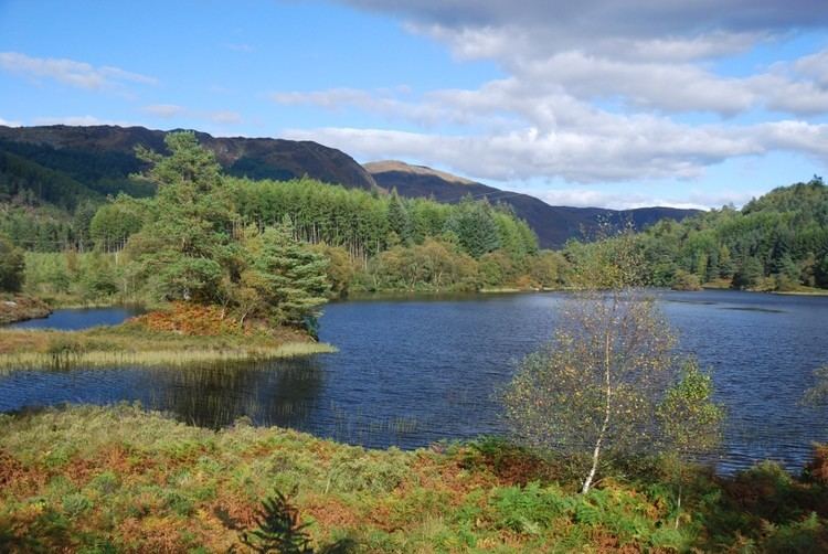
Loch Trool is a narrow, freshwater loch in Galloway, in the Southern Uplands in south-west Scotland. It lies in an elevated position in Glen Trool in the Galloway Forest Park and is approximately 8 mi (13 km) north of the town of Newton Stewart. The loch is the source of the Water of Trool which flows to the Water of Minnoch and the River Cree. The loch and its surroundings are considered an area of natural beauty and there is a scenic footpath around its perimeter.
Contents
Map of Loch Trool, Newton Stewart, UK
In April 1307 Robert the Bruce fought and won the Battle of Glen Trool on the shores of the loch. On its north side stands Bruce's Stone which commemorates the victory.
Loch Trool is also reported to be the darkest place in the UK at night.
Survey
The loch was surveyed in 1903 by James Murray and later charted as part of Sir John Murray's Bathymetrical Survey of Fresh-Water Lochs of Scotland 1897-1909.