
Chapman code WIG | Area 1,261 km² | |
 | ||
Wigtownshire s people
Wigtownshire or the County of Wigtown is a registration county and lieutenancy area in south-west Scotland. Until 1975, Wigtownshire was one of the administrative counties used for local government purposes, and is now administered as part of the council area of Dumfries and Galloway. As a lieutenancy area, Wigtownshire has its own Lord Lieutenant, currently John Alexander Ross.
Contents
- Wigtownshire s people
- Tour of garlieston village wigtownshire scotland
- Description
- Transport
- Railways
- Beeching Axe
- History
- Archaeology
- Civil parishes
- Towns and villages
- Places of interest
- References
Tour of garlieston village wigtownshire scotland
Description
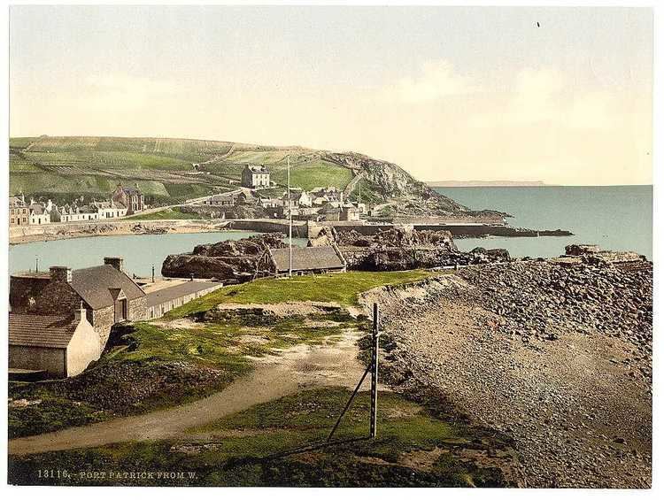
Wigtownshire borders the Irish Sea to the west, the Solway Firth to the south, Ayrshire to the north, and the Stewartry of Kirkcudbright to the east. Together the Stewartry and Wigtownshire are referred to as Galloway. The western area of Wigtownshire is known as Rhinns of Galloway, and the eastern area is known as Machars. Wigtownshire includes the southernmost point in Scotland, the Mull of Galloway, the Machars and the Rhins of Galloway peninsula. The county town was historically Wigtown, with the administrative centre moving to Stranraer, the largest town, on the creation of a county council in 1890.
Transport
Major road links to the area comprise the A77 to the north, and A75 to the east. The European route E18 starts in Northern Ireland and runs from Stranraer, Wigtownshire (A75) – Gretna (M6) – Carlisle (A69) to Newcastle. It then re-joins at Norway, goes through Sweden, Finland and ends at Saint Petersburg, Russia. Like all European routes, it is not signposted as such in the United Kingdom. The European Union is partly financing "The Stranraer and Loch Ryan Waterfront Project", at Inch.
Railways
Stranraer station connects the Glasgow South Western Line to Ayr, Paisley Gilmour Street and Glasgow Central as well as Kilmarnock, and Carlisle for the West Coast Main Line to Preston, Crewe and London Euston.
Beeching Axe
The Beeching Axe cut off the Castle Douglas and Dumfries Railway and Portpatrick Railway in 1965 resulting in an adverse mileage increase via the Glasgow South Western Line to reach Stranraer Harbour from Carlisle and the West Coast Main Line.
History
The 11th-century ex-King of Dublin and Mann, Echmarcach mac Ragnaill, had the title Rex Innarenn, "King of the Rhinns", attributed to him on his death in 1065 AD. The western sections of Galloway had been firmly aligned with the Isle of Man, and Norse and Gaelic-Norse settlement names from the 10th and 11th centuries are spread all along the coastal lands of south-western Scotland.
Archaeology
In 2012 the University of Glasgow led a community archaeology project in Inch, between Stranraer and Cairnryan, including a geophysical survey of the area to the north of the motte at Innermessan. It is a site with a very long history – from the early mesolithic, about 10,000 years ago, to a medieval town, now disappeared, which in its time was more important than Stranraer.
An unnamed detectorist found a gold lunula in a cultivated field near Garlieston, Sorbie in March 2011, the first Scottish gold lunula found in over 100 years. The lunula is a flat, crescent-shaped neck ornament thought to date from around 2300 – 2200 BC, and described by some archaeologists as a symbol of power. The gold sheet, probably hammered out from a bar, is very thin (0.15–0.5 mm) and decorated around its edges with incised and punched zigzags, lines and dots. It had been cut up and folded, and the two pieces do not join; together they amount to just under a third of the original collar. Initial surface analysis has shown that the metal contains 11% silver and 0.5% copper. Further analysis may indicate whether the lunula had been made of Irish or Scottish gold. Staff of Stranraer Museum and the Wigtownshire branch of the University of the Third Age walked the field looking for artefacts. Test pits were dug and Historic Scotland commissioned a geophysical survey. No more metalwork was found, nor any evidence for why the lunula might have been buried there.
From Glenluce Sands there have been recovered "more objects of antiquity than from any area of similar extent in Scotland". The relics range from neolithic to mediaeval times.
The fields between the mound and Dunragit village and Droughduil Mote, Old Luce, Wigtownshire, contain "one of the most important Stone Age sites in Scotland". Aerial photography and archaeological excavation of the henge has revealed the remains of three massive concentric timber circles; the outer circle was 300 metres (980 ft) in diameter, almost six times the size of Stonehenge. Built c.2500 BC, this huge monument was a ceremonial centre and a meeting place for south-west Scotland's early farming communities. Funding for the dig was provided by Historic Scotland and the University of Southampton. The staff at Stranraer Museum assisted with computing and communications facilities and access to collections.
Civil parishes
Wigtownshire is divided into 16 civil parishes.