
Area 1,211 km2 Literacy 73.92 per cent | State | |
 | ||
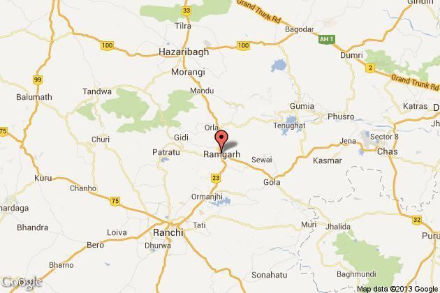
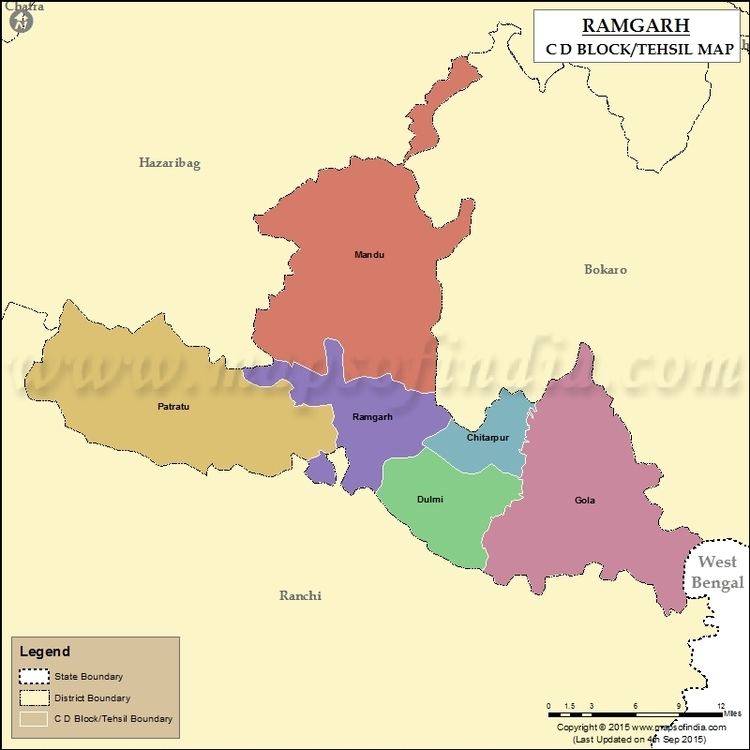
Map of Ramgarh district
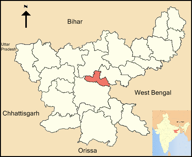
Ramgarh district (Hindi: रामगढ़ जिला) is one of the 24 districts in the Indian state of Jharkhand. It was also a military district during the British Regime, referred to then as Ramghur district.
Contents
- Map of Ramgarh district
- Man beaten to death in jharkhand s ramgarh district on suspicion of carrying beef in his vehicle
- Introduction and geography
- BlocksMandals
- History
- Ancient history
- Medieval period
- Modern era
- Indian National Congress 53rd Session
- Post independence
- Physiography and rivers
- Industries
- Agriculture
- Soils climate forests and wildlife
- Demographics
- Rail
- New Rail Line Project
- Important railway station and train stoppage
- Roads
- Air
- Healthcare
- Schools
- Colleges
- Technical Institutes
- Markets and entertainment
- Culture
- Fairs and festivals
- Cuisine
- Pilgrimage sites
- Rajrappa Mandir
- Historic monuments
- Nature tourism
- Ramgarh in Bollywood
- References
Man beaten to death in jharkhand s ramgarh district on suspicion of carrying beef in his vehicle
Introduction and geography
Ramgarh was made a district on 12 September 2007. It was carved out of erstwhile Hazaribagh District. Ramgarh lies at the heart of the Jharkhand State. It is a mining, industrial and cultural hub with the famous Maa Chhinnamasta Temple. The name Ramgarh means "The Fort of God Ram". The district of Ramgarh has been named after the town Ramgarh, its present headquarters.
The district covers an area of 1360.08 km2.
Subdivision: Ramgarh
District Registration office is in Gola.
Lok Sabha and Vidhan Sabha Constituencies
Lok Sabha Constituencies : Hazaribagh
Vidhan Sabha Constituencies :
- Ramgarh :Ramgarh Police Station (excluding G.Ps. Terpa, Patratu, Koto, Palani, Hapuhua, Harikarpur, Gegda, Deoria, Bargama, Pali, Salgo, Sanki, Jabo, Chaingari, Chikor, Lapanga, Ghutua, Barkakana and Sidhwar-Kalan) and Gola Police Station.
- Mandu (Part):Mandu Police Stations.
- Barkagaon (Part): G.Ps. Terpa, Patratu, Koto, Palani, Hapuhua, Harijarpu Gegda, Deoria, Bargama, Pali, Salgo, Sanki, Jabo, Chaingara, Chikor, Lapanga, Ghutua, Barkakana and Sidhwar-Kalan in Ramgarh Police Station.
Ramgarh District has borders with:
North and West: Hazaribagh District
North and East: Bokaro District
East: Purulia District (West Bengal)
South: Ranchi District
Blocks/Mandals
Ramgarh district consists of 06 BlocksThe following are the list of the Blocks in Ramgarh district:
History
Etymology
The word Ram is derived from Murram and Gadh is derived from Beluagadha. In Hazaribagh district, there is sitagadha and Vishnugadha. Thus, the name 'Ramgarh' must have been derived by using syllables of these places.
Ancient history
History of the Ramgarh District is closely linked with the beginning of human civilisation in India.
Stone age:Along the river Damodar in Ramgarh early stone age (Lower Paleolithic) tools were found
Mahajanapadas
The gigantic king Jarasandh was very powerful, Chotanagpur was in his jurisdiction probably the Chhotanagpur was under sub-ordination of Mahapadam of Magadh. Nand Ugrasen of Nagwanshi’s.
Maurya Empire: It is also said that entire Chhotanagpur was under sub-ordination of Ashoka the Great (c. 273 – c. 232 BC) so that in Buddha period, there was also a Ramgarh.
Buddhism and Jainism: It is certified by the symbolic relics of Buddha period in the temple of Gola. Probably in the 8th century BC. (3) Jain Trithankar was constructed in Parasnath. It is clarified by this that in the beginning of Jainism, There is existence of Ramgarh.
Gupta Empire: King Samudragupta (c. 385 – c. 380 AD) had invaded Eastern Deccan by passing through Ramgarh, so it can be deduced that it was also present at that time. This period has been called the Golden Age of India.
In the regime of the king of Mundaraj, Mudra Munda too, Ramgarh was present. This fact is corroborated by the presence of Munda tribe in Ramgarh.
In Nagvanshi regime, too Ramgarh was present because Chhotanagpur was under control.
Medieval period
Muslim Regime : - In Turk-Afghan period (1206-1526 AD.), Jharkhand the forest country was under subordination of ruler of that time. So, Ramgarh was present in that region too. The Ramgarh regime was established in 1368. The founder King of Ramgarh regime was King Bagdeo Singh. At that time the capital of Ramgarh was in Sira. The headquarters of capital was transferred in urda, Badam, Ramgarh and Padma one by one. In 1670 the headquarters of Ramgarh regime was transferred in Ramgarh. Ramgarh Regime also known as Padma Raja or Regime. In around 1740, Ramgarh was "Jungle District of Ramgarh".
Modern era
British Regime : – The Power of obtaining reference from Ramgarh regime was given to East India Company by King Shah Alam II.
In 1771, Captain Comac was made Military Collector of Ramgarh District, whose headquarters was in Chatra. The military district of Ramgarh contained Nagpur, Palamoo, Hazaribagh, Chatra, Giridih and Kodarma. At that the headquarters of Ramgarh Battalion was Hazaribagh, whose commander was a European. The district name is often spelled "Ramghur" in English documents of the time.
"It appears that the great social reformer and the founder of the Brahm Samaj Raja Ram Mohan Roy was in Ramgarh in1805-06. He went there with Mr. William Digby who was then acting Magistrate and Registrar of Ramgarh. Raja Ram Mohan Roy was the Sheristeder of the Collectorate and lived both at Cahtra and Ramgarh in this capacity when Mr. William Digby was transferred else here he took Ram Mohan Roy with him to his new place of work".
In 1811, Ramgarh Battalion was used for suppressing the Munda Uraon and Tamad Revolt and Kol revolt. In 1837, Ramgarh was police station of British government. In 1938, new G.T. road was started and Banaras road was closed. It is worth mentioning the name of Lubia Manghi. Bainu Manjhi and Arjun Manjhi. In Sitagarh, the cropping of coffee was taking place. The name of Rupu Manjhi is famous in the first national revolt of 1857.
On 8Th January 1856, Sheik Bhikari and Thakur Upraon Singh were hanged on a Bunyan tree of Chhuttupalu valley. This valley is also known as lalki Ghaati and that Bunyan tree is called "Phansiyahi bore".
Ramgarh Cant council was structured in 1941. There are two centers of Army training i.e.Sikh Regimental Centre (SRC) and Punjab Regimental Centre (PRC).
Indian National Congress 53rd Session
In March 1940, INC 53rd Session was accomplished under the presidency of Maulana Abul Qalam Ajad at Jhanda Chowk, Ramgarh now Ramgarh Cant. Mahatma Gandhi, Jawaharlal Nehru, Sardar Patel, Dr. Rajender Prasad, Sarojini Naidu, Khan Abdul Ghaffar Khan, Acharya J.B. Kripalani, Industrialist Jamnalal Bajaj and others greats leaders of Indian freedom movement attended the Ramgarh Session.
Mahatma Gandhi also opened khadi and village Industries Exhibition at Ramgarh. Storm and hurricane was on the peak.
At that time, under the leadership of Netajee Subhas Chandra Bose conference against Samjhauta was completed also. In Ramgarh, Subhsha Chandra Bose was seen as president of All India Forward Block and M.N. Roy was seen as leader of Radicle democratic party.
Post-independence
After independence in 1947, the territory of the present-day Ramgarh district became a part of erstwhile Hazaribagh district. In 1952 Ramgarh Block was created and in 1991 Ramgarh Subdivision was formed. Sikh Regimental Centre was shifted from Merrut to Ramgarh Cant in 1976. On 12 September 2007, Ramgarh was made district consisting Ramgarh, Gola, Mandu and Patratu Block, taking the total count of districts in the state to 24.
Babulal Marandi was the first Chief Minister of Jharkhand, Marandi enters assembly by winning Ramgarh by-poll.
Shibu Soren born in Nemra village of Ramgarh district became chief minister of Jharkhand three times and his son Hemant Soren also became Deputy Chief Minister (11 September 2010 – 18 January 2013) of Jharkhand.
In 2009, two new blocks Dulmi and Chitarpur were created, being carved out from Ramgarh block
On 13 September 2012, Ramgarh become first district of country where payment of Government Scheme like KCC and Indra Awash done through UID or Aadhaar card.
On 8 January 2013, Jharkhand Government has taken decision to merge Dari block of Hazaribag district to Ramgarh District and creation of a new block Chaingada and Government has also taken decision to create new block Mahuatand craved out from Gomia block of Bokaro district and merge them to Ramgarh district but the decision is still pending because President's rule was imposed in Jharkhand on 18 January 2013.
Hemant Soren (born in Nemara in Ramgarh district) was sworn in as the Chief Minister of Jharkhand on 13 July 2013.
Physiography and rivers
Physiography:
The district is a part of Chotanagpur plateau. Important physiographic regions of the district is Damodar Trough or Upper Damodar basin or simply Damodar Valley. Major area of the district comes under Damodar Valley. Damodar Valley is bounded by Hazaribag Plateau in north and Ranchi Plateau in south. Ranchi and Hazaribag plateau is separated by east–west running Damodar Valley.
Barka Pahar (Marang Buru) 1,049 m (3,442 ft) high above sea level located along the Ramgarh-Ranchi border is probably the highest peak, and it also separates the districts.
Rivers and river basins:
Damodar is the main river of the district and it also forms a major river basin, Comprising a number of tributaries. Important amongst them are: Naikari, Bhervi or Bhera and Bokaro river.
In Hindu mythology and folklore Damodar is a Nad means Male River.
Small Rivers are Hurhuri, Gomti, Barki, Kurum, Kochi, Sherbhuki, Dhobdhab etc.
Suwarn Rekha River flow south eastern part of district. Tributaries of Suwarn Rekha are Kadamgara, Khatgara etc.
Waterfalls:
Rajrappa Fall: On the confluence of the Bhairavi (Bhera) and Damodar Rivers.
Dam: Nalkari Dam, Patratu.
Industries
Ramgarh is an important industrial district of East India. Several mineral based industries like Steel, Sponge Iron, Cement, Refractory and Thermal Power Plant etc. are established due to availability of Coal and other minerals. Important industrial unit of district are following:-
Public sector undertaking
Private sector industries
Upcoming projects:
Agriculture
The main occupation of the people of Ramgarh is cultivation. There are three main agricultural seasons in the district, 1) kharif, 2) rabi 3) zaid. Rice, maize, ragi, fruits and vegetables are the main crop of the district.
Soils, climate, forests and wildlife
Soils and climate:
Soils: Mainly two type of soil found -Red Soil and Sand loam.
Climate: The area lies in the sub-humid region of Chotanagpur Plateau and enjoys semi-extreme type of climate. The day temperature rises around 40 °C during the summers and drops down to around 10 °C during the winter.
Three broad seasons can be recognized:
Forests and wildlife:
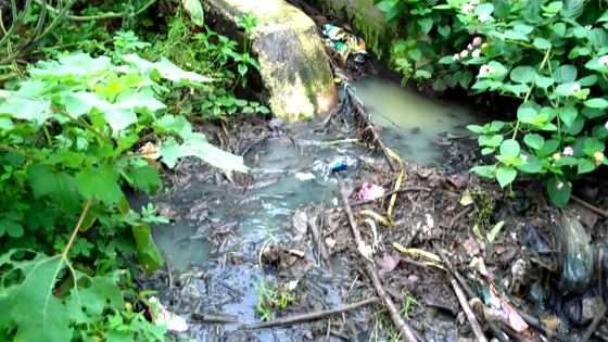
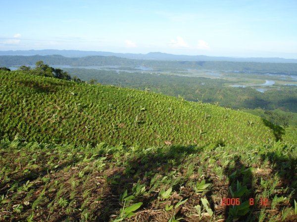
The forest area of the district is 487.93 km2. The district is rich in flora and fauna. Government has planned a deer park in the district. The park will come up on 25 acres (10 ha) on Gola-Muri Road in Gola block. 30 villages in the district is tuskers (elephant) effected.
Demographics
According to the 2011 census, Ramgarh district has a population of 949,159, roughly equal to the nation of Fiji or the US state of Delaware. This gives it a ranking of 459th in India (out of a total of 640). The district has a population density of 684 inhabitants per square kilometre (1,770/sq mi). Its population growth rate over the decade 2001-2011 was 13.06%. Ramgarh has a sex ratio of 921 females for every 1000 males, and a literacy rate of 73.92%.
Rail
The district has very good network of railways. In 1927, Bengal Nagpur Railway (BNR) opened the 72-mile (116 km) Chandil-Barkakana section to traffic. In the same year the Central India Coalfields (CIC) Railway opened the Gomoh-Barkakana line. It was extended to Daltonganj in 1929. Later it is extended to Sonnagar on Howrah-Delhi Grand Chord line and one more branch extended to singrauli from Garwa Road.
At present the district railway network is divided between two zone East Central Railways and South Eastern Railway.
Ramgarh Cantonment, Mael, Barkipona, Gola Road, Harubera, Sondimra and Barlanga Station come under Ranchi Division of SER.
Ranchi Road, Chainpur, Argada, Barkakana Junction, Bhurkunda, Patratu and Tokisud station come Under Dhanbad Division of ECR.
Barkakana is a Railway sub-division under Dhanbad division of East Central Railway zone.Doubling of Danea-Ranchi Road line has announced in the Railway Budget 2013-14.
New Rail Line Project
Ranchi-Tatisilwai-Mesra-Sidhwar-Barkakana-Hazaribag-Koderma-Tilaiya Junction railway station(Bihar)
Ranchi-Koderma-Tilaiya Junction railway station (Bihar) new rail line project of the state is passing through the district. The district portion between Sidhwar-Barkakana-Kuju and Mandu is already completed. The distance between Ranchi and Barkakana by train will be reduce to half by this new rail line. Completion of this project will also shorten the distance between Barkakana, Patna and Delhi. The Bakhtiyarpur–Rajgir line was extended to Tilaiya in 2010. After completion of this line Barkakana will connected with Bakhtiyarpur. Rajgir, Biharsharif etc. Tilaiya Junction railway station is situated near Rajoli of Nawada district of Bihar,please do not be confused with Tilaiya, Tilaiya Dam, or Jhumri Tilaiya of Jharkhand.
57 km long Barkakana- Hazaribagh section of Koderma-Ranchi new line project was inaugurated on 7 December 2016 by Railway Minister Suresh Prabhu in the presence of Chief Minister Raghubar Das.
Special passenger train service started on 31 March 2017 from Barkakana Junction to Sidhwar station of Barkakana–Ranchi new line section.
Railway Station between Barkakana to Koderma: Barkakana,Arigada, Kuju,Mandu halt,Charhi, Bes, Hazaribagh Town,Kanasar Nawada, Katkamasandi, Kathautia, Kurhagada, Padma, Barhi, Urwan, Pipradih, Koderma.
Distance: Barkakana to Hazaribagh-57Km.Hazaribagh to koderma-80Km. Barkakana to Koderma via Hazaribagh through new rail line is 137km. Barkakana to Koderma via Gomo is 195km through old Central India Coalfields Railway( CIC Now ECR) line
Several new route will also open after the completion of this project which are following:-
New route for New Delhi:-
Barkakana-Kuju-Hazaribagh-Barhi-koderma-Gaya-NewDelhi
Three new route for Patna:-
a)Barkakana-Kuju-Hazaribag-Barhi-Koderma-Gaya-Jahanabad to Patna
b)Barkakana-Koderma-Tilaya-Natesar-Rajgir-Nalanda-Biharsharif-Bhaktiyarpur-Fatuah to Patna
c)Barkakana-Koderma-Tilaya-Natesar-Islampur-Fatuah to Patna (after compilation of Natesar-Islampur (21 km) rail line)
Three new route for Katihar,Saharsa, North East India and Nepal:-
a) Barkakana-Koderma-Tilaya-Natesar-Rajgir-Biharsarif-Bhaktiyarpur-Barauni-Begusarai-Khagaria-Mansi to Saharsa and Katihar
b)Barkakana-Koderma-Tilaya- Nawada-Shekhpura-Lakehesarai-Barauni-Begusarai-Khagaria-Mansi to Saharsa and Katihar
c) Barkakana-Koderma-Tilaya- Nawada-Shekhpura-Lakehesarai-Kiul-Jamalpur –Munger-Sahebpur kamal-Khagaria-Mansi to Sharsha and Katihar
Two new route for Bhagalpur:-
a) Barkakana-Koderma-Tilaya-Nawada-Shekhpura-Lakehesarai-Kiual-Jamalpur-Sultanganj-Bhagalpur
b) Barkakana –Koderma-Kawar-Giridih-Madhupur-Jashidih –Deogarh-Banka-Barahat to Bhagalpur(After compilation of Kawar- Gridih(approx 15 km) rail line)
Two New route for Muzafarpur and Dharbanga
a)Barkakana-Koderma-Tilaya-Natesar-Rajgir-Biharsarif-Bhaktiyarpur-Barauni-Samastipur to Muzafarpur and Dharbhanga
b)Barkakana-Koderma-Tilaya- Nawada-Shekhpura-Lakehesarai-Barauni-Samastipur to Muzafarpur and Dharbhanga
New route for Deogarh and Dhumka
Barkakana –Koderma-Kawar-Giridih-Madhupur-Jashidih to Deogarh& Dumka(After compilation of Kawar- Giridih(approx 15 km) rail line)
Important railway station and train stoppage
Barkakana Junction Railway Station :
Barkakana junction is the only junction in the district.
Elevation: 342 m (1,122 ft) above sea level
Zone: ECR/East Central Division: Dhanbad
- Barkakana-Patna, Palamu Express, (daily) Via:Daltonganj
- Jabalpur-Howrah, Shaktipunj Express,(daily) Via:Dhanbad
- Tatanagar-Raurkela-Jammutawi Express,(daily)
- Ranchi-Delhi(Anand Vihar), Jharkhand Swarn Jayanti Express(three days)
- Barkakana- Rajendranagar (Patna), Slip Express (daily) b) Rajendernagar (Patna)-Barkakana, Slip Express, (daily) Via:Gomo
- Ranchi-Chopan Express (three days) b) Chopan-Ranchi Express (three days)
- Sambalpur-Varanasi Express (two days) b) Varanasi-Sambalpur Express (two days)
- Howrah-Bhopal Express (weekly) b) Bhopal-Howrah Express (weekly) Via:Dhanbad
- Kolkatta-Ajmer Express (weekly) b) Ajmer-Kolkatta Express (weekly) Via:Dhanbad
- Kolkata-Ahmedabad Express (weekly) b) Ahmedabad KolkattaExpress (weekly) Via:Dhanbad
- Sataragachi-Ajmer Express (weekly) b) Ajmer-Santragachi Express (weekly):Via Tatanagar, Katni, Kota
- Ranchi-Varanasi Express (four days) b) Varanasi-Ranchi Express (four days)
- Ranchi-Ajmer Garib Nawaz Express (weekly) b) Ajmer-Ranchi Grib Nawaj Express (weekly) Via:Varanasi, Agra Fort,Jaipur
a) Rajdhani Express : Ranchi-New Delhi-Ranchi (Commercial Stoppage started from 1 October 2016)
b) Garib Rath : Ranchi-New Delhi-Ranchi (Commercial Stoppage started from 1 October 2016)
Passenger Train(Ranchi-Barkakana-Hazaribag-Koderma new rail line)
a) Barkakana-Koderma
b) Koderma-Barkakana
Ramgarh Cantt Railway Station:
Ramgarh cant railway station situated at Bijulia near NH33. It is around one km from city bus stand,
- Tatanagar-Raulkela-Delhi-Jammutawi Express, (daily) b) Jammutawi-Delhi-Raulkela-Tatanagar Express, (daily)
- Ranchi-Delhi (Anand Vihar),Jharkhand Swarn Jayanti Express(three days) b) Delhi (Anand-Vihar)-Ranchi,Jharkhand Swarn Jayanti Express(three days)
- Ranchi-Chopan Express (three days) b) Chopan-Ranchi Express (three days)
- Sambalpur-Varanasi Express (two days) b) Varanasi-Sambalpur Express (two days)
- Ranchi-Varanasi Express (four days) b) Varanasi-Ranchi Express (four days)
- Ranchi-Ajmer Garib Nawaz Express (weekly) b) Ajmer-Ranchi Garib Nawaz Express (weekly) Via:Varanasi, Agra Fort, Jaipur
Ranchi Road Railway Station:
Ranchi Road Railway station is situated in the Northern side of the Ramgarh city. In 1927, the Central India Coalfields Railway opened the Gomoh-Barkakana line. Jharkhand capital Ranchi was once connected only by narrow gauge line and at that time Ranchi Road Railway station was the nearest Broad gauge station to the Ranchi City.
- Jabalpur-Howrah, Shaktipunj Express (daily) b) Howrah-Jabalpur, Shaktipunj Express, (daily)
- Barkakana- Rajendranagar (Patna), Slip Express (daily) b) Rajendernagar (Patna)-Barkakana, Slip Express, (daily)
Patratu Railway Station:
- Barkakana-Patna, Palamu Express, (daily) b) Patna-Barkakana, Palamu Express, (daily)
- Jabalpur-Howrah, Shaktipunj Express (daily) b) Howrah-Jabalpur, Shaktipunj Express, (daily)
- Tatanagar-Raulkela-Delhi-Jammutawi Express, (daily) b) Jammutawi-Delhi-Raulkela-Tatanagar Express, (daily)
- Ranchi-Delhi (Anand Vihar), Jharkhand Swarn Jayanti Express b) Delhi (Anand-Vihar)-Ranchi, Jharkhand Swarn Jayanti Express
- Sambalpur-Varanasi Express (two days) b) Varanasi-Sambalpur Express (two days)
- Ranchi-Chopan Express (three days) b) Chopan-Ranchi Express (three days)
- Ranchi-Varanasi Express (four days) b) Varanasi-Ranchi Express (four days)
- Ranchi-Ajmer Garib Nawaz Express (weekly) b) Ajmer-Ranchi Garib Nawaj Express (weekly)
Burkunda Railway Station:
- Barkakana-Patna, Palamu Express, (daily) b) Patna-Barkakana, Palamu Express, (daily)
Gola Road Railway Station:
- Tatanagar-Raulkela-Delhi-Jammutawi Express, (daily) b) Jammutawi-Delhi-Raulkela-Tatanagar Express, (daily)
Roads
Road are the major means of transportation in the district. Three major expressways (NH-33, NH-23 and SH-2) pass through the district. State Highways Authority of Jharkhand (SHAJ) is planning to construct a four-lane road between Patratu and Dhanbad via Sayal, Naya mor, Chas mor and Raj ganj.
National Highway
Main National Highways crossing the district are NH-33 and NH-23.
National Highway 23 connects with NH-33 at Mahatma Gandhi Chowk, Ramgarh Cant.
State highway and other important roads
Ramgarh-Barkakana-Bhurkunda-Patratu-kanke-Ranchi (Four lane work under construction)57 km
Air
Birsa Munda Airport (45 km) at Ranchi is the nearest Airport. Direct links are available to prominent cities such as Delhi, Patna, Mumbai and Kolkata.
Healthcare
Central Coalfield Ltd
State government
Private sector
Schools
Central government schools
Private sector schools
J.M.DIVINE ADARSH VIDYA (p) SCHOOL , Chhattar Mandu ,Ramgarh
State government schools
Other schools
Colleges
Constituent colleges:
Non constituent colleges:
Technical Institutes
Engineering colleges A new Engineering college started this year 2013. Ramgarh Institute of Technology. Government is also planning to open Jharkhand state first women’s engineering College at Ramgarh.
Medical colleges
Government is planning to open a new ESI Medical College in the district.
Management College
Birsa Institute Of Technical Education (B.I.T.E. Ramgarh) started in 2012 at Ramgarh
Pharmacy College/Institute
Trinity Education: Ranchi Road,Ramgarh cantt
Markets and entertainment
Markets: Main markets are Ramgarh, Patratu, Bhurkunda, Kuju and Gola.
Cinema halls:
Clubs:
Museum
Zarina Khatoon Museum Cum Research Centre at Chitarpur.
Culture
Ramgarh culture is rich and diverse and as a result unique in its very own way. Rajrappa Mandir and Tooti Jharna Mandir is a popular destination for marriage ceremonies.
Fairs and festivals
The major and most celebrated fairs and festivals include Dipawali, Holi, Chhath, Dussehra or Durga Puja or Navaratri, Ramanavami, Karma, Sarhul, Tusu, Eid, Sarsawati puja, Makar Sankranti, Jivitputrika or Jitiya (Hindi: जिउतिया) etc. Due to presence of industries and mining activities Viskarma Puja is also one of the important festival. Makar Sankranti fair in Rajrappa mandir also attracts lots of people. Fairs also organized during Jitiya, karma and others festival.
Cuisine
Ramgarh has a variety of foods and cuisines. The most known and common cuisine in Ramgarh that are practically prepared in every household includes Roti (Chapati) or Phulka, Rice or Bhat, Dal, Sabzi or Tarkari and last but definitely not the least, Achar or Pickle. Duska and Vada is famous local fast food. Salty Duska ingredients is rice and urad dal. Ingredient of Vada is also urad dal. Different types of flowers and leaves are used as a vegetables like Bamboo shoot pakoras, Pampkin flower fried pakoras, Khukri or mushroom tarkari etc. Khoya pedas of Rajrappa mandir is also famous dry sweets.
Pilgrimage sites
Tooti Jharna Temple: Situated about 7 km from Ramgarh cantonment on NH-33 Patna-Ranchi highway a famous temple of Lord Shiva where water from river falls through a canal on Shivalinga. The Raghu baba of this temple is belongs from the nearby village Digwar and hence most of the Digwar villagers are connected with this temple. To reach this tample is very simple. Just take a route of Ranchi-Patna road and take a right turn from Ranchi Road. It is very near to Ranchi road, just 2–3 km ahead towards the way of Village Digwar.
Mayatungri Temple:It is also known as daughter of the Hills and is 5 km South of Ramgarh in the Chutupalu Valley. This hill has much natural scenery and is a beautiful tourist spot. Although it is located on a height of 300 ft, it takes only 15 minutes to march its peak. Every year the local festival of karma is celebrated here with gaiety and fanfare by the people of the surrounding villages. It is popularly believed that worshipping on the hill brings rain to this area. Nowadays on the occasion of Durgapuja, Nawratra is performed twice a year on this hill.
Kaitha Shiv Mandir: This ancient temple of Shiwa is loeated on NH-23 and is 3 km away from Ramgarh cantonment. It has been declared as a National Monument. The temple was built in 1670. The sculpture of this temple is extremely attractive. The Shivalinga in the temple is located at a height which is accessible by means of two stairs. A detailed analysis of this temple shows that some of its portion was also used for military purpose. At present this temple is in a dilapidated condition.
Khere Math: Khere Math temple of Gautama Buddha is situated at Matwa-tand village near NH-23 of Gola Block.
Gurudawara Singh Sabha: This Gurudwara was established and inaugurated by the Sikh community of Ramgarh around 1940 in a small room situated on Shivajee road in Ramgarh. But today a grand structure has taken the form of Gurudwara Sri Guru Singh Sabha in place of that small room. It is the centre of attraction for its great tomb and minarets. The interior decoration of the Darbar hall of Gurudwara Sahib is picture squire.
Rajrappa Mandir
The famous Maa Chhinmastika temple (मां छिन्नमस्तिका मंदिर) is situated at Rajrappa (रजरप्पा), 28 km away from Ramgarh Cantonment on the confluence of rivers Damodar and Bhairavi or Bhera. This temple finds place in Vedas and Puranas and it has been recognized as an ancient and strong source of Shakti. The Chhinamastika Temple is a very holy and popular place of Hindu pilgrimage. Devotees from all corners of Country visit this holy place throughout the year. The temple is very old and its architectural design is the same as that of other temples of tantrik importance. Though its antiquity is yet to be dated. Marriages are also solemnized here on a large scale. The headless statue of Goddess Chhinamastika stands upon the bodies of Kamdeo and Rati in a lotus bed. A number of other temples have come up around the original temple. Particularly, the temples of Mahavidyas (Tara, Shodashi, Bhubneswari, Bhairavi, Bagla, Kamla, Matangi, and Dhumavati) built in a series and others temple like Sun God temple, Lord Shiva temple God hanuman temple, Ma Kali temple etc. In Hindu Mythology Damodar is considered an incarnation of God Shiva and while Bharvi is Goddess Shakti. Confluence of both river in Rajrappa consider as scared union of Damoder (God Shiva) and Bharvai (Goddess Shakti). The water of river Bharvi flow down from top to river damoder which is flows below, it is also shows Goddess or Devi power. Many take a dip in the river before offering puja (Hinduism).
Rajrappa is not only famous Shakti Peeth (शक्तिपीठ) but also a great picnic spot. Picnic at Rajrappa provides one with double excitement as one could get opportunity to offer prayers to goddess and also enjoy the picnic with fun and food in the sands of river amid beautiful natural scenario of forest, green valleys, hills and rocky terrains. Food, cooking materials, groceries, milk, fruits and fresh vegetable are also available in the market. Now one portion of sand beach of river Bharvi is prepared for picnic by madir samiti with the help of caretaker or agent. They will provide space with Chatai, table etc. after paying some nominal charge. During the rainy season the paid sand beach submerged with water.
How to Reach
By air: The nearest airport is Ranchi (70 km)
By rail: The nearest railway stations are Ramgarh Cant station (28 km), Ranchi Road (30 km), Barkakana (33 km), Ranchi (70 km), Koderma (135 km).
By road: Get down at Ramgarh Cantonment and take a trekker or jeep to reach Rajrappa Mandir. From early morning to evening trekker or jeep are available at old bus stand.
Bus service:
Only one bus service provided by Ramgarh project Cooperative Society is running between Rajrappa mandir to Ranchi (Ratu Road) via Ramgarh Cantonment. (Please check the availability and time)
Regular bus services are available from new bus stand Ramgarh Cantonment to all important places of Jharkhand and Bihar.
Road route:
Ramgarh Cant-Chitarpur (Rajrappa Mor)-Rajrappa Mandir (17+11=28 km)
Gola-Rajrappa Mandir (13 km). (Do not go during rainy season)
Gola-Chitarpur (Rajrappa Mor)-Rajrappa Mandir
Accommodations
Low and medium budget hotels are available at Ramgarh Cant.
Jharkhand tourism dept. has constructed a new mega complex in Rajrappa mandir for tourist which consists:
The Dharamsala (rest house) consists of 16 deluxe rooms. One stage is also constructed for the purpose of marriage and other ceremony. The complex is ready and shortly going to open for public.
Historic monuments
Mahatama Gandhi Samadhi Sathal:
This sthal popularly known as Gandhi Ghat is situated on the bank of river Damodar in Ramgarh. Mohandas K. Gandhi had visited Ramgarh in 1940 at the time of the Indian National Congress session at Ramgarh. After the assassination of Mahatma Gandhi in 1948, the pitcher containing the remains of the departed soul were dispatched to different places of our country and Ramgarh is fortunate to be one of those places. A Samadhi of Gandhiji was erected on it. Earlier, a fair used to be organized here on the occasion of the birthday and anniversary of Bapu but now this practice has been abandoned. The Samadhi is made of Black Granite Stones.
China Cemetery: Situated 5 km away from Ramgarh cantonment, China Kabristan is a famous historical monument. At the outbreak of World War II some soldiers who rose in history against Mawtse tunge the grate hero of Cultural Revolution and who were also the supporters of the friendly states were made capture and imprisoned at Ramgarh. After a few days these soldiers died of hunger and snake bites. A collective burial ground of these soldiers who had died of hunger and snake bites was made in this China Kabristan where these are a total of 667 graves. In the middle of the graveyard a pillar in memory of Chyan Kai Sek was erected. The total area covered by this graveyard is around seven acres. There is a Buddha temple also in its vicinity. Three beautiful cantonment have come into existence around the graveyard. Inside the graveyard the pucca roads have been indorsed with rows of beautiful flowers. China Kabristan is in fact a material witness to the annals of the history of Ramgarh.
Megalithic sites of Ramgarh District: Ramgarh district is very rich in ancient and historical sites, different Megaliths site has been identified near Chitarpur, Gola and Kuju.
Nature tourism
Nalkari Dam :Nalkari or PTPS dam Constructed on Nalkari and others small rivers is around 5 km from Patratu. Surrounded by hills, forest and rivers, Nalkari dam is a beautiful site for picnic and boating.
Dhur-duria Fall: Dhurduria fall situated near Sidhwar village is about 4 km from Ramgarh Cantt. The fall is created on the course of Sherbhuki river. Road is up to Sidhwar village only so approach road should be constructed from Sidhwar village to fall. The water falls from approximately 50 ft height.
Am-Jharia Fall: Situated near the border of Halwadi and Sidhwar village.
Nimi Fall:Nimi fall situated near nimi village and around 5 km from Bhurkunda.
Dhara Fall: Dhara Fall is situated near Khakara village under Gola Block. Government is planning to construct approach road from NH-23 (between Gola and Peterwar) to fall.
Gandhaunia (Hindi: गंधौनिया (गरम पानी कुंड)): Situated at about 20 km. near Mandu. It is a hot water spring (pond).
Chutupallu: Situated at about 10 km from Ramgarh on the Ramgarh - Ranchi NH 33 is a hill top with awesome beauty. There are many a dhabas and motels in the way after crossing Chutupallu that offer great food. The scenic beauty in the ghats is worth seeing getting mesmerized by the scene is very common even if you visit the place many daily.
Bankhetta: Situated near Chutupallu. Water falls from a height giving the feeling of rainfall in a cave when someone claps inside.
Liril Fall: Situated between Ramgarh and Chutupallu looks like the fall from the old Liril Soap advertisement. It is popularly known as Liril Fall. A great picnic spot.
Barso Paani: Situated at about 30 km. from Ramgarh near Charhi towards Hazaribagh. Water falls from the ceiling giving the feeling of rainfall in a cave when someone claps.
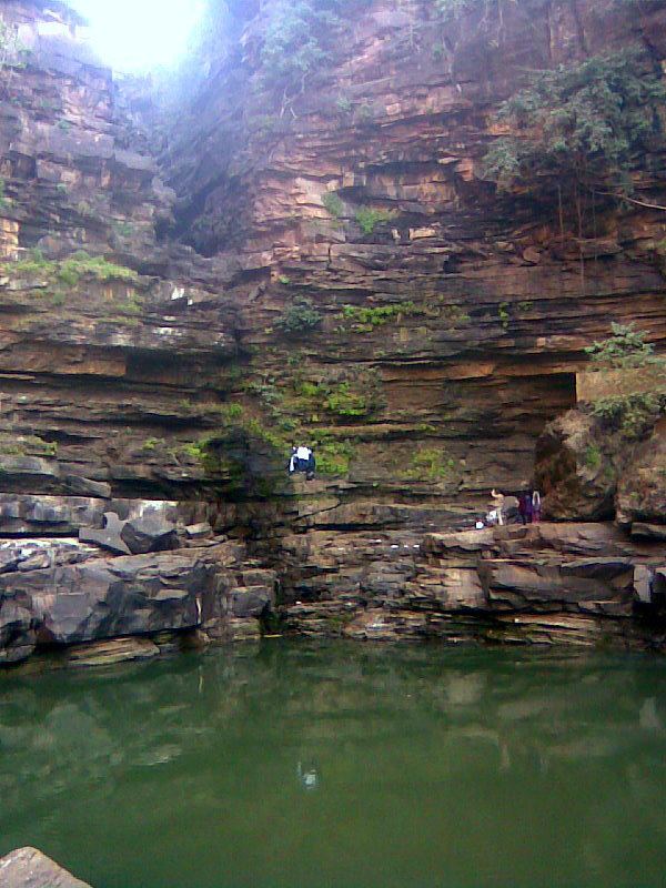
Hundru Fall:The Hundru Fall located near the Ranchi-Ramgarh district border is created on the course of the Subarnarekha River.
Road route for tourist coming from Hazaribagh, Dhanbad and Bokaro:
Shortest route but do not go during rainy season
All-weather road