
Country India Languages spoken Hindi, Santali | State District Hazaribagh | |
Colleges and Universities Vinoba Bhave University, St Columbas College - Hazaribagh, Markham College of Commerce | ||
Hazaribagh is a city and a municipality in Hazaribagh district in the Indian state of Jharkhand. It is the divisional headquarters of North Chotanagpur division. It is famous as a health resort and for Hazaribagh National Park (17 km from city). It is represented in the Indian Lok Sabha by its Member of Parliament Jayant Sinha
Contents
- Map of Hazaribagh
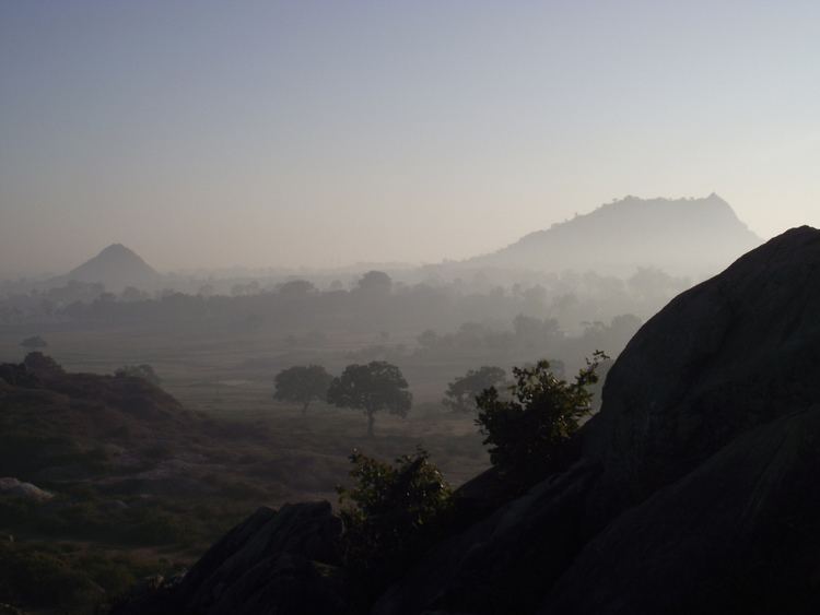
- Wooden sticks catch fire from water in hazaribagh jharkhand
- Geography
- History
- Economy
- Tourist attractions
- References
Map of Hazaribagh
Wooden sticks catch fire from water in hazaribagh jharkhand
Geography
Konar River, a tributary of Damodar River, flows past the town. Hazaribagh has been a thick forest earlier and is still surrounded by forests.
History
In ancient times the district was covered with inaccessible forests inhabited by tribes who remained independent. The entire territory of Chhotanagpur, known as Jharkhand (meaning forest territory) was presumably beyond the pale of outside influence in ancient India. Throughout the Turko-Afghan period (up to 1526 CE), the area remained virtually free from external influence. It was only with the accession of Akbar to the throne of Delhi in 1556 that Muslim influence penetrated Jharkhand, then known to the Mughals as Kokrah. In 1585, Akbar sent a force under the command of Shahbaj Khan to reduce the Raja of Chotanagpur to the position of a tributary. After the death of Akbar in 1605, the area presumably regained its independence. This necessitated an expedition in 1616 by Ibrahim Khan Fateh Jang, the Governor of Bihar and brother of Queen Noorjehan. Ibrahim Khan defeated and captured Durjan Sal, the 46th Raja of Chotanagpur. He was imprisoned for 12 years but was later released and reinstated on the throne after he had shown his ability in distinguishing a real diamond from a fake one.
In 1632, Chotanagpur was given as Jagir to the Governor at Patna for an annual payment of Rs.136,000. This was raised to Rs.161,000 in 1636. During the reign of Muhammad Shah (1719–1748), Sarballand Khan, the Governor of then Bihar, marched against the Raja of Chotanagpur and obtained his submission. Another expedition was led by Fakhruddoula, the Governor of Bihar in 1731.
He came to terms with the Raja of Chotanagpur. In 1735 Alivardi Khan had some difficulty in enforcing the payment of the annual tribute of Rs. 12000 from the Raja of Ramgarh, as agreed to by the latter according to the terms settled with Fakhruddoula.
This situation continued until the occupation of the country by the British. During the Muslim period, the main estates in the district were Ramgarh, Kunda, Chai and Kharagdiha. Subsequent to the Kol uprising in 1831 that, however, did not seriously affect Hazaribag, the administrative structure of the territory was changed. The parganas of Ramgarh, Kharagdiha, Kendi and Kunda became parts of the South-West Frontier Agency and were formed into a division named Hazaribag as the administrative headquarters.
In 1854 the designation of South-West Frontier Agency was changed to Chota Nagpur Division, composed of five districts - Hazaribagh, Ranchi, Palamau, Manbhum, and Singhbhum. The division was administered as a Non-regulation province under a Commissioner reporting to the Lieutenant Governor of Bengal. In 1855-56 there was the great uprising of the Santhals against the British but was brutally suppressed.
During British rule, one had go by train to Giridih and then travel in a vehicle called push-push to Hazaribagh. It was pushed and pulled by human force over hilly tracts. It was exciting journey across rivers and through dense forests infested with bandits and wild animals. Rabindranath Tagore travelled in a push-push along the route in 1885. He has recorded the experience in an essay, Chotanagpur families. When the Grand Chord was opened in 1906, Hazaribagh Road station was linked with the town. For many years, Lal Motor Company operated the rail-cum-bus service between Hazaribagh town and Hazaribagh Road station.
In 1912, a new province of Bihar and Orissa was split from Bengal Province. In 1936, the province was split into separate provinces of Bihar and Orissa, with the Chota Nagpur Division part of Bihar. Bihars boundaries remained mostly unchanged after Indian Independence in 1947.
After 1991 census, the district of Hazaribag has been divided into three separate districts, viz., Hazaribag, Chatra and Koderma. The two sub-divisions namely Chatra and Koderma were upgraded to the status of independent districts.
In 2000, Jharkhand was separated from Bihar to become Indias 27th state.
Economy
Hazaribagh has the 2nd highest coal reserve in Jharkhand (1st is Dhanbad region) and is still largely intact. Recently there has been a spurt in the coal mining activities in the region by Central Coalfields Ltd, a subsidiary of Coal India Limited. Work is currently going on for the development of NTPCs 3000 MW Super Thermal Power Project, and Reliance Powers 3600 MW Thermal power project Super Thermal Power Project. A major NTPC township is also coming 10 km from city. Many Steel Plants and other industries are also envisioned due to its proximity to coal, water and power. Damodar Valley Corporation has a number of offices in Hazaribagh.
Tourist attractions
- Barso Pani Cave is located at Barkagaon in Hazaribagh District.
- Budhwa Mahadev Mandir (Lord Shiva Temple)
- Kanheri Hill(meaning bow-arrow shaped in Santhali) not to be confused with Canary is a popular spot for nature lovers. There is a guest house and a watch tower on the top of the hills. Recently a proposal has been submitted for setting up a tiger and deer safari at the place.
- Hazaribagh National Park is located with hillocks, deep nullahs, thick tropical forests and grassy meadows. The Sanctuary has wild bears, sambhar, nilgai, chital and kakar, sloth bears, tigers and leopards.
- Konar Dam situated about 50 km East of Hazaribag.
- Narsingh Temple dedicated to Narsingh avatara (incarnation) of Lord Vishnu.
- Panchmandir.
- Rajrappa Mandir which is 80 km away at the bank of river Damodar is a very sacred place.
- Surajkund hot spring which is 60 km away from city on NH2 near Barkattha village.
- Swarnajayanti Cafeteria at Hazaribagh Jheel (Natural Lake)is a major family attraction.
- Tillaya (Jhumri Tillaya) Dam 45 km North from Hazaribag.
- The lake of hazaribag is also famous as cafeteria which is the picnic spot in the heart of the town
- The Chadwa Dam, about 15 km away from the town, is another picnic spot.
- Saheed Nirmal Mahto Park which is 2 km away from Dist. Board Chowk Hazaribagh o NH33
- Hazaribagh railway station is also a great source of soharai art and one of most beautiful railway station of the state.