
 | ||
Similar | ||
La vall e de la maurienne echapp es belles
Maurienne is one of the provinces of Savoy, corresponding to the arrondissement of Saint-Jean-de-Maurienne in France. It is also the original name of the capital of the province, now Saint-Jean-de-Maurienne.
Contents
- La vall e de la maurienne echapp es belles
- Happy we are from saint jean de maurienne
- Location
- Roads and railways
- Districts
- Economy
- History
- The Basse Maurienne
- The Haute Maurienne
- Skiing and snowboarding
- Alpinedownhill
- Cross country
- References
Happy we are from saint jean de maurienne
Location
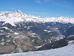
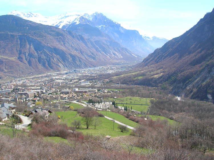
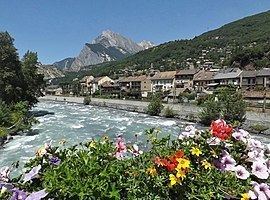
The Maurienne valley is one of the great transverse valleys of the Alps. The river which has shaped the valley since the last glaciation is the Arc. The valley begins at the village of Écot (in the commune of Bonneval-sur-Arc), at the foot of the Col de l'Iseran, and ends at the confluence of the Arc and the Isère in the commune of Aiton. The mountains on the southern side are the Dauphiné Alps and the Cottian Alps. On the northern side are the part of the Graian Alps known as the Vanoise. The capital, Saint-Jean-de-Maurienne, lies at the confluence of the Arc and the Arvan River.
Roads and railways
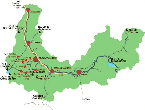
Part of the main road and rail route between Lyon and Turin runs through the valley. The A43 autoroute and a railway line enter at the western end from the Isère valley, and leave at Modane using the Fréjus Road and Rail Tunnels respectively which both emerge at Bardonecchia in Italy.
The other roads out of the valley use the following mountain cols:
Other cols such as the Col d'Etache, Col du Carro and the Col de Vallée Etroite are only passable on foot.
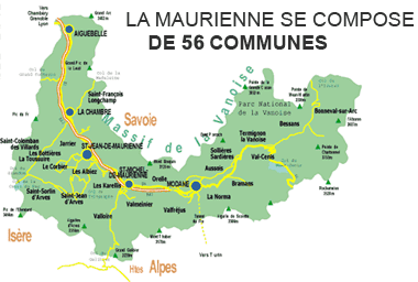
Districts
The province contains the following cantons:
Economy
The abundance of hydro-electric power (there are twenty-four hydroelectric stations in the valley) created heavy industry such as electrochemical plants and aluminum refining, but now the emphasis in the area is on tourism, especially winter sports. Numerous ski resorts line the valley, from the small villages like Albiez-Montrond to the purpose-built resorts, dating from the 1970s like Le Corbier and Les Karellis.
The Vanoise National Park and its protected surroundings are a major tourist attraction. Alpine ibex, grey wolves, lynx, royal eagles or vultures are among the many rare species that live in the numerous valleys of Maurienne.
History
The region has numerous traces of human habitation since the Paleolithic. In 1032, Humbert the White-Handed received the Maurienne, his native land, from Conrad II the Salian whom he had helped in his Italian campaigns against Aribert, Archbishop of Milan. The House of Savoy maintained their independence as counts and then dukes until Savoy was linked with the Kingdom of Sardinia, which included Piedmont in north-western Italy. In the Maurienne are a series of five forts, La Barrière de l'Esseillon, that were created by the Sardinians in the early 19th century to protect Piedmont from a French invasion. The Maurienne was not incorporated into France until 1860, as part of the political agreement with Napoleon III that brought about the unification of Italy. Despite this, the Maurienne and the Tarantaise valleys are classified as French towns and lands of Art and History.
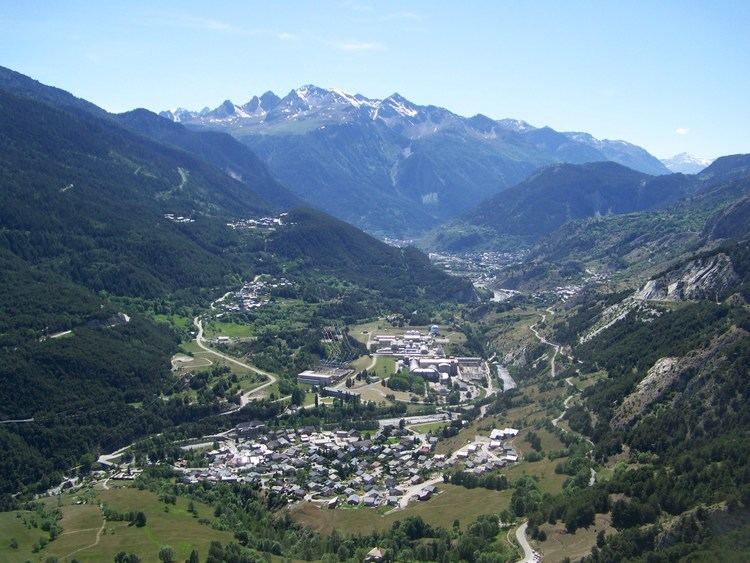
The Basse-Maurienne
The lower part of the valley is industrial, and its three significant towns are:
The Haute-Maurienne
The upper valley of the Arc is known as the Haute-Maurienne. It lies along the Italian border around 45 km near Mont Cenis. The principal town is Modane, an old frontier town, at the mouth of the Fréjus Road Tunnel and dominated by the resort of Val Fréjus. The other villages, rising up from the valley, are:
About 5,000 inhabitants live there permanently, but the population reaches about 15,000 in the winter.
Much of the Haute-Maurienne is included in the Vanoise National Park, which became the first national park in France in 1973. This borders the Gran Paradiso National Park of Italy. The two parks are important areas for ibexes, chamois, and golden eagles; the lammergeier was recently reintroduced into the area. It appears that wolves have reached the region within the past five years.
Skiing and snowboarding
The Maurienne valley is home to around 20 ski resorts. There is also access to The Three Valleys via the Orelle gondola.
Alpine/downhill
In rough order heading up the valley: