
Source elevation 2,760 m | Length 128 km | |
 | ||
Main source Graian Alps2,760 m (9,060 ft) Similar Alps, Maurienne, Val Cenis Vanoise, Col de l'Iseran, Les Arcs | ||
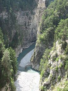
The Arc is a 128-kilometre-long (80 mi) river in the Savoie département of south-eastern France. It is a left tributary of the Isère River, which it joins at Chamousset, approximately 15 km (9.3 mi) downstream from Albertville. Its source is near the border with Italy, in the Graian Alps, northeast of Bonneval-sur-Arc. The valley of the Arc, the Maurienne, is an important transport artery between France and Italy.
Contents
Map of L'Arc, Bramans, France
Towns crossed by the river
References
Arc (Savoie) Wikipedia(Text) CC BY-SA