
Prominence 213 Easiest route snow/glacier First ascent 2004 | Elevation 1,473 m | |
 | ||
Similar Mount Friesland, Levski Peak, Ongal Peak, Needle Peak, St Boris Peak | ||
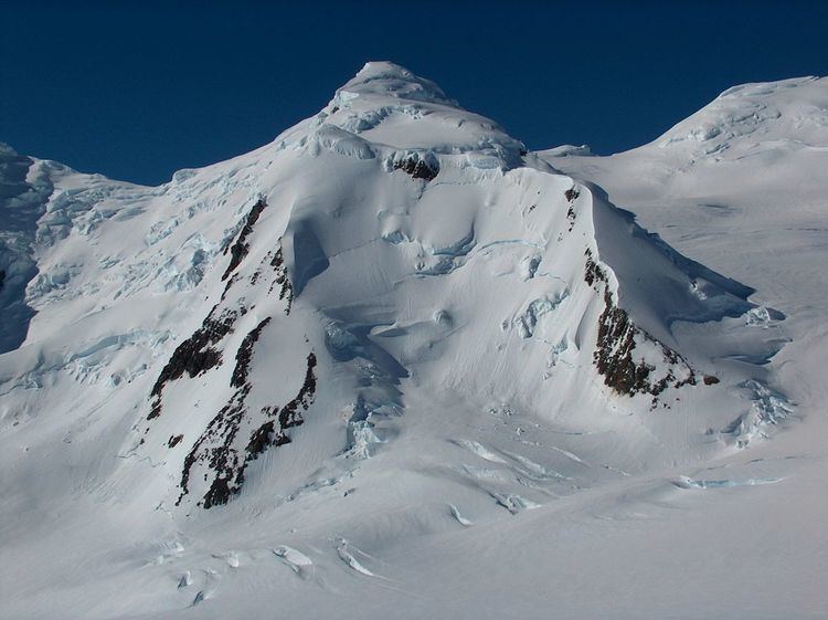
Lyaskovets Peak (Vrah Lyaskovets \'vr&h 'lyas-ko-vets) is the easternmost peak of Friesland Ridge in the Tangra Mountains, eastern Livingston Island and has an elevation 1,473 m. The peak is bounded by Catalunyan Saddle to the west and Shipka Saddle to the east and is heavily glaciated and crevassed, with precipitous western, southern and eastern slopes. It surmounts Huron Glacier to the northwest and northeast, and Macy Glacier and Brunow Bay area to the south. Its northern offshoot forms Zograf Peak, and is linked to Lozen Nunatak, Erma Knoll and Aheloy Nunatak in Huron Glacier.
Contents
Map of Lyaskovets Peak, Antarctica
The peak is named after Lyaskovets, a town in central northern Bulgaria.
Location
Lyaskovets Peak is located at 62°39′48.5″S 60°08′34.7″W, which is 2.3 km east-northeast of Mount Friesland (the summit of Friesland Ridge and Livingston Island, 1,700 m), 3.2 km south-southeast of Kuzman Knoll, 1.33 km south by east of Zograf Peak, 1.3 km west of Levski Peak, and 4.6 km west by north of Great Needle Peak (the summit of Levski Ridge, approx. 1,690 m). The feature was mapped by the UK Directorate of Overseas Surveys in 1968, and by Bulgaria in 2005 and 2009.
History
The first ascent of Lyaskovets Peak was made on 14 December 2004 by Lyubomir Ivanov and Doychin Vasilev from Camp Academia (541 m) during the Tangra 2004/05 Survey. Their route (UIAA grade III) started with 4 km of solid but crevassed firn surface ascent up to Catalunyan Saddle (1,260 m) on the main crest of Tangra Mountains, from where they traversed the precipitous west slope of the peak until the north slope was reached, from where the summit – itself split by a crevasse – was easily reached.
The second ascent, also by way of Ivanov–Vasilev route, was made by the Bulgarian mountaineers Doychin Boyanov and Nikolay Petkov on 1 January 2015.