
Elevation 1,680 m | ||
 | ||
First ascent 8 January 2015 Doychin Boyanov, Nikolay Petkov and Aleksander Shopov Similar Mount Friesland, Levski Peak, Ongal Peak, Deception Island | ||
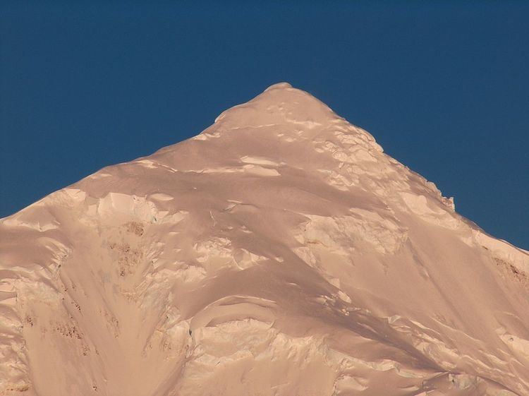
Great Needle Peak (Bulgarian: Голям Иглен връх, ‘Golyam Iglen Vrah’ go-'lyam 'i-glen 'vr&h; variant name in Spanish: pico Falsa Aguja, ‘False Needle Peak’) is the summit of the central Levski Ridge in Tangra Mountains on Livingston Island, Antarctica. Rising to 1,679.5 m, it is the third highest peak of both the mountains and the island after Mount Friesland (1700.2 m) and St. Boris Peak (1685 m). Great Needle Peak surmounts Huron Glacier and its tributary draining Devnya Valley to the north, Magura Glacier to the east, Srebarna Glacier to the south, and Macy Glacier to the southwest.
Contents
Map of Great Needle Peak, Antarctica
History
The peak’s name derives from the Spanish name form pico Falsa Aguja (False Needle Peak) that probably dates back to 1957, with ‘great’ becoming established in usage and considered more suitable than ‘false’ as this heavily glaciated, major peak could hardly be associated with the ‘true’ Needle Peak (pico Aguja), a sharp rocky peak of elevation just 370 m situated near Samuel Point 8 km away.
The first ascent and GPS survey of Great Needle Peak was made on 8 January 2015 by the Bulgarian mountaineers Doychin Boyanov, Nikolay Petkov and Aleksander Shopov from Camp Academia locality (541 m) via Lozen Saddle (437 m) and Plana Peak (740 m). Their measured peak elevation of 1,679.5 m) updated the previously existing estimate (1,690 m according to the Bulgarian topographic survey Tangra 2004/05), and confirmed that the summit of both the mountains and the island is indeed the 1700.2 m high Mount Friesland.
Location
The peak is located 6.7 km east of Mount Friesland, 3.32 km east by south of Levski Peak, 2.21 km south-southeast of Plana Peak, 2.54 km south of Sitalk Peak and 1.84 km south of Tutrakan Peak, 2.15 km southwest of Helmet Peak, 3.32 km northwest of M'Kean Point and 1.29 km north of Serdica Peak.