
Country United States Elevation 43 ft (13 m) Zip code 94901 Population 58,994 (2013) | Incorporated February 18, 1874 Time zone PST (UTC-8) Local time Monday 9:37 PM Area code Area codes 415 and 628 | |
 | ||
Weather 13°C, Wind SE at 19 km/h, 98% Humidity | ||
About san rafael california marin county town profile video
San Rafael (/ˌsæn rəˈfɛl/ SAN rə-FELL; [san rafaˈel] "Saint Raphael") is a city and the county seat of Marin County, California, United States. The city is located in the North Bay region of the San Francisco Bay Area. As of the 2010 census the city's population is 57,713.
Contents
- About san rafael california marin county town profile video
- Map of San Rafael CA USA
- Contemporary ridge top living in san rafael california
- History
- Geography
- Environmental features
- Climate
- 2010
- 2000
- Politics and government
- Federal and state
- Economy
- Entertainment industry
- Top employers
- Parks
- Educational institutions
- Transportation
- In popular culture
- Notable residents
- Neighborhoods
- References
Map of San Rafael, CA, USA
Contemporary ridge top living in san rafael california
History
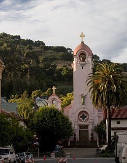
What is now San Rafael was once the site of several Coast Miwok villages; Awani-wi, near downtown San Rafael, Ewu, near Terra Linda, and Shotomko-cha, in Marinwood. Mission San Rafael Arcángel was founded in what is now downtown San Rafael as the 20th Spanish mission in the colonial Mexican province of Alta California by three priests—Father Narciso Durán from Mission San José, Father Abella from Mission San Francisco de Asís, Father Luis Gíl y Taboada from La Iglesia de Nuestra Señora Reina de los Angeles—on Dec. 14, 1817, four years before Mexico gained independence from Spain. Mission San Rafael Arcángel was located a donkey's day walk to the mission below it. The mission and the city are named after the Archangel Raphael, the Angel of Healing.
The mission was originally planned as a hospital site for Central Valley American Indians who had become ill at the cold San Francisco Mission Dolores. Father Luis Gil, who spoke several Native American languages, was put in charge of the facility. In part because of its ideal weather, San Rafael was later upgraded to full mission status in 1822. The mission had 300 converts within its first year, and 1,140 converts by 1828. The Mexican government took over the California missions in 1834, and Mission San Rafael was abandoned in 1844, eventually falling into ruin. The current mission was built in 1949 in the style of the original, but faces at right angles to the alignment of the original.
The San Francisco and North Pacific Railroad reached San Rafael in 1879 and was linked to the national rail network in 1888. The United States Navy operated a San Pablo Bay degaussing range from San Rafael through World War II.
Geography
According to the United States Census Bureau, the city has a total area of 22.4 square miles (58 km2). 16.5 square miles (43 km2) of it is land and 6.0 square miles (16 km2) of it (26.55%) is water. South of the county is San Francisco.
Notable landmarks include:
There are several public parks in the city.
Environmental features
The San Rafael shoreline has been historically filled to a considerable extent to accommodate land development, with underlying bay mud (saturated clayed silt) of up to 90 feet (27 m) in thickness. At certain locations such as Murphys Point, the sandstone or shale rock outcrops through the mud.
San Rafael has a wide diversity of natural habitats from forests at the higher elevations to marshland and estuarine settings. Its marshes are home to the endangered species Salt Marsh Harvest Mouse. There are also riparian areas including the San Rafael Creek and Miller Creek corridors.
Climate
San Rafael has a Mediterranean climate (Köppen climate classification Csb), with mild winter lows seldom reaching the freezing mark. The National Weather Service reports that August is usually the warmest month with a high of 80.1° (26.7 °C) and a low of 55.0° (12.8 °C). December, the coldest month, has an average high of 55.1° (12.8 °C) and an average low of 41.0° (5.0 °C). The highest temperature on record is 110° (43 °C), recorded in June 1961. The highest temperature in recent years, 108° (42 °C), occurred on July 23, 2006. The record lowest temperature was 20° (-7 °C) on December 22, 1990. There are an average of 17.9 days annually with a high of 90° or more and 1.2 days with a high of 100° or more. Freezing temperatures (32° or below) occur on an average of 3.6 days.
Total annual precipitation averages 32.16 inches (817 mm). There are normally 64.3 days with measurable rain. The rainy season is from November to early April. Rain is rare outside of this period and it is normal to receive no rain in June, July, August, and September. The most rain in one month was 24.11 inches (612 mm) in January 1995. The heaviest 24-hour rainfall was 8.74 inches (222 mm) on December 11, 1995. A trace of snow was recorded on January 30, 1976.
2010
The 2010 United States Census reported that the city of San Rafael had a population of 57,713. This figure does not, however, include portions of the Santa Venetia and Lucas Valley-Marinwood CDPs, nor various other unincorporated areas, all of which have San Rafael postal addresses; in total, according to the 2010 Census, there are 70,197 residents of San Rafael postal addresses (ZIP codes 94901 and 94903).
The following statistics refer to the incorporated limits of San Rafael only. The population density was 2,573.9 people per square mile (993.8/km²). The racial makeup of San Rafael was 40,734 (70.6%) White, 1,154 (2.0%) African American, 709 (1.2%) Native American, 3,513 (6.1%) Asian, 126 (0.2%) Pacific Islander, 8,513 (14.8%) from other races, and 2,964 (5.1%) from two or more races. Hispanic or Latino of any race were 17,302 persons (30.0%).
The Census reported that 55,594 people (96.3% of the population) lived in households, 1,314 (2.3%) lived in non-institutionalized group quarters, and 805 (1.4%) were institutionalized.
There were 22,764 households, out of which 6,358 (27.9%) had children under the age of 18 living in them, 9,845 (43.2%) were opposite-sex married couples living together, 2,004 (8.8%) had a female householder with no husband present, 1,133 (5.0%) had a male householder with no wife present. There were 1,450 (6.4%) unmarried opposite-sex partnerships, and 301 (1.3%) same-sex married couples or partnerships. 7,434 households (32.7%) were made up of individuals and 2,954 (13.0%) had someone living alone who was 65 years of age or older. The average household size was 2.44. There were 12,982 families (57.0% of all households); the average family size was 3.02.
The population was spread out with 11,132 people (19.3%) under the age of 18, 4,956 people (8.6%) aged 18 to 24, 16,915 people (29.3%) aged 25 to 44, 15,574 people (27.0%) aged 45 to 64, and 9,136 people (15.8%) who were 65 years of age or older. The median age was 40.2 years. For every 100 females there were 99.7 males. For every 100 females age 18 and over, there were 98.1 males.
There were 24,011 housing units at an average density of 1,070.9 per square mile (413.5/km²), of which 11,909 (52.3%) were owner-occupied, and 10,855 (47.7%) were occupied by renters. The homeowner vacancy rate was 1.6%; the rental vacancy rate was 5.1%. 27,554 people (47.7% of the population) lived in owner-occupied housing units and 28,040 people (48.6%) lived in rental housing units.
2000
As of the census of 2000, there were 56,063 people, 22,371 households, and 12,773 families residing in the city. The population density was 3,378.9 inhabitants per square mile (1,304.8/km²). There were 22,948 housing units at an average density of 1,383.1 per square mile (534.1/km²). The racial makeup of the city in 2010 was 59.0% non-Hispanic White, 1.8% non-Hispanic African American, 0.2% Native American, 6.0% Asian, 0.2% Pacific Islander, 0.3% from other races, and 2.6% from two or more races. 30.0% were Hispanic or Latino of any race.
There were 22,371 households out of which 25.8% had children under the age of 18, 44.3% were married couples living together, 9.0% had a female householder with no husband present, and 42.9% were non-families. 32.1% of all households were made up of individuals and 10.9% have someone living alone who is 65 or older. The average household size was 2.42 and the average family size was 2.99. The age distribution is as follows: 19.5% under the age of 18, 8.1% from 18 to 24, 33.3% from 25 to 44, 24.8% from 45 to 64, and 14.4% who were 65 years of age or older. The median age was 38 years. For every 100 females there were 98.2 males. For every 100 females age 18 and over, there were 95.7 males.
The reported median income for a household in the city was $60,994; the median reported income for a family was $74,398 (these figures had risen to $67,789 and $85,459 respectively as of a 2007 estimate). Males reported a median income of $50,650 versus $39,912 for females. The reported per capita income for the city was $35,762. About 5.6% of families and 10.2% of the population reported incomes below the poverty line, including 11.7% of those under age 18 and 5.0% of those age 65 or over.
Politics and government
San Rafael is a stronghold of the Democratic Party. As of October 22, 2012, there were 29,638 registered voters in San Rafael, of which 16,357 (55.2%) were Democrats, 5,332 (18.0%) were Republicans, and 6,676 (22.5%) declined to state a political party.
San Rafael is governed by a city council with a five members, elected at-large for four-year terms. The current members are:
Federal and state
In the United States House of Representatives, San Rafael is in California's 2nd congressional district, represented by Democrat Jared Huffman. From 2008 to 2012, Huffman represented Marin County in the California State Assembly.
In the California State Legislature, San Rafael is in:
Economy
Autodesk, In Defense of Animals, Westamerica Bank, and GIS Data Resources are among the companies headquartered in San Rafael.
Entertainment industry
After the arrival of George Lucas in San Rafael in 1970 to film the movie THX 1138, the city became a center for the entertainment industry, particularly the high-tech elements of the business. Lucasfilm was founded by George Lucas in 1971, and is best known for the global hit movie series Star Wars and also for Indiana Jones. Some of the company's operations were moved to San Francisco in 2005. Portions of the Universal movie production American Graffiti were filmed in downtown San Rafael under George Lucas's direction, and portions of THX 1138 were shot at the Marin County Civic Center in San Rafael. Much of the movie Gattaca, starring Ethan Hawke, was also shot in the Marin County Civic Center. Industrial Light & Magic was founded in 1975 by Lucas to do special effects for his films and those of other filmmakers. The new-age music program Hearts of Space has been headquartered in San Rafael since 2004.
Largely because of the presence of LucasFilm, San Rafael started to attract video game developers, with several major studios located in the city. However, in recent years most of the companies, including Lucas Arts, have left San Rafael:
Top employers
According to San Rafael's 2010 Comprehensive Annual Financial Report, the top employers in the city are:
Parks
San Rafael contains a number of parks:
Educational institutions
San Rafael has one university, Dominican University of California.
The Ali Akbar College of Music, was founded in San Rafael by Indian musician Ali Akbar Khan to teach Indian classical music.
San Rafael is also the home to one of the two campuses of Guide Dogs for the Blind, a guide dog training school.
Most public schools in San Rafael are operated by the San Rafael City Schools district. Dixie School District operates some public elementary and middle schools north of San Rafael proper. All comprehensive public high schools are governed by San Rafael City Schools.
The district operates two comprehensive public high schools: San Rafael High School, Terra Linda High School and one alternative high school, Madrone.
Public schools not operated by the district include:
Private schools:
Transportation
The major north-south freeway through San Rafael is U.S. Route 101, connecting the North Coast (California) and the Redwood Empire to the north, and San Francisco to the south. Interstate 580 heads across the Richmond–San Rafael Bridge to the East Bay.
The San Rafael Transit Center, located at the corner of 3rd and Hetherton Streets, is served by a number of bus agencies, including Golden Gate Transit, Marin Transit, Sonoma County Transit, and Greyhound. Local bus service is provided primarily by Golden Gate Transit and Marin Transit.
Commuter train service to the Santa Rosa Airport will be started in 2016. By 2018, its extension to the south to Larkspur is expected to be completed.
In popular culture
The term "420" when used in reference to cannabis consumption is believed to have originated in San Rafael, specifically, at San Rafael High School. Since then, use of "420" has spread throughout the rest of the United States, and much of the rest of the world, in reference to cannabis consumption on April 20 or at 4:20 p.m. -- the time the original group gathered after school.
The Oakland, California hardcore punk band Short Changed's EP & song entitled "Burn Down Wagon Town" is about San Rafael, the guitarist Shipwrex's home town, and the old practice spot of the band as well.
Shel Silverstein's poem The Great Smoke-Off, is about a girl named Pearly Sweetcakes who came from the town of San Rafael.
Notable residents
Neighborhoods
Although not every location in San Rafael is part of a neighborhood that has a widely accepted and widely recognized name, there are some neighborhoods that have names that are accepted and recognized by most locals. The City of San Rafael 2020 General Plan recognizes 30 distinct neighborhoods in San Rafael: