
Country United States State California | Population 109,320 (2013) Area 37.635 sq mi Mayor Harry T. Price | |
 | ||
Unemployment rate 5.9% (Feb 2015) | ||
Map of Fairfield, California
Fairfield is a city in, and the county seat of, Solano County, California, in the North Bay sub-region of the San Francisco Bay Area. It is generally considered the midpoint between the cities of San Francisco and Sacramento, approximately 40 miles (64 km) from the city center of both cities, approximately 40 miles (64 km) from the city center of Oakland, less than 19 miles (31 km) from Napa Valley, 16 miles (26 km) from the Carquinez Bridge, and 14 miles (23 km) from the Benicia Bridge. Fairfield was founded in 1856 by clippership captain Robert H. Waterman, and named after his former hometown of Fairfield, Connecticut.
Contents
- Map of Fairfield California
- Milpitas high school marching band taking 1st place 2013 fairfield ca
- Fairfield california
- Geography
- History
- 2010
- 2000
- Climate
- Industry and major employers
- Top employers
- Schools
- Recreation
- Transportation
- Sister city relations
- Notable people
- References
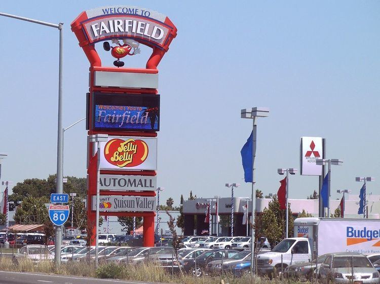
It is the home of Travis Air Force Base and the headquarters of Jelly Belly. With a population of 108,321 at the 2010 census, it is slightly smaller in population than Vallejo. Other nearby cities include Suisun City, Vacaville, Rio Vista, Benicia, and Napa.
Milpitas high school marching band taking 1st place 2013 fairfield ca
Fairfield california
Geography
According to the United States Census Bureau, the city has a total area of 37.6 square miles (97 km2), of which, 34.4 square miles (89 km2) of it is land and 3.2 square miles (8.3 km2) of it is water. The total area is 5.65% water.

The city is located within the California Coastal Ranges. The city is centered directly north of the Suisun Bay and northeast of the San Pablo Bay. Much of the Suisun Bay contains the Suisun Marsh, the largest saltwater marsh on the west coast of the United States.
History
According to the City of Fairfield website, Native Americans, such as those from the Ion culture, settled in the Rockville and Green Valley areas. Artifacts that have been found from some of the earliest human inhabitants of the Fairfield area are dated to be around five to six thousand years old, making them some of the oldest Native American settlements in Northern California.
The first European contact came in 1810 when the Spanish army was ordered to attack the Suisun Indians. In 1835 the Mexican General Vallejo was so magnanimous in victory over the Indian Chief Sem Yeto that the chief later became his ally in conflicts against other tribes. In 1837 the Indian Chief Solano received the Rancho Suisun Mexican land grant. This grant eventually came into the hands of a clipper ship captain from Fairfield, Connecticut named Robert H. Waterman. He not only parceled out the town in 1856, but also, in a commercially shrewd move, entered Fairfield in the race for Solano County seat in 1858, and won it from Benicia. As an inducement he granted 16 acres (6.5 ha) of land for the construction of county buildings. In 1903 Fairfield was incorporated as a city.
2010
The 2010 United States Census reported that Fairfield had a population of 105,321. The population density was 2,798.5 people per square mile (1,080.5/km²). The racial makeup of Fairfield was 48,407 (46.0%) White, 16,586 (15.7%) African American, 869 (0.8%) Native American, 15,700 (14.9%) Asian (9.1% Filipino, 1.8% Indian, 1.0% Chinese, 0.6% Vietnamese, 0.6% Japanese, 0.4% Korean, 0.3% Laotian, 0.2% Thai, 0.1% Pakistani), 1,149 (1.1%) Pacific Islander, 13,301 (12.6%) from other races, and 9,309 (8.8%) from two or more races. Hispanic or Latino of any race were 28,789 persons (27.3%); 21.2% of Fairfield is Mexican, 1.1% Puerto Rican, 1.0% Salvadoran, 0.5% Nicaraguan, 0.3% Guatemalan, 0.2% Cuban, and 0.2% Peruvian.
The Census reported that 102,832 people (97.6% of the population) lived in households, 1,221 (1.2%) lived in non-institutionalized group quarters, and 1,268 (1.2%) were institutionalized.
There were 34,484 households, out of which 14,725 (42.7%) had children under the age of 18 living in them, 18,461 (53.5%) were opposite-sex married couples living together, 5,203 (15.1%) had a female householder with no husband present, 2,179 (6.3%) had a male householder with no wife present. There were 2,052 (6.0%) unmarried opposite-sex partnerships, and 237 (0.7%) same-sex married couples or partnerships. 6,802 households (19.7%) were made up of individuals and 2,500 (7.2%) had someone living alone who was 65 years of age or older. The average household size was 2.98. There were 25,843 families (74.9% of all households); the average family size was 3.42.
The population was spread out with 28,499 people (27.1%) under the age of 18, 11,246 people (10.7%) aged 18 to 24, 28,917 people (27.5%) aged 25 to 44, 25,884 people (24.6%) aged 45 to 64, and 10,775 people (10.2%) who were 65 years of age or older. The median age was 33.7 years. For every 100 females there were 97.0 males. For every 100 females age 18 and over, there were 94.6 males.
There were 37,184 housing units at an average density of 988.0 per square mile (381.5/km²), of which 20,835 (60.4%) were owner-occupied, and 13,649 (39.6%) were occupied by renters. The homeowner vacancy rate was 2.5%; the rental vacancy rate was 7.1%. 61,652 people (58.5% of the population) lived in owner-occupied housing units and 41,180 people (39.1%) lived in rental housing units.
2000
As of the census of 2000, there are 96,178 people, 30,870 households, and 24,016 families residing in the city. The population density is 986.3/km² (2,554.2/mi²). There are 31,792 housing units at an average density of 326.0/km² (844.3/mi²). The racial makeup of the city is 56.21% White, 15.02% Black or African American, 0.77% Native American, 10.89% Asian, 0.93% Pacific Islander, 8.77% from other races, and 7.41% from two or more races. 18.77% of the population are Hispanic or Latino of any race.
There are 30,870 households out of which 43.1% have children under the age of 18 living with them, 58.4% are married couples living together, 14.2% have a female householder with no husband present, and 22.2% are non-families. 17.0% of all households are made up of individuals and 5.5% have someone living alone who is 65 years of age or older. The average household size is 2.98 and the average family size is 3.33.
In the city, the population is spread out with 29.8% under the age of 18, 11.1% from 18 to 24, 31.3% from 25 to 44, 18.8% from 45 to 64, and 9.0% who are 65 years of age or older. The median age is 31 years. For every 100 females there are 99.1 males. For every 100 females age 18 and over, there are 97.4 males.
The median income for a household in the city is $51,151, and the median income for a family is $55,503. Males have a median income of $38,544 versus $30,616 for females. The per capita income for the city is $20,617. 9.3% of the population and 7.1% of families are below the poverty line. Out of the total population, 12.1% of those under the age of 18 and 5.2% of those 65 and older are living below the poverty line.
Climate
Fairfield has a hot-summer Mediterranean climate (Köppen Csa).
Industry and major employers
Fairfield has a diversified economy, with government, manufacturing, health care, retail, professional and commercial construction sectors. Anheuser-Busch operates a large regional Budweiser brewery, Clorox produces bleach products, and the Jelly Belly Candy Company confects its specialty jelly beans in Fairfield. Partnership HealthPlan of California, an insurer, is based in Fairfield.
Top employers
According to the City's 2013 Comprehensive Annual Financial Report, the top employers in the city are:
Schools
Area alternative schools and other programs:
Area elementary schools:
Vanden High School, Golden West Middle School, Travis Education Center, Travis Community Day School, Center Elementary School, Scandia Elementary School, and Travis Elementary School are part of the Travis Unified School District (TUSD), and serve Travis Air Force Base (TAFB) as well as parts of Fairfield and Vacaville. Golden Hills Community School is part of the Solano County Office of Education (SCOE). All others are part of the Fairfield-Suisun Unified School District (FSUSD).
Universities and colleges nearby: the California Maritime Academy (CSU), UC Davis, UC Berkeley, Sacramento State, CSU East Bay, Sonoma State, St. Mary's College, University of Phoenix and Brandman University. The main campus of Solano Community College is located in Fairfield—as well as satellite campuses of University of Phoenix, Brandman University, InterCoast Colleges, and Embry Riddle Aeronautical University (at Travis AFB).
Recreation
Downtown Fairfield offers shopping, community festivals and entertainment.
Fairfield is home to three golf courses, two public and one private (located in unincorporated area East of Fairfield, North of TAFB for use by military personnel). Paradise Valley and Rancho Solano Golf Courses, both public, are rated in the Zagat Survey of "America's Best Golf Courses," rated 3 ½ stars by Golf Digest Magazine in 2010 and voted #1 & #2 golf courses in Solano County for consecutive years.
Transportation
Interstate 80 passes through Fairfield, connecting San Francisco to the southwest and Sacramento to the northeast. Interstate 680 begins its journey south through the eastern cities of the Bay Area to San Jose. State Route 12 connects Fairfield with Napa to the west, and Rio Vista to the east.
Fairfield-Vacaville is a current railroad station construction project in Fairfield, located on Peabody Rd, which would serve the communities of Fairfield/Suisun and Vacaville. Completion will be completed in August 2017. When completed, the station will see service from Capitol Corridor trains operated by Amtrak California. Currently, the Suisun-Fairfield railroad station in Suisun City serves the central Solano area. Greyhound utilizes this station for service to the Fairfield-Suisun area as well.
The Fairfield Transportation Center is the main hub for commuters via bus as well as vanpools and park-and-ride to the Sacramento area and the San Francisco Bay Area. There is connecting bus service to Sacramento and to BART stations in El Cerrito and Concord/Walnut Creek, as well as intercity to Vacaville, Vallejo, Davis, Napa, and Rio Vista.