
Existed: 1931 – present Length 817.5 km | Constructed 1931 | |
 | ||
Counties: TN: ClaiborneVA: Lee, Scott, Washington, City of Bristol, Grayson, City of Galax, Carroll, Floyd, Patrick, Henry, Pittsylvania, City of Danville, Halifax, Mecklenburg, Brunswick, Greensville, City of Emporia, Southampton, City of Suffolk, City of Chesapeake, City of Portsmouth, City of Norfolk, City of Virginia Beach | ||
U.S. Route 58 is an east–west U.S. Highway that runs for 508 miles (818 km) from U.S. Route 25E just northwest of Harrogate, Tennessee, to U.S. Route 60 in Virginia Beach, Virginia. Until 1996, when the Cumberland Gap Tunnel opened, US 58 ran only inside the commonwealth of Virginia. It was then extended southwest along a short piece of former US 25E, which no longer enters Virginia, to end at the new alignment in Tennessee.
Contents
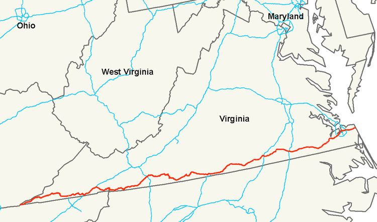
Map of US-58, Virginia, USA
State Route 383 is overlaid on U.S. Route 58 in Tennessee.
U.S. Route 58 is the longest numbered route in Virginia.
Tennessee
US 58 begins at a trumpet interchange with US 25E, just south of the Cumberland Gap Tunnel. The route travels northeast through the outskirts of Cumberland Gap before crossing into Virginia.
US 58 in Tennessee carries the designation State Route 383.
Virginia
US 58 enters Virginia and travels east to Jonesville, where Alternate US 58 branches off and travels to the north. East of Jonesville, US 58 intersects US 421, and the two routes stay concurrent through Duffield (where the concurrency also picks up U.S. 23), Gate City, Weber City (where the US 23 concurrency ends), and Bristol, where US 58 begins a concurrency with Interstate 81. The two routes stay concurrent until I-81 exit 19 in Abingdon, where US 58 resumes its eastward journey close to the Virginia–North Carolina state line. The route is signed as the J.E.B. Stuart Highway and the A. L. Philpott Memorial Highway. Much of the highway through the region features hairpin turns, steep grades, and load-zoned bridges.
US 58 begins a concurrency with US 221 in Independence, and the routes stay merged through Hillsville, just past the interchange with Interstate 77. Continuing eastward, the route crosses the Blue Ridge Parkway in the unincorporated community of Meadows of Dan before winding its way to Martinsville, where US 58 and US 220 share a southern bypass of the city.
Approaching Danville, US 58 once again follows an expressway bypass to the south of the city, while a business route enters the city itself. The southeastern half of this bypass is shared with US 29. East of Danville, US 29 continues north, while US 58 picks up US 360 (which begins in central Danville) and resumes its eastward journey. The routes stay cosigned until South Boston, where US 360 resumes a more northerly route to Richmond, while US 58 travels eastward to Clarksville and crosses Kerr Lake.
The route crosses US 1 and Interstate 85 in South Hill, followed by Interstate 95 in Emporia. Near Franklin, an expressway bypass carries US 58 (and, for one stretch, US 258) south of the city, while a business route enters the city. A bypass also carries traffic around Suffolk, where US 58 begins concurrencies with US 13 and then US 460. The three US routes stay merged until an intersection with the Hampton Roads Beltway at the confluence of Interstate 64, Interstate 264, and Interstate 664. US 58 travels inside the beltway and through Portsmouth and into Norfolk via the Midtown Tunnel. The route crosses I-64 once again, and continues to Virginia Beach, roughly paralleling I-264 to its south. US 58, designated as Virginia Beach Boulevard and becoming Laskin Rd. in Virginia Beach, ends at US 60, Pacific Ave. Historically, US 58 continued for one additional block to the east, ending at Atlantic Ave., which once carried US 60 and then Business US 60.
Much of the western section of US 58 is part of The Crooked Road: Virginia's Heritage Music Trail.
Alternate route
An alternate route of US 58, known as U.S. Route 58 Alternate (US 58 Alt.), splits from the main route in Abingdon, Virginia and travels northwest (signed west) as the "Trail of the Lonesome Pine" to Coeburn. From there, US 58 Alt. travels in a southwesterly direction (signed west) through Norton, Big Stone Gap and Pennington Gap before rejoining the main route in Jonesville.
History
The corridor across southern Virginia was part of the initial 1918 state highway system, in which it was State Route 12. It generally followed the present U.S. 58 from Abingdon to Virginia Beach, while present US 58 west of Abingdon was part of State Route 10. These routes deviated from present US 58 in the following places: