
Named for Light Horse Harry Lee Website www.leecova.org Founded 1793 | Area 1,132 km² Population 25,185 (2013) | |
 | ||
Rivers Powell River, Blackwater Creek, Lone Branch Points of interest Cumberland Gap, Pinnacle Overlook, Wilderness Road State Park, Martin's Station, Leeman Field | ||
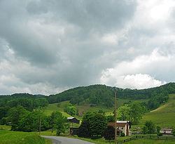
Lake keokee in lee county virginia
Lee County is the westernmost county in the U.S. Commonwealth of Virginia. As of the 2015 estimate, the population was 24,742. Its county seat is Jonesville.
Contents
- Lake keokee in lee county virginia
- Map of Lee County VA USA
- History
- Economy
- Geography
- Districts
- Adjacent counties
- National protected areas
- Major highways
- Demographics
- Politics
- Public high schools
- Public middle schools
- Public elementary schools
- Technical schools
- Towns
- Census designated places
- Other unincorporated communities
- Notable residents
- References
Map of Lee County, VA, USA
History
The first Europeans to enter what is present-day Lee County were a party of Spanish explorers, Juan de Villalobos and Francisco de Silvera, sent by Hernando de Soto in 1540, in search of gold.
The county was formed in 1793 from Russell County. It was named for Light Horse Harry Lee, the Governor of Virginia from 1791 to 1794, who was known as "Light Horse Harry" for his exploits as a leader of light troops in the American Revolutionary War. He was the father of the Confederate General Robert E. Lee.
Lee County was the final front on the Kentucky Trace, which has become known as the Wilderness Road and The Trail of the Lonesome Pine. During the 1780s and 1790s, fortified buildings ("stations") were erected as protection from Indian raids while they followed Daniel Boone's footsteps to the new region of Kentucky. Stations or forts during that time were: Far Eastern Lee County Yoakum Station at present-day Dryden, westward to Powell River and Station Creek at present-day Rocky Station, then to Mump's Fort at present day Jonesville, Prist Station, Chadwell Station at present-day Chadwell Gap, Martin's Station at present-day Rose Hill, Owen Station at present-day Ewing, and finally Gibson Station, which still holds its name.
Among the largest early landowners in the county was Revolutionary War officer and explorer Joseph Martin, for whom Martin's Station and Martin's Creek at Rose Hill are named, and who was awarded some 25,000 acres (100 km2) in the county, which he later sold. Martin was among the earliest explorers of the region.
In 1814, parts of Lee County, Russell County, and Washington County were combined to form Scott County. In 1856, parts of Lee County, Russell County, and Scott County were combined to form Wise County.
Economy
The economy of Lee County is dependent largely on growing tobacco and mining coal. The decline of both has left a large unemployment in the county.
Using the slogan Where Virginia Begins, it has attempted to increase its tourism industry by emphasizing its role in the route used by settlers going west through the Cumberland Gap, at Lee County's western tip.
Lee County shares Cumberland Gap National Historical Park with Kentucky and Tennessee. Attractions listed in the park include Hensley's Settlement, the Pinnacle Overlook, the Sand Cave, and the White Rocks overlooking the towns of Ewing and Rose Hill.
Geography
According to the U.S. Census Bureau, the county has a total area of 437 square miles (1,130 km2), of which 436 square miles (1,130 km2) is land and 1.9 square miles (4.9 km2) (0.4%) is water.
Lee County is physically closer to eight state capitals other than its own capital in Richmond: Raleigh, North Carolina; Columbia, South Carolina; Atlanta, Georgia; Nashville, Tennessee; Charleston, West Virginia; Frankfort, Kentucky; Columbus, Ohio, and Indianapolis, Indiana. Additionally, Cumberland Gap in the far western part of Lee County is closer to Montgomery, Alabama, a ninth state capital.
Districts
The county is divided into seven districts: Jonesville, Rocky Station, Rocky Station Mineral, Rose Hill, White Shoals, Yoakum, St. Charles, Pennington Gap, Keokee, Robbins Chapel and Yoakum Mineral.
Adjacent counties
National protected areas
Major highways
US 58 Alt.
Demographics
As of the 2010 United States Census, there were 25,587 people residing in the county. 94.2% were White, 3.7% Black or African American, 0.4% Native American, 0.2% Asian, 0.6% of some other race and 0.9% of two or more races. 1.6% were Hispanic or Latino (of any race).
According to the census 2009 estimates, there were 25001 people, 11,587 households, and 6,852 families residing in the county. The population density was 54 people per square mile (21/km²). There were 11,587 housing units at an average density of 25 per square mile (10/km²). The racial makeup of the county was 96.3% White, 2.9% Black or African American, 0.2% Asian, 0.1% from other races, 0.7% of the population were Hispanic or Latino of any race.
The largest ancestry groups in Lee County include:English (14 percent), Irish (11 percent), German (9 percent), and Scots-Irish (3 percent).
There were 9,706 households out of which 29.0 percent had children under the age of 18 living with them, 55.0 percent were married couples living together, 11.7 percent had a female householder with no husband present, and 29.4 percent were non-families. 27.0 percent of all households were made up of individuals and 12.1 percent had someone living alone who was 65 years of age or older. The average household size was 2.41 and the average family size was 2.91.
In the county, the population was spread out with 22.8 percent under the age of 18, 8.0 percent from 18 to 24, 27.5 percent from 25 to 44, 26.3 percent from 45 to 64, and 15.4 percent who were 65 years of age or older. The median age was 40 years. For every 100 females there were 94.2 males. For every 100 females age 18 and over, there were 91.3 males.
The median income for a household in the county was $29,889, and the median income for a family was $40,721. The per capita income for the county was $16,317. About 20.3 percent of families and 22.7 percent of the population were below the poverty line, including 30.1 percent of those under age 18 and 23.3 percent of those age 65 or over.
Politics
In 2008, Arizona Senator John McCain received 5,825 votes (63 percent) and Illinois Senator Barack Obama received 3,219 votes (35 percent).
In 2012, Republican Presidential Candidate Mitt Romney received 6,847 votes (71 percent) and incumbent Democratic President Barack Obama received 2,583 (27 percent).
Public high schools
Public middle schools
Public elementary schools
Pennington Elementary School, consisting of three buildings built at various times (1912, 1917 and 1937), was demolished in 1989. A bank was constructed on its Morgan Avenue site.