
Length 522.9 km | ||
 | ||
A drive on interstate 81 in virginia
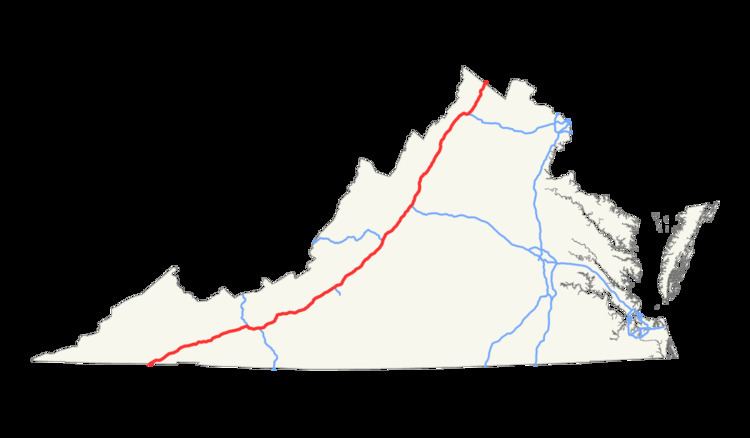
Interstate 81 (I-81) is an 855-mile (1,376 km) long highway. In the U.S. state of Virginia, I-81 runs for 324.92 miles (522.91 km), making the portion in Virginia longer than any other state's portion. It is also the longest Interstate highway within the borders of Virginia. It stretches from the Tennessee state line near Bristol to the West Virginia state line near Winchester.
Contents
Map of I-81, United States
Route description
Interstate 81 enters Bristol, Virginia from Tennessee and runs primarily along the mountains of western Virginia. For most of its length, I-81 parallels U.S. Route 11. I-81 runs concurrently with Interstate 77 in Wytheville, Virginia for about 10 miles (16 km) in a notable example of a wrong-way concurrency: both I-81 south and I-77 north share the same roadbed there. Further north, the highway also runs concurrently with several miles of Interstate 64.
Future
The state has proposed to widen its entire portion of I-81 to a minimum of three or four lanes in each direction to accommodate increased truck traffic and to toll non-passenger vehicles. Some sections of the new Virginia I-81 may completely separate car and truck traffic. Between exits 315 and 317 the state has proposed to widen it to 4 lanes for this 2 mile portion in Winchester, Virginia.