
Existed: 1957 – present Constructed 1957 | Length 287.6 km | |
 | ||
Counties Greensville County, Virginia, Emporia | ||
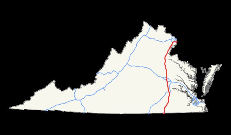
Within the Commonwealth of Virginia, Interstate 95 runs 179 miles (288 km) between its borders with Maryland and North Carolina. I-95 is concurrent with I-64 for 3 miles (4.8 km) in Richmond, and meets the northern terminus of I-85 in Petersburg. Although I-95 was originally planned as a highway through Washington, D.C., it was rerouted along the eastern portion of the Capital Beltway. From Petersburg to Richmond, I-95 was most of the Richmond-Petersburg Turnpike (the south end of the toll road was on I-85.)
Contents
- From North Carolina to Petersburg
- Petersburg through Richmond
- Central Virginia toward Washington DC
- Current
- Former
- HOV facilities
- Welcome centers rest areas and weigh stations
- Usage
- References
The point where it enters the Capital Beltway, the Springfield Interchange, is one of the busiest interchanges in the United States. I-95 continues into Washington, D.C., then Maryland, along the Beltway over the Woodrow Wilson Bridge.
From North Carolina to Petersburg
Interstate 95 continues the pattern of being a four-lane highway from North Carolina. The welcome center forbids trucks, but truck stops at the first two interchanges provides a substitute place for truckers to stay before reaching Emporia. North of here, I-95 and US 301 are often intertwined with each other as they encounter interchanges with Virginia Secondary State Routes. In the Owens-Stony Creek area in Sussex County, the road not only runs parallel to US 301 but shares bridges with I-95, many of which have access to Route 301 from connecting roads. This pattern ends at Exit 33 at the corner of a fairly popular truck stop and travel center. Crossing the Sussex-Prince George County Line, the first site along I-95 is another rest area that also serves as the Petersburg Area Tourist Information Center. The road makes a slight northeast turn between Carson and Templeton, then turns straight north again before approaching the south end of Interstate 295 just before crossing the southern border of the City of Petersburg at Exit 47. A series of frontage roads connect the interchanges with US 460, US 301 and the northern terminus of Interstate 85. Immediately after the interchange with Interstate 85, remnants of the former toll booths for the Richmond–Petersburg Turnpike can be found.
Petersburg through Richmond
North of Petersburg, I-95 crosses the Appomattox River and enters the City of Colonial Heights and then Chesterfield County. Pocahontas Parkway and an extraordinarily high Vietnam Veterans Memorial Bridge over I-95 and the James River just south of the Richmond City Limits. A CSX railroad line runs parallel to the northbound lane in the vicinity of the Port of Richmond, and the Commerce Road Industrial Area, a region that includes a Philip Morris office and an old bridge manufacturing plant. As I-95 itself crosses the James River, Main Street Station can be seen on the north bank, and the road winds around the station itself. The first interchange after it crosses the James River is the tolled State Route 195 and from there the road winds towards the multiplex with Interstate 64. I-64/95 curves to the northwest to cross under US 1/301, only to turn back north briefly, and curve northwest again, as it approaches VA 161. This pattern ends when I-64 turns west at the same interchange as the northern terminus of I-195. From here I-95 curves back to the northeast and has two interchanges with US 1, and later US 301 separately, the latter of which has separate carriageways on both side of I-95. Another interchange with Interstate 295 exists in Glen Allen. However, I-295 does not terminate there, and the south-to-eastbound and west-to-northbound off-ramps between the two can be accessed in the medians of both roads.
Central Virginia toward Washington, D.C.
Throughout much of central Virginia, I-95 climbs a series of hills, and contains wide tree-lined medians. Near mile marker 100 in Doswell, signs for the Kings Dominion amusement park are blended in with standard destination signs. US 17 overlaps I-95 from Massaponax at exit 126 to Falmouth at exit 133. The wide tree-line divider resumes north of here. At Exit 143 in Aquia, the northbound off and on ramps connect directly to US 1, even though the interchange is specifically for VSR 610. Crossing over the Chopawamsic Creek takes I-95 through the Quantico Marine Base, which includes restrictive interchanges. Northbound, the bi-directional HOV lane begins, and runs through the center of I-95 through most of the rest of its journey toward D.C.
Further north in Prince William County, there are four rest areas; two for trucks in Dumfries, and two for cars in Dale City. The truck rest areas, with weigh stations, are near exit 152. The car rest areas have uniquely positioned entrance and exit ramps. The southbound car rest area, near exit 156, is accessible only from the southbound collective-distributor road. In Lorton, a scissor interchange exists with US 1, and shortly after this Lorton Auto Train Station is conveniently located near exit 163. Due to public opposition of efforts to build I-95 through Washington D.C. and College Park, Maryland, I-95 is diverted onto a multiplex with Interstate 495 at the Springfield Interchange. I-95/495 trudge east through Franconia, over the WMATA Blue Line and Rose Hill. At Huntington, I-95/495 run under the WMATA Yellow Line, and through Alexandria before crossing the Woodrow Wilson Bridge briefly into D.C., and then into Maryland.
Current
Former
HOV facilities
Interstate 95 extends the twin-lane barrier-separated HOV Lanes that begin on I-395 at the 14th Street Bridge in Washington. These lanes have been extended south several times, most recently to just north of Stafford right before the Garrisonville Road exit.
As part of the Quantico Creek bridge rebuilding project, a three-lane, 300-foot (91 m) long bridge was constructed in the median just south of the old southern HOV terminus for use when the HOV facilities were extended. It was previously used as a detour bridge and retained its lane striping from such use.
In December 2014, this bridge became part of the Southern HOV/HOT lane extension project that now runs to just north of Garrisonville Rd. (exit 143) in Stafford.
The new I-95 HOV/HOT lanes project created approximately 29 miles (47 km) of HOV/HOT lanes on I-95 from Garrisonville Rd. in Stafford County to the vicinity of Edsall Road on I-395 in Fairfax County.
In July 2016, VDOT began construction of an additional one-mile (1.6 km) extension of the HOV/HOT lanes on I-95 south of Garrisonville Rd. in Stafford County. This addition is expected to be completed by the summer of 2018.
Welcome centers, rest areas and weigh stations
Usage
In 2010, volume at Newington, northbound, from 6-9 am, is about 8,800 vehicles in the two HOV lanes, and 18,300 vehicles in the three lanes with no restriction.