
J F M A M J | F M A M J J | |
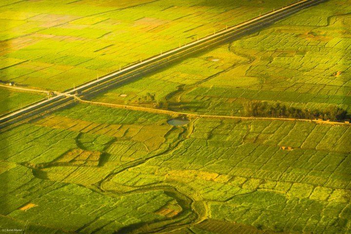 | ||
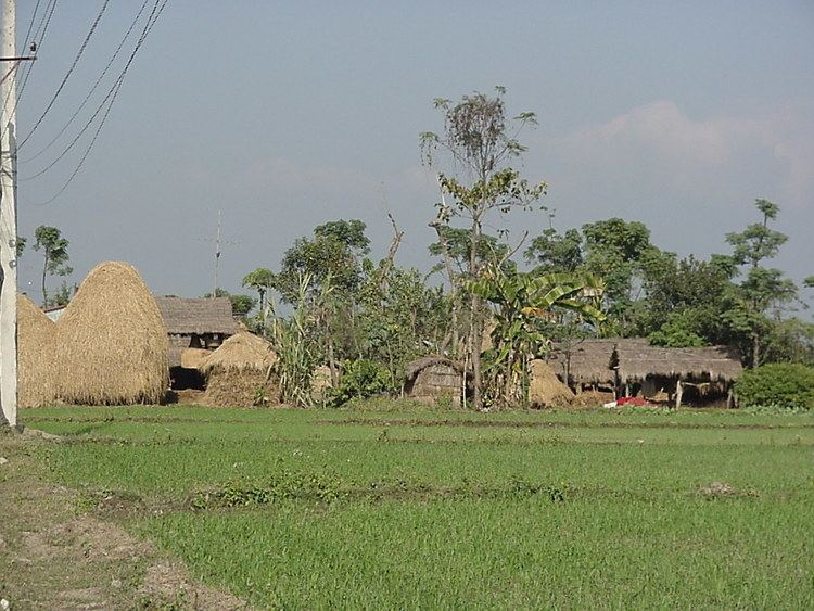
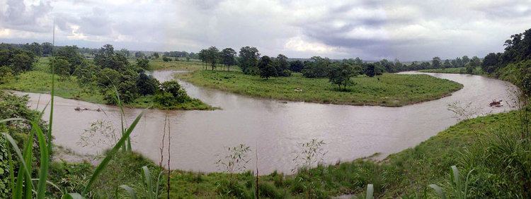
Homestay in the terai the flatlands of nepal
The Terai (Hindi: तराई Nepali: तराइ) is a lowland region in southern Nepal and northwestern India that lies south of the outer foothills of the Himalayas, the Siwalik Hills, and north of the Indo-Gangetic Plain. This lowland belt is characterised by tall grasslands, scrub savannah, sal forests and clay rich swamps. In northern India, the Terai spreads from the Yamuna River eastward across Himachal Pradesh, Haryana, Uttarakhand, Uttar Pradesh and Bihar. The Terai is part the Terai-Duar savanna and grasslands ecoregion. The corresponding lowland region in West Bengal, Bangladesh, Bhutan and Assam in the Brahmaputra River basin is called 'Dooars'. In Nepal, the Terai lies at an altitude of between 67 and 300 m (220 and 984 ft) and comprises more than 50 wetlands. North of the Terai rises the Bhabhar, a narrow but continuous belt of forest about 8–12 km (5.0–7.5 mi) wide.
Contents
- Homestay in the terai the flatlands of nepal
- Himalayas terai valley nepal by asiatravel com
- Etymology
- Geology
- Climate
- Terai in India
- Terai in Nepal
- Inner Terai
- Outer Terai
- History
- Indian influence in Nepal Terai
- Ethnic groups
- Seccessionist demands
- Economy
- Transport
- Tourism
- References
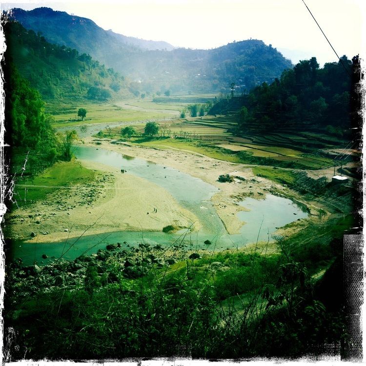
Himalayas terai valley nepal by asiatravel com
Etymology
In Hindi the region is called तराई, 'tarāī' meaning "foot-hill". In Nepali, the region is called तराइ 'tarāi' meaning "the low-lying land, plain" and especially "the low-lying land at the foot of the Himālayas". The region's name in Urdu is ترائي 'tarāʼī' meaning "lands lying at the foot of a watershed" or "on the banks of a river; low ground flooded with water, valley, basin, marshy ground, marsh, swamp; meadow".
Geology
The Terai is crossed by the large perennial Himalayan rivers Yamuna, Ganges, Sarda, Karnali, Narayani and Kosi that have each built alluvial fans covering thousands of square kilometres below their exits from the hills. Medium rivers such as the Rapti rise in the Mahabharat Range. The geological structure of the region consists of old and new alluvium, both of which constitute alluvial deposits of mainly sand, clay, silt, gravels and coarse fragments. The new alluvium is renewed every year by fresh deposits brought down by active streams, which engage themselves in fluvial action. Old alluvium is found rather away from river courses, especially on uplands of the plain where silting is a rare phenomenon.
A large number of small and usually seasonal rivers flow through the Terai, most of which originate in the Siwalik Hills. The soil in the Terai is alluvial and fine to medium textured. Forest cover in the Terai and hill areas has decreased at an annual rate of 1.3% between 1978 and 1979, and 2.3% between 1990 and 1991. With deforestation and cultivation increasing, a permeable mixture of gravel, boulders and sand evolves, which leads to a sinking water table. But where layers consist of clay and fine sediments, the groundwater rises to the surface and heavy sediment is washed out, thus enabling frequent and massive floods during monsoon, such as the 2008 Bihar flood.
The reduction in slope as rivers exit the hills and then transition from the sloping Bhabhar to the nearly level Terai causes current to slow and the heavy sediment load to fall out of suspension. This deposition process creates multiple channels with shallow beds, enabling massive floods as monsoon-swollen rivers overflow their low banks and shift channels. Many areas show erosion such as gullies.
Climate
There are several differences between the climate on the western edge of the Terai at Chandigarh in India and at Biratnagar in Nepal near the eastern edge.
Terai in India
In India, the Terai extends over the states of Himachal Pradesh, Haryana, Uttarakhand, Uttar Pradesh and Bihar. These are mostly the districts of these states that are on the Indo-Nepal border:
Terai in Nepal
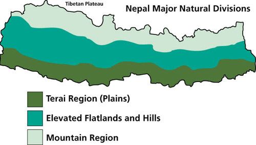
The Terai in Nepal is differentiated into "Inner" and "Outer" Terai and includes 20 districts.
Inner Terai
The Inner Terai refers to the river valleys in the lowlands of southern Nepal located between the Mahabharat and Shivalik ranges. The Inner Terai comprises five elongated valleys extending from north-west to south-east parallel to the enclosing hilly ranges:
Most of these valleys are five to ten kilometers wide (north-south) and up to a hundred kilometers long (east-west).
The 2001 national census counted 2.3 million population (10% of the national total) in these seven Inner Terai districts (counting Banke district as Outer Terai). Adding 45% in the outer Terai gives 55% of Nepal's population living in its Terai districts.
Outer Terai
The Outer Terai begins south of the Siwalik Hills and extends to the Indo-Gangetic plain. In the Far-Western Region, Nepal it comprises the Kanchanpur and Kailali districts, and in the Mid-Western Region, Nepal Bardiya and Banke districts. Farther east, the Outer Terai comprises the Kapilvastu, Rupandehi, Nawalparasi, Parsa, Bara, Rautahat, Sarlahi, Mahottari, Dhanusa, Siraha, Saptari, Sunsari, Morang and Jhapa districts.
East of Banke the Nepalese Outer Terai is interrupted where the international border swings north and follows the edge of the Siwaliks adjacent to Deukhuri Valley. Here the Outer Terai is entirely in Uttar Pradesh's Shravasti and Balrampur districts. East of Deukhuri the international border extends south again and Nepal has three more Outer Terai districts.
The 2001 national census counted 10.3 million population (45% of the national total) in the Outer Terai districts.
History
References to primary historical sources makes it clear that much of the Terai was under the cultural orbit of India as opposed to Nepal with the existence of Indian kingdoms like Tulsipur State ruling parts of the Terai from India and the people speaking Indian languages. The Raj Darbhanga also had significant territory in the Terai which was taken by the British and gifted to the Kingdom of Nepal. Certain parts of the Terai now under Nepal have historically been a part of India with the people sharing cultural marriage ties with those across the border before their land was gifted by the British to Nepal.
The Muslim invasion of northern India during the 14th century caused Hindu and Buddhist people to seek refuge from religious persecution. Rajput nobles and their entourage migrated to the Himalayan foothills and gained control over the region from Kashmir to the eastern Terai during the next three centuries. Until the mid 18th century, the Nepal Terai was divided into several smaller kingdoms, and the forests were little disturbed. The Tulsipur State in the Dang Valley of Nepal's western Terai was such an independent kingdom, until it was conquered in 1785 by Bahadur Shah of Nepal during the unification of Nepal. The Shah rulers encouraged Indian people to settle in this area. The far-western and mid-western regions of the Nepal Terai called 'Naya Muluk' (new country) lay on the northern periphery of the Awadh dynasty. After Nepal lost the Anglo–Nepalese War (1814–1816), this region was annexed by the British in the Sugauli Treaty, but returned in 1860 as reward for Nepal's military aid in the Indian Rebellion of 1857. Dacoit gangs retreated to the Terai jungles, and the area was considered lawless and primitive by the British, who sought control of the region's valuable timber reserves. The Indian Terai remained largely uninhabited until the end of the 19th century, as it was arduous and dangerous to penetrate the dense and marshy malarial jungle. The region was densely forested with stands of foremost Sal.
Since the mid 19th century, Indian immigrants settled in the eastern Nepal Terai together with native Terai peoples. They were encouraged to convert forest to agriculture. Heavy logging began in the 1920s. Extracted timber was exported to India to collect revenues. Cleared areas were subsequently used for agriculture. But still, the Terai jungles were teaming with wildlife.
Inner Terai valleys historically were agriculturally productive but extremely malarial. Some parts were left forested by official decree during the Rana dynasty as a defensive perimeter called Char Kose Jhadi, meaning 'four kos forest'; one kos equals about 3 km (1.9 mi). A British observer noted, "Plainsmen and paharis generally die if they sleep in the Terai before November 1 or after June 1." British travelers to Kathmandu went as fast as possible from the border at Raxaul to reach the hills before nightfall.
Malaria was eradicated using DDT in the mid-1950s. Subsequently, people from the hills migrated to the Terai. About 16,000 Tibetan refugees settled in the Nepal Terai in 1959–1960, followed by refugees of Nepali origin from Burma in 1964, from Nagaland and Mizoram in the late 1960s, and about 10,000 Bihari muslims from Bangladesh in the 1970s. Timber export continued until 1969. In 1970, the king granted land to loyal ex-army personnel in the districts of Jhapa, Sunsari, Rupandehi and Banke, where seven colonies were developed for resettling about 7,000 people. They acquired property rights over uncultivated forest and 'waste' land, thus accelerating the deforestation process in the Terai. Since the 1990s, migration from the Terai to urban centres is increasing and causing sociocultural changes in the region.
Several protected areas were established in the Terai since the late 1950s:
Indian influence in Nepal Terai
Many Indian politicians doubt about whether much of the Terai was under Nepalese control prior to 1816. An Indian politician, Kirti Azad is of the opinion that some districts in the Nepal Terai should be returned to India.
After the Nepalese Constituent Assembly election, 2008, Indian politicians kept on trying to secure strategic interests in the Nepal Terai, such as over hydropower energy, development projects, business and trade. By supporting the 2015 Nepal blockade, India tried to dominate Nepal's internal politics and foment the conflict in the Nepal Terai.
Ethnic groups
Maithili speaking people inhabit the eastern part of the Terai, Bhojpuri speakers reside in the central and eastern Terai, and Awadhi speakers live in the central and western Terai. Bantawa people reside foremost in two districts of eastern Terai, and several migrant Chepang people also live in the central and eastern Terai.
The eastern Terai in Nepal was part of the Mithila region and has always been home to Maithils, which is why some are proposing to rejoin Mithila in India.
Tharu people are the traditional inhabitants of the Terai forests. They used to be semi-nomadic, practised shifting cultivation and collected wild fruits, vegetables and medicinal herbs. Several Tharu subgroups are scattered over most of the Terai. They have been living in this region for many centuries and reputedly had an innate resistance to malaria. Following the malaria eradication program using DDT in the 1960s, a large and heterogeneous non-Tharu population settled in the region.
Pahari people from the mid-hills including Bahun, Chhetri and Newar moved to the plains in search of arable land. In the rural parts of the Terai, distribution and value of land determine economic hierarchy to a large extent. High caste migrants from the hills and traditional Tharu landlords who own agriculturally productive land constitute the upper level of the economic hierarchy. The poor are the landless or near landless Terai Dalits, including the Musahar, Chamar and Mallah. Other ethnic groups include Yadav, Teli, Thakur, Mahato, Muslim, Rajbansi.
Seccessionist demands
The Janatantrik Terai Mukti Morcha is a separatist organisation founded in 2004 by Jay Krishna Goit with the aim of gaining independence for the Terai (Madhesh) region from Nepal. Organisation members have been responsible for various acts of terrorism including bombings and murders. Other armed outfits have appeared that also demand secession through violent means including the "Terai Army", "Madhesh Mukti Tigers" and the "Tharuwan National Liberation Front".
There is also a non-violent movement that is demanding the secession of the region led by CK Raut called the Alliance for Independent Madhesh, a group of activists, parties and organisations demanding an end to Nepalese occupation of the Terai.
Economy
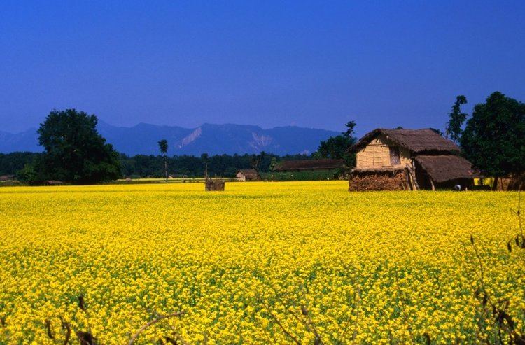
The Terai is the most productive region in Nepal with the majority of the country's industries. Agriculture is the basis of the economy. Major crops include rice, wheat, pulses, sugarcane, jute, tobacco, and maize. In the eastern districts from Parsa to Jhapa they support agro-based industries: jute factories, sugar mills, rice mills and tobacco factories. The Terai is also known for beekeeping and honey production, with about 120,000 colonies of Apis cerana.
Cities over 50,000 population in Nepal's Terai include:
Transport
Mahendra Highway crosses the Nepal Terai from Kankarbhitta on the eastern border in Jhapa District, Mechi Zone to Mahendranagar near the western border in Kanchanpur District, Mahakali Zone. It is the only motor road spanning the country from east to west.
Tourism
Tourist attractions in the Terai include: