
Native name राप्ती नदी Length 600 km Mouth Ghaghara | River system Ganges Source Rapti Zone Country India | |
 | ||
Main source Rapti Zone, Nepal south of border of Rukum District with Rolpa District
3,500 m (11,500 ft) Basin size 23,900 km (9,200 sq mi) River mouth Ghaghara River; 60 m (200 ft); 26°17′20″N 83°40′08″E / 26.289°N 83.669°E Coordinates: 26°17′20″N 83°40′08″E / 26.289°N 83.669°E Tributaries Left: Lungri Khola, Jhimruk Khola, Ami River, Rohini River; Right: Arun Khola Discharge Average rate: 136 m3/s (4,800 cu ft/s) | ||
West Rapti drains Rapti Zone in Mid-Western Region, Nepal, then Awadh and Purvanchal regions of Uttar Pradesh state, India before joining the Ghaghara a major left bank tributary of the Ganges known as the Karnali inside Nepal.
Contents
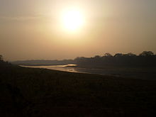
Map of Rapti River, Uttar Pradesh
The West Rapti is notable for janajati ethnic groups – Kham Magar among its highland sources and then Tharu in Inner Terai Deukhuri Valley, for its irrigation and hydroelectric potential, and for recurrent floods that led to its nickname "Gorakhpur's Sorrow".
Geography
The Rapti rises south of a prominent E-W ridgeline midway between the western Dhaulagiri Himalaya and the Mahabharat Range. A 3,500 metres (11,500 ft) summit on this ridgeline marks a triple divide. North of the triple divide the Karnali and Gandaki basins are adjacent; south of it the Rapti and similar but smaller Babai River (Nepali: बबई नदी; Babaī Nadī) separate the two larger basins. After crossing into India, the Babai and Rapti separately join the Karnali's continuation called Ghaghara. The Ghaghara ultimately joins the Ganges, as does the Gandaki.
Ancient river
Aciravati, an ancient river has been identified with the modern Rapti. .
History
House of Tulsipur
Development
The Rapti's flow has great seasonal variation because the river lacks sources in high elevation glaciers and snowfields to buffer pre-monsoon drought. Average monthly flows at Jalkundi (27°58'N, 82°14'E) in Deukhuri Valley vary from 17.6 m3/s in pre-monsoon April to 451 m3/s at the peak of the monsoon in August. Maximum recorded flood was 7,390 m3/s on 10 September 1981. 100-year flood flows are predicted at 10,100 m3/s. Over 700,000 acres (280,000 ha) in Uttar Pradesh are at risk of floods every year.
Flood control projects under study include a dam at Jalkundi that would inundate 71,000 acres (29,000 ha) of farmland in Deukhuri Valley. An alternative dam site is upstream at Naumure on the Pyuthan-Dang district border (27°53'N, 82°48'E). This would be an earthen dam 169 m high with 351 million cubic meters live storage capacity, storing excess monsoon flows for irrigation use during the following dry season and generating up to 207 megawatts. Impoundment would mainly be in gorges through the Mahabharat Range, inundating less farmland than the Jalkundi alternative.
Plans are also underway for three irrigation sub-projects – Kapilvastu District 30,500 hectares (75,000 acres) involving interbasin water transfer to the southeast, Deukhuri Valley 9,500 hectares (23,000 acres), and Banke District 40,000 hectares (99,000 acres).