
Country Nepal Time zone NPT (UTC+5:45) Zone Narayani Zone | Area 1,190 km² | |
 | ||
Region Central Development Region, Nepal | ||
Bara District (Nepali: बारा जिल्ला Listen ) lies in Province No. 2. It is one of the seventy-five districts of Nepal. The district, with Kalaiya as its district headquarters, covers an area of 1,190 km² and has a population (2011) of 687,708. Bakaiya, Jamuniya, Pasaha, Dudhaura and Bangari are the main rivers of Bara. The main languages spoken in Bara are Bhojpuri, Bajjika, Maithili and Nepali.
Contents
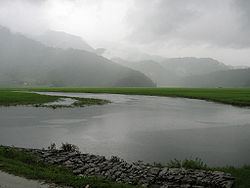
Map of Bara, Nepal
Education
Nepal Loktantrik Primary School is one of the schools in the district.
History
Simraungadh is major part of Bara district. It is historical place in Nepal. Simraungarh is famous for agriculture product in Nepal. The people grow wheat, corn, green vegetables (cauliflower, tomato, banana (raw), beetroot, bitter gourd, bottle gourd, brinjal, cabbage, carrot, cauliflower, chilli (green), chilli (dry red), Arbi coriander leaves, cucumber, potato and so on).
Bara district is famous for the Gadhimai Temple, particularly as every five years it celebrates the Gadhimai Mela. This festival has historically been celebrated every 5 years by sacrificing animals. In the future animal sacrifice will no longer occur, as temple authorities have decided to convert the festival into a "momentous celebration of life."