
Elevation(maximum) 506 m (1,660 ft) Area 1,606 km² | Headquarters Chandragadhi Time zone NPT (UTC+5:45) Zone Mechi Zone | |
 | ||
Documentary of jhapali samaj australia
Jhapa (Nepali: झापा जिल्ला Listen ) is a Terai district in Mechi zone of south-eastern Nepal. Under the new federal division, the district lies in Province No. 1. The latest official data, 2011 Nepal Census, puts the total population of the district at 812,650. An inhabitant of Jhapa is known as a Jhapali. The district headquarters is Bhadrapur.
Contents
- Documentary of jhapali samaj australia
- Map of Jhapa Nepal
- Location
- Climate
- Administration
- Towns Municipalities
- Demography
- Geography and climate
- Attractions and sites
- Development
- Education
- Role in national politics
- Agriculture and industry
- References
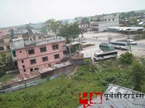
Map of Jhapa, Nepal
Location
Jhapa is the easternmost district of Nepal and lies in the fertile Terai plains. It is bound by Ilam in the north, Morang in the west, the Indian state of Bihar in the south and another Indian state of West Bengal to the southeast and east. Geographically, it covers an area of 1,606 km2 (620 sq mi).
Climate
Jhapa observes moderate climate complexion as it lies in the Indo-Gangetic plain and Churia low hills. Though due to close proximity to the lower Himalaya, the weather is calm throughout the year. Seasonal monsoon is well distributed across the district. The temperature is highest during May through September, though winter is not extreme, keeping aside fogging during mornings. Climatic variation is not extreme; however, the southern parts of districts are warmer than the northern ones.
Administration
The district is divided into 37 Village Development Committees (VDC) and 8 municipalities which are as follows.
Towns (Municipalities)
Demography
Not much is known about Jhapa's early settlements. Many scattered villages used to be in the less dense forest area. Nepali speaking people have been living in Jhapa for centuries. In the 1960s and early '70s, the landscape of Jhapa began to change as people from the hills came there to own and cultivate the land under the 'resettlement program' encouraged by King Mahendra.
The eradication of malaria changed the district into an attractive and fertile place. Fertile land, beautiful landscape, proximity to the Nepali-speaking part of modern-day India, territories that the Kingdom of Nepal lost during Partition of Nepal in 1814, attracted many people there for settlement. Santhal, Tajpuriya, Uraon, Sunuwar, Maithil and many indigenous ethnicities are known to have lived there for centuries. Small numbers of Bahun Chhetris and larger groups of Limbu, Kirati people's were found to have lived there before the mass migration from the Indian state Assam and the northeastern part of India and Burma.rajbanshi people are believed to be the first settlers of Jhapa with about 800 years of history.
Jhapa is home to many indigenous ethnic nationalities such as the Limbu, rajbanshi, Gangai and Dhimal. Other ethnic groups such as Dhangad, Santhal, Tamang, Uraon, Magar, Gurung, Sunuwar/सुऩुवाऱ/मुखीय, and many others came to Jhapa in the late 19th century, as did the Brahmins, Chhettri, and Newar. Many Nepali language speaking Indian immigrants from Assam, have also settled in Jhapa. Many Maithil people and Madhesis migrated from Mithila region of Nepal in mid-eastern Nepal and also much Indian Madhesis (majority) from Indian states of U.P and Bihar for trade and work. Jhapa is diverse and rich in culture and traditions due to the influences of its tribes. All the tribes/ethnic groups have their own languages, customs, and traditions. They celebrate their festivals every year.
Geography and climate
Jhapa receives 250 to 300 cm of rainfall a year, mostly during the summer monsoon season. Its hilly northern area receives more rainfall than the south. Its major rivers, like the Mechi, Kankai Mai, Ratuwa, Biring, Deuniya,(Aduwa), (Bhuteni), (Dhangri), Hadiya, Ninda, Krishne Khola, Gauriya, Ramchandre, Kamal etc. provide water for irrigation.
Due to its alluvial soil best suited for agriculture, Jhapa has been the largest producer of rice and is therefore known as the Grain Grocery of Nepal. Besides cereal crops like rice and wheat, it is one of the largest producers of jute, tea, betel nut, rubber, and other cash crops.
Jhapa has vast areas of forests, such as Deonia, Charali, Charkose Jhaadi, Hadiya, Sukhani, Jalthal, and others. Its name itself is derived from the Rajbanshi word jhapa meaning "canopy", which suggests that the area had a dense forest in the past. It was once such a dense and dangerous forest that it was called Kaalapaani and prisoners were sent here to die of malaria and other diseases in the jungle.
Attractions and sites
Jhapa has several religious and historical sites of great importance like Kankai Mai, Kichakbadh, Satasidham, Arjundhara, Chillagadh, Biratpokhar, Mini Mountain-Bahundangi,Sukhani Park, and Krishnathumki among others. It is believed that Pandu's son Bhim killed Kichak in Kichakbadh (near Kechana in the south border) in the time of the Mahabharata and a great festival is observed on that day every year. There is also the historic fort of Chandragadh which gave its name to Chandragadhi. Other sites, too, have their religious and historical values.
It is the gateway to Darjeeling and Sikkim and the rest of northeast India from Nepal from where a large number of people migrated to Jhapa during "resettlement program" by Panchayati system. Arable land and majestic tea gardens manufacturing the fastest and largest tea contribution in Nepal have added beauty in the lap of uprising hills; paddy production and coconuts are also significant in this Jhapa.
Recently, Jhapa is gaining popularity in the medical field, especially in eye treatment. Each day hundreds of patient from adjoining districts of Nepal and neighbouring India visit Mechi Eye Hospital for treatment.
The other major centers of attractions are Jhamunkhadi Simsar Tourism Area in Surunga, Domukha and Sukhani Park(Jhill) in Shani-Arjun as well.
Development
Jhapa is one of the most developed districts of the Country. Almost all the villages and towns are linked by roads, facilitated with drinking water, electricity, health centers, schools. There are schools and colleges in virtually all parts of the district. There is one airport named Chandragadhi Airport and a zonal hospital in Bhadrapur. Jhapa also has the highest literacy rate in the country after Kathmandu, Kaski and Chitwan districts.
The airport is domestic and one can get several regular flights between Kathmandu and Bhadrapur daily. It takes 45 minutes by air to fly from Kathmandu to Jhapa.
There is a hundred bedded Zonal hospital. It has different departments as Medicine, Surgery, Gynaecology & obstetrics, Paediatrics, and the 24 hours emergency facilities. AMDA Hospital Damak,established in 1992 as AMDA referral center of 15-bed capacity with the help of AMDA International, and Damak Municipality. There are some private hospitals like Life Line Hospital,Damak, Mechi Model Hospital, Kanchunga Hospital, Pathivara Hospital & Research Center Pvt.Ltd., Manmohan Memorial Eastern Regional Hospital, Birta City Hospital and Research Center, B & C Hospital, Birtamod etc. It also has Mechi eye Hospital which is supposed to be one of the biggest eye hospital in Nepal.
The government hospital provides plastic surgery services occasionally.
Education
Jhapa is the district with highest number of literate with literacy rate being 98.33%.
Shree Singha Devi Higher Secondary School, Chulla Chulli English Boarding School, Emerald Academy, Birat Jyoti English Boarding Higher Secondary School,bhanu higher secondary school bhaundagi, Siddhartha Sishu Sadan and Little Flowers School are some of the best in the country. There are some good private schools like Everest view English Secondary Boarding School. , East Horizon English School, Bal Kalyan Boarding Secondary School, Shree Harikul Model Higher Secondary School, Suryodaya English School,North Point Secondary English Boarding School, ADES, Siddhartha Boarding School, Newtons Education Academy, Shree Pashupati Secondary School, Balmiki providence, Gyanjyoti Higher Secondary School, Dipjan English Boarding School, Divya Jyoti Secondary School, Purwanchal Academy,Unique English Secondary School etc.
The number of colleges providing higher studies has been increasing in Jhapa. Mechi Multiple Campus and Damak Multiple Campus are the wings of Tribhuvan University. Manakamana Multiple Campus Birtamode, Kankai Adarsh Campus Birtamode, Gomendra Multiple College Birtamode, College for Higher Education (COHED) and Kanakai Multiple Campus Surunga are the other main colleges providing higher education up to master's degree in Management, Education, and Humanities stream. Mechi Multiple Campus, Devi H.S. School & Devi Campus and Manakamana Multiple Campus are the most known campuses in Jhapa that provides better education qualities. There is a government school providing quality education to students in English. Shree Kankai Higher Secondary School is the school serving since 2015 BS. Private colleges like Amity College, Balmiki Providence, Birta Jyoti, Indreni College, Newton's Academy, etc. are providing quality of education admitting students from whole eastern Nepal.
Role in national politics
It plays the main role in national politics. The Communist revolution was started from the Jhapa, which led to formation of one of the most prominent parties and largest communist party of Nepal: CPN-UML. Many national political figures are from Jhapa such as C.K. Prasai (Bharat Babu), R.K Mainali, K.P Oli, Krishna Prasad Sitaula, Chakra Bastola, and Chandra Prakash Mainali.
During Jana Andolan 2063 (April Revolution), Jhapa played a significant role in the agitation against Royal takeover. Around 5 people were killed by the Royal Army in Bhadrapur, and many more deaths weren't disclosed. Moreover, Jhapa is recognized as the site of intelligence across the country, and major political agendas are guided by Jhapali leaders. The inception of movements and awareness could be observed in Jhapa first and disseminated elsewhere.
Agriculture and industry
Jhapa is famous for microcredit development. The Small Farmer Development Programme (SFDP) was the first rural and micro-financing program in Jhapa. The Agricultural Development Bank started this SFDP in 1988. It started in a few VDCs and spread. After lifting many people out of poverty, the SFDP was handed over to the local people and the new institution was named Small Farmer Cooperative Ltd (SFCL). There are 13 SFCLs in Jhapa, each of which covers a single VDC.
It is one of the major districts for the production of tea and rice. Budhabare is on the northern side of the Mahendra Highway and is one of the most fertile lands of Nepal. Jhapa as a district is popular for the betel nuts (Supari). Several large tea estates are in Jhapa. Giri Bandhu Tea Estate, Burne Tea State, Tokla Tea Estate, Himalaya Tea State, Damak, Sattighatta Tea Estate are the major ones.
Jhapa has different sorts of communication medium.