
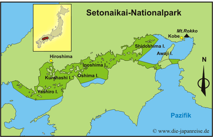
Established March 16, 1934 | Area 669.3 km² | |
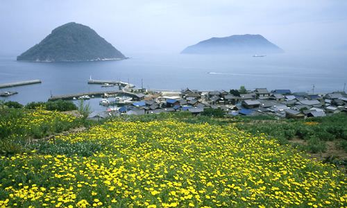 | ||
Saikazaki setonaikai national park
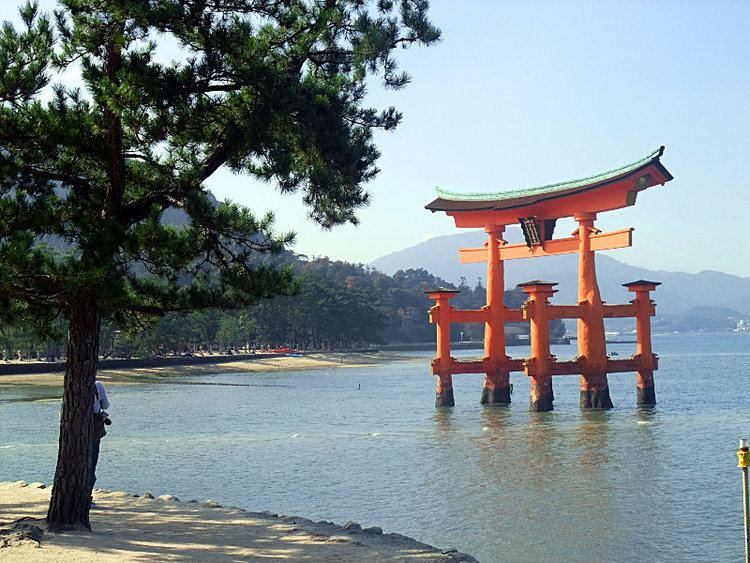
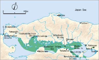
Setonaikai National Park (瀬戸内海国立公園, Setonaikai Kokuritsu Kōen) is a national park comprising areas of Japan's Inland Sea and of ten bordering Prefectures. Designated a national park in 1934, it has since been expanded several times. It contains about 3,000 islands, including the well-known Itsukushima. As the park is formed of many non-contiguous areas, and covering a tiny proportion of the Inland Sea's total extent, control and protection is problematic, with much of the wider area heavily industrialized.
Contents
- Saikazaki setonaikai national park
- Setonaikai national park manabe jima island to tadotsu
- History
- Climate
- Sites
- Facilities
- Natural areas
- Cultural sites
- Related municipalities
- References
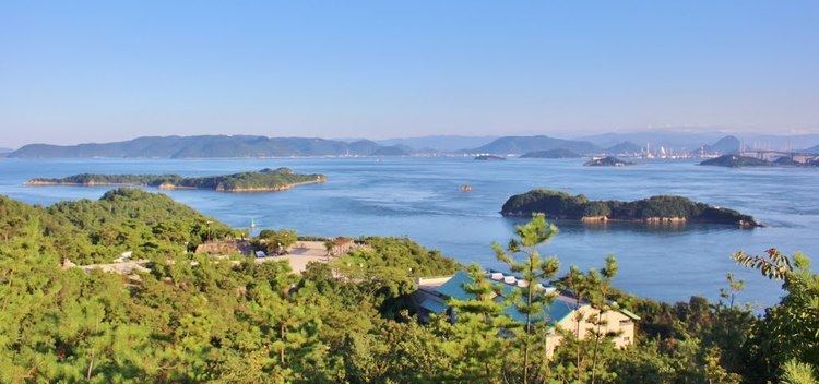
Setonaikai national park manabe jima island to tadotsu
History
In 1934, when the park was designated as the first national park in Japan, the area was much smaller than the area is now. Sixteen years later, it was extended to almost the same size as now in order to include other famous places in the area. Also, the park is the biggest national park in Japan. In 1996, Itsukushima Shrine in the park which is located in Hiroshima prefecture was registered as a cultural site of world heritage by UNESCO. It is known as one of the three most scenic spots in Japan. But in the 1960s and 1970s, which was a period of rapid economic growth in Japan, industrialization contaminated the environment. For example, bank protection works, pollution of the discharge from chemical works, and farm cultivation led to environmental deterioration. These changes had an influence on an ecosystem and water pollution. Recently, the water has been improved because of a high-performance sewage disposal.
Climate
It is warm weather around the park throughout the year, so the climate is called a Mediterranean climate. Since the area is easily accessible by public transport, people have lived on the coast to work on the land, taking advantage of the warmth. Mandarin oranges and sweet potato are examples of special products in the area. Compared to the Mediterranean Sea, the Inland Sea has more minerals in the water, so there are plentiful plankton. The diversity of creatures is one of the fascinations in the park.
Sites
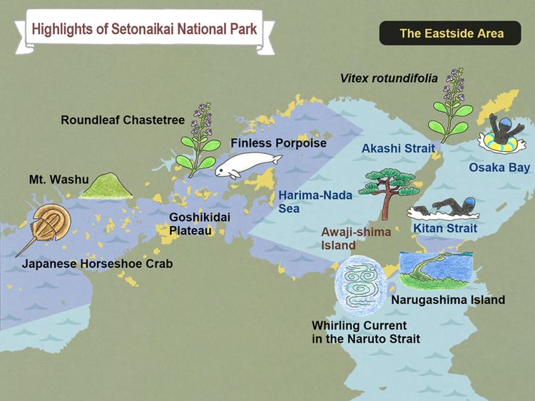
There are numerous sightseeing places in the national park. Kanmon Strait is one of them. It is located between Honshu and Kyushu. There is a suspension bridge called Kammon Strait Bridge across the strait. In 1973, when the bridge was opened for the public, it was the longest bridge (0.66 miles) in the East. Also, the Naruto whirlpools in Tokushima prefecture are tidal whirlpools in the Naruto Strait, a channel between Naruto and Awaji Island in Hyogo prefecture. The whirlpools, one of the prefecture’s major tourist attractions, are formed due to a narrow width (0.8 miles) of the strait and a water level of 5.6 feet between the Inland Sea and the Open Sea caused by the ebb and flow of the tide. It sometimes creates a whirlpool 100 feet in diameter.
Facilities
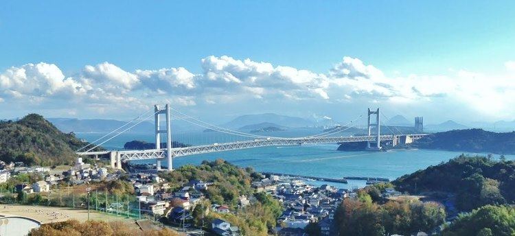
There are facilities where people can experience and learn about nature in the park. Mt. Rokko Nature Conservation Center and Mt. Rokko Guide House in Hyogo prefecture are places where people can find numerous natural specimens of Mt. Rokko. Wasuzan Business Center is located in Okayama prefecture. It stands on the top of Washuzan Mountain. It is also near Seto-ohashi Bridge which is a series of ten bridges between Okayama and Kagawa prefectures. The total length is 8.1 miles (13.1 km). From the center, people can see the panorama of the bridge and the Inland Sea. It is also possible to learn about the nature around the bridge and the history of the Inland Sea.
Natural areas
Cultural sites
Related municipalities
The park crosses the borders of fifty-five cities, fourteen towns, and one village: