
Country Japan | Population 239,973 (2010) Area 353.74 km2 Mayor Kazutoshi Komura | |
 | ||
Points of interest | ||
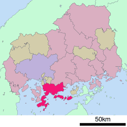
Map of Kure, Hiroshima
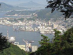
Kure (呉市, Kure-shi) is a port and major shipbuilding city situated on the Seto Inland Sea in Hiroshima Prefecture, Japan. With a strong industrial heritage Kure hosts the second oldest naval dockyard in Japan and remains an important base for the Japan Maritime Self-Defence Force (JMSDF).
Contents
- Map of Kure Hiroshima
- History
- Historic Timeline
- Geography
- Climate
- Transportation
- Economy
- Museums
- Shrines
- Historical places
- Parks and gardens
- Mountains
- Beaches
- Festivals
- Sister cities
- Musicians
- Authors
- Sports
- References
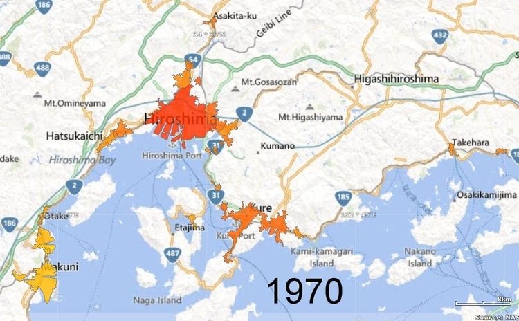
As of May 1, 2015, the city has an estimated population of 228,030 and a population density of 646 persons per km². The total area is 352.80 km².
History
The Kure Naval District was first established in 1889, leading to the construction of the Kure Naval Arsenal and the rapid growth of both steel production and shipbuilding in the city. The city itself was formally incorporated on October 1, 1902. From 1889 until the end of World War II, the city served as the headquarters of the Kure Naval District.
Kure dockyards recorded a number of significant engineering firsts including; in 1905 the launching of the first major domestically built capital ship, the cruiser Tsukuba, and, in 1940, the launching of the largest battleship ever built, the Yamato.
During the Pacific War, Kure acted as Japan's single largest naval base and arsenal. Most of the city's industry and workforce were employed in the service of the naval installations, munitions factories and associated support functions. In the later stages of the conflict Kure came under sustained aerial bombardment culminating in the Bombing of Kure in June and July 1945.
From February 1946 until the end of Japan's postwar occupation in 1952, military establishments in Kure served at the operational headquarters for the British Commonwealth Occupation Force.
Historic Timeline
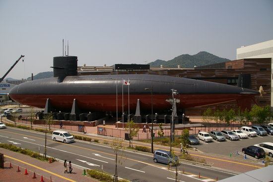
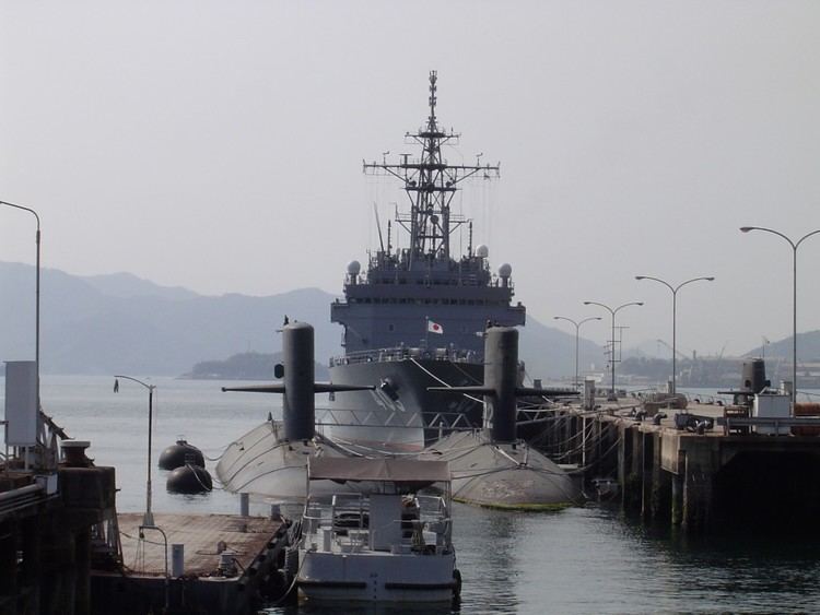
The city continues as a major maritime center hosting both the dockyards of Japan Marine United and numerous shore based facilities of the JMSDF including training centers and a major hospital. The city serves as the home port of an Escort Flotilla (Destroyers), a Submarine Flotilla and the Training Squadron of the JMSDF Regional Kure District.
Since 2005 Kure has also attracted attention as a tourism center with the Yamato Museum hosting a 1:10 scale model of the battleship Yamato alongside a waterfront JMSDF museum of naval history.
Geography
Kure is located 20 kilometres (10 mi) south-east of Hiroshima city and faces the Seto Inland Sea. Surrounded by steep hillsides to the north, the two major commercial and industrial centers of the city are bisected by Mount Yasumi 497 m (1,631 ft). The city is next to the Setonaikai National Park. As well as densely populated urban and industrial centers, the city also incorporates sparsely inhabited outlying islands such as Kurahashi, Shimo-kamagari and Kami-kamagari.
Climate
Kure has a humid subtropical climate (Köppen climate classification Cfa) with hot summers and cool winters. Precipitation is significant throughout the year and is heaviest in summer.
Transportation
Kure is served by the Kure Line, operated by West Japan Railway Company (JR West). It leads to Hiroshima, which is a terminal station.
There has been a municipal bus since December 1, 1942. The Kure City Transportation Bureau (Kure City Bus) started using natural gas in 2002. There is a bus route run by Hiroshima Electric Railway, too. In addition, there is Bōyo Kisen, which operates the San'yō Bus and Setouchi Sankō which runs two bus enterprises.
National Route 31 spreads out from Kure to Kaita, but the distance of the road is short. National Route 185 is connected from Kure to Mihara. This road has a view of the Inland Sea. National Route 375 is a 165-kilometre-long (103 mi) road to be connected from Kure to Ōda, Shimane. U.S. forces can use this way for their ammunition transportation. National Route 487 spreads out from Kure to the city of Hiroshima. This road crosses the Ondo Bridge, and goes around Etajima.
Though they are independent roads, separate from National Routes, there are a series of access roads toward the archipelago of the city. The Akinada Islands series of bridges conclude at Shimokamagari island, Kamikamagari island, Toyoshima, Osakishimojima, Herashima, Nakanoshima at seven bridges. Toyoshima Bridge, concluding at Toyoshima regards traffic of a ship as Kamikamagari island, and is 50 m high from the surface of the sea.