
Area 124.6 km² | Population 24,623 (31 Mar 2012) Local time Tuesday 7:37 AM | |
 | ||
Time zone Japan Standard Time (UTC+9) City hall address 1650 Ōji-Aiai, Bungotakada-shi, Ōita-ken878-8555 Website www.city.bungotakada.oita.jp Weather 6°C, Wind W at 18 km/h, 63% Humidity Points of interest Fuki‑ji, Kumano magaibutsu, Tennen‑ji Temple, Maki Ōdō, Central Park | ||
Bungotakada (豊後高田市, Bungotakada-shi) is a city located in Ōita Prefecture, Kyushu, Japan.
Contents
Map of Bungotakada, Oita Prefecture, Japan
As of March 31, 2012, the city has an estimated population of 24,623, with 10,479 households and a population density of 119.15 persons per km². The total area is 206.65 km².
On March 31, 2005, the towns of Kakaji and Matama (both from Nishikunisaki District) were merged into Bungotakada.
Agriculture
Bungotakada is known for negi (Welsh onions).
Points of interest
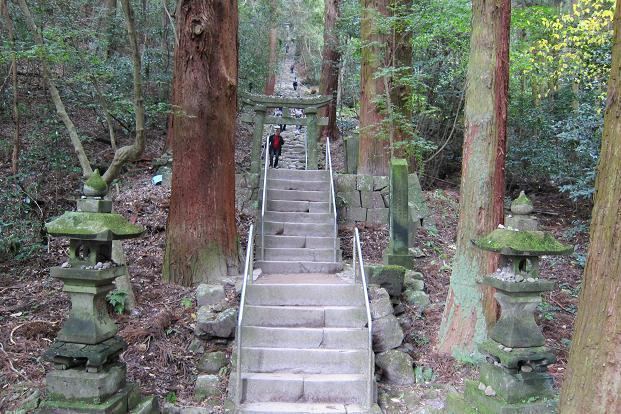
Historic sites include Fuki-ji, Maki Ōdō, and Kumano magaibutsu.
The Shōwa Style Town Visitor Attraction (Shōwa no Machi in Japanese) is also a famous sightseeing spot.
References
Bungotakada, Ōita Wikipedia(Text) CC BY-SA