
Length 828 km | ||
 | ||
History: Proposed 1938Opened December 1947 – October 11, 1968Extended June 28 and November 21, 2015 | ||
North america s busiest freeway eastbound ontario highway 401 thru toronto km 344 to km 375
King's Highway 401, commonly referred to as Highway 401 and also known by its official name as the Macdonald–Cartier Freeway or colloquially as the four-oh-one, is a 400-series highway in the Canadian province of Ontario. It stretches 828.0 kilometres (514.5 mi) from Windsor in the west to the Ontario–Quebec border in the east. The part of Highway 401 that passes through Toronto is North America's busiest highway, and one of the widest. Together with Quebec Autoroute 20, it forms the road transportation backbone of the Quebec City–Windsor Corridor, along which over half of Canada's population resides and is also a Core Route in the National Highway System of Canada. The route is maintained by the Ministry of Transportation of Ontario (MTO) and patrolled by the Ontario Provincial Police. The speed limit is 100 km/h (62 mph) throughout its length, unless posted otherwise.
Contents
- North america s busiest freeway eastbound ontario highway 401 thru toronto km 344 to km 375
- Map of ON 401 Ontario Canada
- Route description
- Southwestern Ontario
- Greater Toronto Area
- Eastern Ontario
- Traffic
- Predecessors
- Assumption
- Advantage I 75
- Carnage Alley
- Highway of Heroes
- Safety concerns and highway improvements
- Future
- Central Ontario
- Services
- Exit list
- References
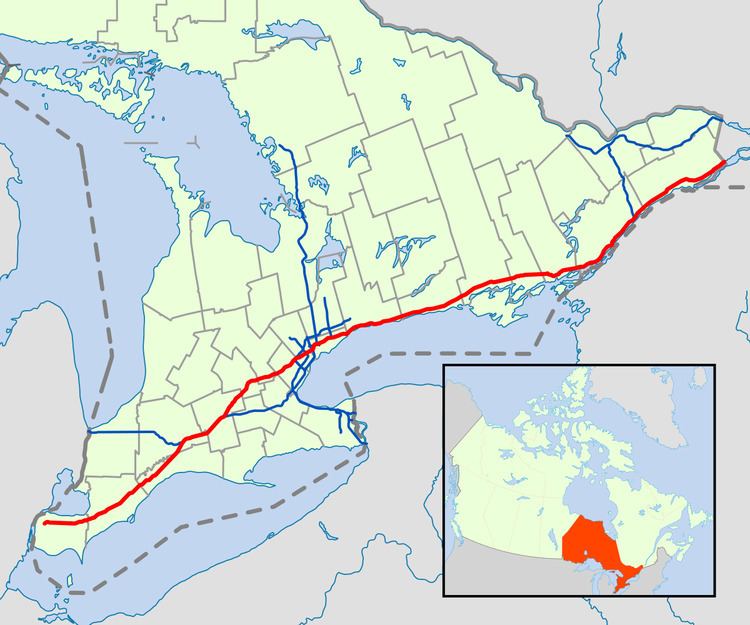
Map of ON-401, Ontario, Canada
By the end of 1952, three individual highways were numbered "Highway 401": the partially completed Toronto Bypass between Weston Road and Highway 11 (Yonge Street); Highway 2A between West Hill and Newcastle; and the Scenic Highway between Gananoque and Brockville, now known as the Thousand Islands Parkway. These three sections of highway were 11.8, 54.7 and 41.2 km, (7.3, 34.0 and 25.6 mi), respectively. In 1964, the route became fully navigable from Windsor to the Ontario–Quebec border. In 1965 it was given a second designation, the Macdonald–Cartier Freeway, in honour of the Fathers of Confederation. At the end of 1968, the Gananoque–Brockville section was bypassed and the final intersection grade-separated near Kingston, making Highway 401 a freeway for its entire 817.9-km length. On August 24, 2007, the portion of the highway between Glen Miller Road in Trenton and the Don Valley Parkway / Highway 404 Junction in Toronto was designated the Highway of Heroes, as the road is travelled by funeral convoys for fallen Canadian Forces personnel from CFB Trenton to the coroner's office in Toronto. On September 27, 2013, the Highway of Heroes designation was extended west to Keele Street in Toronto, to coincide with the move of the coroner's office to the new Forensic Services and Coroner's Complex at the Humber River Hospital.
In 2011, construction began on a westward extension called the Right Honourable Herb Gray Parkway. This new route follows, but does not replace, former Highway 3 between the former end of the freeway and the E. C. Row Expressway, at which point it turns and parallels that route towards the site of the future Gordie Howe International Bridge. An 8-kilometre (5 mi) section of the parkway, east of the E. C. Row interchange, opened on June 28, 2015, with the remaining section completed and opened on November 21. Elsewhere in Ontario, plans are under way to widen the remaining four-lane sections between Windsor and London to six lanes and to widen the route between Cambridge and Milton as well as through Oshawa. The expansive twelve-plus-lane collector–express system will also be extended west through Mississauga to Milton and east through Ajax and Whitby.
Route description
Highway 401 extends across Southwestern, Central and Eastern Ontario. In anticipation of the future expansion of the highway, the transportation ministry purchased a 91.4-metre-wide (300 ft) right-of-way along the entire length. Generally, the highway occupies only a portion of this allotment. It is one of the world's busiest highways; a 2008 analysis stated the annual average daily traffic (AADT) count between Weston Road and Highway 400 in Toronto was approximately 450,000, while a second study estimate over 500,000 vehicles travel that section on some days. This makes it North America's busiest roadway, surpassing the Santa Monica Freeway in Los Angeles and I-75 in Atlanta. The just-in-time auto parts delivery systems of the highly integrated automotive industry of Michigan and Ontario have contributed to the highway's status as the world's busiest truck route, carrying 60 percent of vehicular trade between Canada and the US.
Highway 401 also features North America's busiest multi-structure bridge, located at Hogg's Hollow in Toronto. The four bridges, two for each direction with the collector and express lanes, carried an average of 373,700 vehicles daily in 2006. The highway is one of the major backbones of a network in the Great Lakes region, connecting the populous Quebec City–Windsor corridor with Michigan, New York and central Ontario's cottage country. It is the principal connection between Toronto and Montreal, becoming Autoroute 20 at the Ontario–Quebec border.
Southwestern Ontario
Highway 401 does not yet extend the last few kilometres to Detroit; an extension to Brighton Beach (at the Canada–US border in Windsor) was completed in November 2015, after which the Gordie Howe International Bridge will extend Highway 401 across the Canada–United States border through Delray to Interstate 75 in Michigan by 2019. At present, Highway 401 begins as a six-lane freeway at the west end of the E. C. Row Expressway. At the Dougall Parkway, the highway turns east and exits Windsor. From here, Highway 401 mostly parallels the former route of Highway 98 from Windsor to Tilbury.
Southwestern Ontario is flat, primarily agricultural land, that takes advantage of the fertile clay soil deposited throughout the region. The main river through the region is the Thames River, which drains the second largest watershed in southern Ontario and largely influences the land use surrounding the highway; It parallels the route to the north between Tilbury and Woodstock.
Near Tilbury, Highway 401 loses its tall wall median barrier and narrows to four lanes, following lot lines laid between concession roads in a plan designed to limit damage to the sensitive agricultural lands through which the highway runs. Here the highway's flat and straight route is notorious for leading to driver inattention. The section from Windsor to London (especially west of Tilbury) has become known for deadly car accidents and pile-ups, earning it the nickname Carnage Alley. As the highway approaches London, Highway 402 merges in, resulting in a six-lane cross-section. Within London, it intersects the city's two municipal expressways, Highbury Avenue and the Veterans Memorial Parkway.
The section between London and Woodstock generally parallels the former Highway 2 but lies on the south side of the Thames River. This area is not as flat but the highway is generally straight. This part of Highway 401 often experiences heavy snowsqualls in early winter, sometimes extending as far east as Toronto. To the south of Woodstock, Highway 401 curves northeast and encounters the western terminus of Highway 403. The highway heads towards Kitchener and Cambridge, where it encounters Highway 8 and returns to its eastward orientation. East of Cambridge, the highway meanders towards Milton, passing through hills and rock cuts along the way.
Greater Toronto Area
As Highway 401 approaches the Greater Toronto Area (GTA), it descends through the ecologically protected Niagara Escarpment to the west of Milton. Upon entering the town, it enters the first urbanized section of the GTA, passing through two rural areas between there and Oshawa. The first rural gap is the western side of Toronto's Greenbelt, a zone around Toronto protected from development. After this 10 km (6.2 mi) gap, the highway interchanges with the Highway 407 Express Toll Route. Within the GTA, the highway passes several major shopping malls including Yorkdale Shopping Centre, Scarborough Town Centre and Pickering Town Centre.
Highway 401 widens into a collector-express system as it approaches Hurontario Street in Mississauga, a concept inspired by the Dan Ryan Expressway in Chicago. The system divides each direction of travel into collector and express lanes, giving the highway a wide span and four carriageways. To avoid confusion between carriageways, blue signs are used for the collector lanes and green signs for the express lanes. Unlike the collector lanes, which provide access to every interchange, the express lanes only provide direct access to a select few interchanges. Access between the two is provided by transfers, which are strategically placed to prevent disruptions caused by closely spaced interchanges. The overall purpose of the collector-express system is to maximize traffic flow for both local and long-distance traffic. In addition, Highway 401 was equipped with a traffic camera system called COMPASS in early 1991. Using closed-circuit television cameras, vehicle detection loops and LED changeable-message signs, COMPASS enables the MTO Traffic Operations Centre to obtain a real-time assessment of traffic conditions and alert drivers of collisions, congestion and construction. The system currently stretches from the Highway 403 / 410 interchange in Mississauga to Harwood Avenue in Ajax.
Two sets of collector-express systems exist in the GTA. The first set is 6.6 km (4.1 mi) long and connects Highway 403, Highway 410 and Highway 427. This system primarily serves to accommodate and organize various traffic movements from the Highway 403 / 410 and Highway 427 interchanges along Highway 401, replacing an earlier plan that would have run Highway 403 directly to Eglinton Avenue and the never-built Richview Expressway. East of the interchange with Renforth Drive, the collector lanes diverge to become the on-ramps to Highway 427 northbound and southbound. The second 43.7 km (27.2 mi) system passes through the centre of Toronto and ends in Pickering to the east. The 5 km (3.1 mi) gap between the two systems is a traffic bottleneck. However, the interchange cannot currently accommodate future widening of Highway 401.
Highway 401 widens to 18 lanes south of Toronto Pearson International Airport. Progressing eastward, eight lanes are carried beneath the large spaghetti junction at Highway 427. The highway curves northeast and follows a power transmission corridor to Highway 409, which merges with the mainline and forms the collector lanes. It returns to its eastward route through Toronto, now carrying 12–16 lanes of traffic on four carriageways. Highway 401 is often congested in this section, with an average of 442,900 vehicles passing between Weston Road and Highway 400 per day as of 2008. In spite of this congestion, it is the primary commuting route in Toronto; over 50 percent of vehicles bound for downtown Toronto use the highway.
East of Highway 400 is The Basketweave, a criss-crossing transfer between the express and collectors carriageways, beyond which is Yorkdale Centre. Twelve lanes pass beneath a complicated interchange with Allen Road, built to serve the cancelled Spadina Expressway. Further east, the highway crosses Hogg's Hollow, over the West Don River and Yonge Street in the centre of Toronto, the busiest multi-span bridge crossing in North America, surpassing the Brooklyn Bridge. It then crosses the East Don River and climbs toward the Don Valley Parkway, which provides access to downtown Toronto and Highway 404, which provides access to the suburbs to the north. Progressing eastward, the highway continues through mostly residential areas in Scarborough, eventually reaching the Rouge Valley on the city's eastern edge and crossing into Pickering.
West of Pickering, Highway 401 again meets former Highway 2, which thereafter parallels it to the Ontario–Quebec border. As the highway approaches Brock Road in Pickering, the collector and express lanes converge, narrowing the 14-lane cross-section to 10, divided only at the centre. It remains this width as it passes into Ajax, before narrowing back to six lanes at Salem Road. Planned expansions east of Salem to accommodate an interchange with Highway 412 will see the highway widened to ten lanes east to Brock Street.
East of Ajax, the highway passes through the second 3.5 km (2.1 mi) rural gap, and enters Whitby. The stretch of Highway 401 through Whitby and Oshawa features several structures completed during the initial construction of the highway in the 1940s. Several of these structures are to be demolished, either due to their age, or to prepare for the planned widening of Highway 401 through this area. A former Canadian National Railway overpass, which was fenced off but commonly used by pedestrians during Highway of Heroes repatriations, was demolished on the night of June 11, 2011. A second structure in Bowmanville was demolished during two overnight closures on July 9 and 16. At Harmony Road, the suburban surroundings quickly transition to agricultural land. The highway curves around the south side of Bowmanville and travels towards Highway 35 and Highway 115.
Eastern Ontario
From east of Highway 35 and Highway 115 to Cobourg, Highway 401 passes through a mix of agricultural land and forests, maintaining a straight course. As the highway passes through Cobourg, it narrows to four lanes and the terrain becomes undulating, with the highway routed around hills and through valleys along the shores of Lake Ontario. At Trenton, the highway crosses the Trent Canal and returns to an agricultural setting. It then crosses the Moira River as it goes through Belleville before heading eastward to Kingston. The Kingston portion of the highway, originally named the Kingston-Bypass, was one of the first sections of the highway to be completed; it is now mostly three lanes each way.
East of Kingston, the highway continues through a predominantly agricultural area alongside the Saint Lawrence River to Gananoque, where it splits with the Thousand Islands Parkway, one of the original sections of the highway designated in 1952. The current Highway 401 runs parallel to the parkway several kilometres inland from the river. The Canadian Shield, an ancient geological formation, appears through this heavily forested section of the highway. Highway 401 rejoins the Thousand Islands Parkway immediately southwest of Brockville, now heading northeast.
The remainder of the highway runs parallel to the former Highway 2 along the shore of the Saint Lawrence River within the Saint Lawrence Valley. Northeast of Brockville is the interchange with Highway 416, which heads north to Ottawa. At the Ontario–Quebec border, Highway 401 becomes Autoroute 20 and continues to Montreal.
Traffic
The MTO publishes yearly traffic volume data for provincial highways, expressed as an average daily vehicle count over the span of a year (AADT). The table below compares the AADT at several locations along Highway 401 using data from 1969, 1988 and 2008.
Predecessors
Highway 401's history predates its designation by over two decades. As automobile use in southern Ontario grew in the early 20th century, road design and construction advanced significantly. Following frequent erosion of Lake Shore Road, then macadamized, a concrete road known as the Toronto–Hamilton Highway was proposed in January 1914. Construction began on November 8 of that year, following the onset of World War I. The highway was designed to run along the lake shore, instead of Dundas Street to the north, because the numerous hills encountered along Dundas would have increased costs without improving accessibility. Middle Road, a dirt lane named because of its position between the two, was not considered since Lake Shore and Dundas were both overcrowded and in need of serious repairs. The road was formally opened on November 24, 1917, 5.5 m (18 ft) wide and nearly 64 km (40 mi) long. It was the first concrete road in Ontario, as well as one of the longest stretches of concrete road between two cities in the world.
Over the next decade, vehicle usage increased substantially, and by 1920 Lakeshore Road was again congested, particularly during weekends. In response, the Department of Highways examined improving another road between Toronto and Hamilton. The road was to be more than twice the width of Lakeshore Road at 12 m (39 ft) and would carry two lanes of traffic in either direction. Construction on what was then known as the Queen Street Extension west of Toronto began in early 1931.
Before the highway could be completed, Thomas McQuesten was appointed the new minister of the Department of Highways, with Robert Melville Smith as deputy minister, following the 1934 provincial elections. Smith, inspired by the German autobahns—new "dual-lane divided highways"—modified the design for Ontario roads, and McQuesten ordered that the Middle Road be converted into this new form of highway. A 40 m (130 ft) right-of-way was purchased along the Middle Road and construction began to convert the existing sections to a divided highway. Work also began on Canada's first interchange at Highway 10.
Beginning in 1935, McQuesten applied the concept of a dual-highway to several projects along Highway 2, including along Kingston Road in Scarborough Township. When widening in Scarborough reached the Highland Creek ravine in 1936, the Department of Highways began construction on a new bridge over the large valley, bypassing the former alignment around West Hill. From here the highway was constructed on a new alignment to Oshawa, avoiding construction on the congested Highway 2. As grading and bridge construction neared completion on the new highway between West Hill and Oshawa in September 1939, World War II broke out and gradually tax revenues were re-allocated from highway construction to the war effort.
At the same time, between September 6 and 8, 1939, the Ontario Good Roads Association Conference was held at Bigwin Inn, near Huntsville, drawing highway engineers from across North America to discuss the new concept of "Dual Highways". On the first day of the convention, McQuesten announced his vision of the freeway: an uninterrupted drive through the scenic regions of Ontario, discouraging local business and local traffic from accessing the highway except at infrequent controlled-access points. It was announced in the days thereafter that this concept would be applied to a new "trans-provincial expressway", running from Windsor to the Ontario–Quebec border.
Highway engineers evaluated factors such as grading, curve radius and the narrow median used along the Middle Road (which was inaugurated on August 23, 1940, as the Queen Elizabeth Way), and began to plan the course of a new dual highway mostly parallel to Highway 2, with precedence given to areas most hampered by congestion. Unlike the Queen Elizabeth Way (QEW), this highway would not be built along an existing road, but rather on a new right-of-way, avoiding the need to provide access to properties.
Along with immense improvements to machinery and construction techniques over its six-year course, the war provided planners an opportunity to conduct a survey of 375,000 drivers, asking them about their preferred route to travel to their destination. Using this information, a course was plotted from Windsor to Quebec, bypassing all towns along the way.
Highway 2S (S for Scenic), was the first completed section of new roadway. Built to connect with the Thousand Islands Bridge at Ivy Lea and opened as a gravel road in late 1941 or early 1942, the road followed the shore of the Saint Lawrence River and connected with the western end of the twinned Highway 2 near Brockville. In addition, the highway between Highland Creek and Oshawa was opened as a gravel-surfaced road in May 1942.
Following the war, construction resumed on roadways throughout Ontario. The expressway between Highland Creek and Oshawa was completed in December 1947, while other sections languished. The Toronto–Barrie Highway was the primary focus of the Department of Highways at the time, and the onset of the Korean War in 1950 stalled construction again. Despite the delays, highway minister George Doucett officially announced the plans for construction of the new trans-provincial expressway that year, with the Toronto to Oshawa expressway serving as a model for the design. Work on the most important link, the Toronto Bypass, began in 1951, but it would not open with that name.
Assumption
In July 1952 (possibly July 1, the same day Highway 400 was numbered), the Highland Creek to Oshawa expressway and Highway 2S were designated Controlled-Access Highway No 401, a move scorned by one critic because of the lack of thought into the numbered name. Construction was completed for several sections of the Toronto Bypass; between Highway 400 and Dufferin Street in August, west to Weston Road in September, east to Bathurst Street in October and finally to Yonge Street in December. Extensions east and west began in 1953; the eastern extension to Bayview Avenue would open in April 1955, the western extension was delayed by the damage caused by Hurricane Hazel on October 15, 1954, which nearly destroyed the new bridge over the Humber River. The reconstruction would take until July 8, 1955, and the highway was opened between Weston and Highway 27 in September 1955.
The entire bypass, including the widening of Highway 27 into an expressway south of Highway 401, was completed in August 1956. Upon its opening, the bypass was described by one reporter as "a motorist's dream" providing "some of the most soothing scenery in the Metropolitan area". The reporter continued, with regard to the eastern section through Scarborough, that it "winds smoothly through pastures across streams and rivers, and beside green thickets. It seems a long way from the big city." By 1959 however, the bypass was a lineup of cars, as 85,000 drivers crowded the roadway, designed to handle a maximum of 48,000 vehicles, on a daily basis. Motorists found the new road to be a convenient way of travelling across Toronto; this convenience helped influence the suburban shift in the city and continues to be a driving force of urban sprawl today.
Meanwhile, beyond Toronto, the highway was being built in a patchwork fashion, focusing on congested areas first. Construction west from Highway 27 began in late 1954, as did the Kingston Bypass in Eastern Ontario. Work began to connect the latter with the Scenic Highway in 1955. After the 1954 New York State Thruway opened from Buffalo to New York City, Michigan officials encouraged Ontario to bypass Highway 3 as the most direct path from Detroit to Buffalo. By 1956, construction had begun on a segment between Highway 4 in London and Highway 2 in Woodstock, as well as on the section between Windsor and Tilbury.
In 1958, a section bypassing Morrisburg was opened to accommodate traffic displaced from a portion of Highway 2 through The Lost Villages of the Saint Lawrence Seaway. Highway 2 would ultimately be reopened on a new alignment which followed the CN rail right-of-way.
By the end of 1960, the Toronto section of the highway was extended both eastwards and westwards: first, to the east between Newcastle and Port Hope on June 30, then later to the west between Highway 25 in Milton and Highway 8 south of Kitchener on November 17. By mid-1961, the section between Brighton and Marysville had opened. The gap to the east, from Highway 28 in Port Hope to Highway 30 in Brighton was opened on July 20, 1961.
The gap between Woodstock and Kitchener was completed on November 9, 1961, while the gap between Tilbury and London was completed two lanes at a time; the northbound lanes on October 22, 1963, the southbound on July 20, 1965. The gap between Marysville and Kingston was opened by 1962. The final sections, from west of Cornwall to Lancaster, were opened between 1962 and 1964; two lanes opened to Lancaster on September 11, 1962, but the other two were not completed until July 31, 1964. The last segment, to the Ontario–Quebec border, was opened on November 10, 1964. Finally, on October 11, 1968, the Thousand Islands Bypass opened. This final piece was commemorated with a plaque to signify the completion of Highway 401.
In Toronto, engineers and surveyors were examining the four-lane bypass, while planners set about designing a way to handle the commuter highway. In 1963, transportation minister Charles MacNaughton announced the widening of Highway 401 in Toronto from four to a minimum of 12 lanes between Islington Avenue and Markham Road. The design was taken from the Dan Ryan Expressway in Chicago, which was widened into a similar configuration around the same time. Construction began immediately. While the plan initially called for construction to end in 1967, it continued for nearly a decade. At least four lanes were always open during the large reconstruction project, which included complex new interchanges at Highway 27, Highway 400, the planned Spadina Expressway and the Don Valley Parkway. The system was completed in 1972, along with the Highway 27 (renamed Highway 427) bypass between the QEW and Pearson Airport. Most of the interchanges in Toronto were reconstructed as partial cloverleafs and a continuous lighting system was installed.
On January 11, 1965, at the dinner celebration of Sir John A. Macdonald's 150th birthday, the Premier of Ontario John Robarts designated Highway 401 the Macdonald–Cartier Freeway to honour Macdonald and George-Étienne Cartier, two of Canada's Fathers of Confederation. Unlike other names later applied to the highway, the Macdonald–Cartier Freeway designation covers the entire length of Highway 401. Signs designating the freeway and shields with the letters 'M-C' were installed, but these had been removed by 1997. In 2003, 38 years after Robarts' naming of the highway, a Member of Provincial Parliament attempted to get the Macdonald-Cartier Freeway highway name enshrined into law; the bill only passed first reading and was not enacted.
In the 1970s, Highway 401 was widened to six lanes in Durham, but otherwise saw little improvement. The 1980s saw more sections widened, as well as a new collector-express system between Highway 403 / 410 and Highway 427 completed in mid-1985. Plans were made to extend the eastern system from Neilson Road to Brock Road in Pickering in the late 1980s, but took over a decade to reach fruition by 2000. This was followed shortly thereafter by the widening of the highway through Ajax and a new interchange at Pickering Beach Road (renamed Salem Road) and Stevenson Road.
The 1990s also saw the first step in widening the highway to six lanes from Toronto to London. A project in the mid-1990s brought the highway up to a minimum of six lanes between Highway 8 in Kitchener and Highway 35 / 115 in Newcastle. Other projects prepared sections for eventual widening.
In 1993, the stretch of Highway 401 eastbound near Milton and westbound near Whitby had chevrons painted in each lane in an effort to reduce tailgating, a concept borrowed from France and Britain. Signs advised motorists to keep at least two chevrons apart, in essence warning them not to follow too closely. Some of these chevrons remain intact in the westbound lanes in Whitby, though the signs stating their use have since been removed.
Beginning in 1998, several projects were initiated on Highway 401 within Toronto. These included the addition of one lane through the Highway 427 interchange in 2005, as well as the resurfacing of the pavement through the city.
Advantage I-75
Between June 1990 and 1998, Highway 401 and Interstate 75 were used for a pilot project named Advantage I-75 to test the reliability and versatility of an automated tracking system for transport trucks. Termed MACS for Mainline Automated Clearance System, it would allow a truck to travel from Florida to Ontario without a second inspection. MACS was initially tested out at two truck inspection stations in Kentucky, with transponders installed in 220 trucks. Exact time, date, location, weight and axle data were logged as a truck approached an equipped station. Following initial tests, MACS was deployed at every inspection station along I-75 from Miami to Detroit and along Highway 401 from Windsor to Belleville in 1994. The project demonstrated the effectiveness of electronic systems in enforcing freight restrictions without delaying vehicles, while alleviating security fears that such systems could be easily compromised. The concept has since been applied to many parts of Canada, including Highway 407's electronic tolling system.
"Carnage Alley"
The section of Highway 401 between Windsor and London has often been referred to as Carnage Alley, in reference to the numerous crashes that have occurred throughout its history. The term became more commonplace following several deadly pileups during the 1990s. The narrow and open grass median was an ineffective obstacle in preventing cross-median collisions. The soft shoulders consisted of gravel with a sharp slope which was blamed for facilitating vehicle rollovers. The nature of that section of highway, described as largely a straight road with a featureless agricultural landscape, was said to make drivers feel less involved and lose focus on the road. In winter, the area between Woodstock and Chatham is also subject to sudden snow squalls from lake-effect snow. Several collisions have resulted from motorists deviating from their lane and losing control of their vehicles.
Various other names, including The Killer Highway circulated for a time, but Carnage Alley became predominant following an 87-vehicle pile-up on September 3, 1999 (the start of Labour Day weekend), the worst in Canadian history, that resulted in eight deaths and 45 injured individuals.
Only a few days prior, then-Transportation Minister David Turnbull had deemed the highway "pleasant" to drive. On the morning of September 3, the local weather station reported clear conditions due to a malfunction, while a thick layer of fog rolled onto the highway. Dozens of vehicles including several semi-trailers quickly crashed into each other shortly after 8 a.m., one following another in the dense fog, and the accumulating wreckage caught traffic travelling in the opposite direction. Immediately following the crash, the MTO installed paved shoulders with rumble strips and funded additional police to patrol the highway, a move criticized as being insufficient.
Beginning in 2004, 46 km (29 mi) of the highway was widened from four asphalt lanes to six concrete lanes, paved shoulders were added, a concrete Ontario Tall Wall median was installed, which was the solution that the Canadian Automobile Association promoted in 1999. Interchanges were improved and signage was upgraded as part of a five-phase project to improve Highway 401 from Highway 3 in Windsor to Essex County Road 42 (formerly Highway 2) on the western edge of Tilbury.
Highway of Heroes
On August 24, 2007, the MTO announced that the stretch of Highway 401 between Glen Miller Road in Trenton and the intersection of the Don Valley Parkway and Highway 404 in Toronto would bear the additional name Highway of Heroes (French: Autoroute des héros), in honour of Canadian soldiers who have died, though Highway 401 in its entirety remains designated as the Macdonald–Cartier Freeway. This length of the highway is often travelled by a convoy of vehicles carrying a fallen soldier's body, with his or her family, from CFB Trenton to the coroner's office at the Centre for Forensic Sciences in Toronto. Since 2002, when the first fallen Canadian soldiers were repatriated from Afghanistan, crowds have lined the overpasses to pay their respects as convoys pass.
The origin of the name can be traced to an article in the Toronto Sun on June 23, 2007, by columnist Joe Warmington, in which he interviewed Northumberland photographer Pete Fisher. Fisher, along with Bob Jenkins, an emergency dispatcher, were responsible for organizing the first bridge salutes following the loss of four soldiers on April 18, 2002. Warmington described the gathering of crowds on overpasses to welcome fallen soldiers as a "highway of heroes phenomena". This led a Cramahe Township volunteer firefighter to contact Fisher on July 10 about starting a petition, leading Fisher to publish an article which was posted to the Northumberland Today website. The online article eventually caught the attention of London resident Jay Forbes. Forbes began a petition, which received over 20,000 signatures before being brought to the Minister of Transportation on August 22. Following the announcement on August 24, the provincial government and MTO set out to design new signs. The signs were erected and unveiled on September 7, and include a smaller reassurance marker (shield), as well as a larger billboard version.
Safety concerns and highway improvements
On August 10, 2008, following a series of explosions at a propane facility in Toronto, Highway 401 was closed between Highway 400 and Highway 404 as a precautionary measure, the largest closure of the highway in its history. The highway remained closed until 8 p.m., though several exits near the blast remained closed thereafter.
Between 2006 and 2008, Highway 401 was widened from four to six lanes between Highway 402 and Wellington Road in London. This included replacing the original Wellington Road overpass. In Oshawa, Exit 416 (Park Road) was replaced by a new interchange at Exit 415 (Stevenson Road). The contract, which began September 7, 2005, included the interchange and the resurfacing of 23.4 km (14.5 mi) of the highway between Oshawa and Highway 35 / Highway 115. The westbound ramps were opened in mid-September 2007 and the eastbound ramps in mid-2009. The resurfacing was completed mid-2010.
In November 2010, the widening of Highway 401 from four to six lanes between Woodstock and Kitchener was completed after many years of planning and construction. The project included the installation of a tall-wall median barrier, straightening curves and adding additional interchanges on the freeway, allowing it to be easily vacated in an emergency event.
In 2004, a joint announcement by the federal government of the United States and Government of Canada confirmed that a new border crossing would be constructed between Detroit and Windsor. The Detroit River International Crossing (DRIC) was formed as a bi-national committee to manage the project. The MTO took advantage of this opportunity to extend Highway 401 to the Canada–US border and began an environmental impact assessment on the entire project in late 2005. The City of Windsor also hired New York traffic consultant Sam Schwartz to design a parkway to the border. Schwartz's proposal would eventually inspire the DRIC's own design, but his route was not chosen, with the DRIC opting instead to take a northern route. On February 8, 2008, the MTO announced that it had begun purchasing property south of the E.C. Row Expressway, upsetting many area residents who had purchased properties in the years prior.
On March 3, 2008, the Michigan Department of Transportation and the MTO (in partnership with Transport Canada, the Federal Highway Administration of the United States and the Detroit River International Crossing group) completed a joint assessment on the soils along the Detroit River and determined that they could indeed support the weight of a new bridge; the stability of the underlying soil and clay and the impact of the nearby Windsor Salt Mine had caused concern for all parties involved in the project.
Despite protest from area residents, as well as a dismissed lawsuit from Ambassador Bridge owner Matty Moroun, it was announced on May 1, 2008, that a preferred route had been selected and that the new route would be named the Windsor–Essex Parkway. The new parkway is below-grade and has six through-lanes. It follows (but does not replace) Talbot Road and Huron Church Road from a new interchange at the former end of Highway 401 to the E. C. Row Expressway, where it runs concurrently westward for 2 km (1.2 mi). From there, it turns northwest and follows a new alignment to the border. Initial construction of a noise barrier from North Talbot Road to Howard Avenue began in March 2010; full construction began on August 19, 2011.
On November 28, 2012, the Ministry of Transportation announced that a Federal Order in Council was passed to change the name of the parkway to the Right Honourable Herb Gray Parkway, after the long-time Windsor MP. In early 2015, it was announced that the parkway would open to traffic between Highway 3 and Labelle Street (near the E. C. Row Expressway) in the spring; an 8-kilometre (5 mi) section was opened to traffic on June 28, extending Highway 401 as far west as the E. C. Row Expressway. It was the first new segment of the highway to be opened since the Thousand Islands Bypass in 1968. The stretch to Ojibway Parkway was opened on November 21, completing the parkway as far as the planned bridge approach and border plaza. Construction on projects related to the Gordie Howe International Bridge began in 2015 with an initial completion date in 2019–20. Construction of the bridge itself is expected to start in 2018 after a project contractor is selected in 2017. An updated completion date would be in or after 2022.
Future
In 2007 Minister of Transportation Donna Cansfield commented that the MTO intends to widen all of the remaining four-lane sections to a minimum of six. With no dates set for construction or completion, this is a tentative announcement for the long-term future.
Southwestern Ontario
In Southwestern Ontario, several improvements are under way to provide six lanes on Highway 401 from Windsor to Toronto, in response to the Carnage Alley pile-up in 1999. West of Essex County Road 42 on the west of Tilbury, the highway has been widened to six lanes with a concrete divider in anticipation of the Windsor–Essex Parkway. Between Tilbury and Highway 402, the highway remains four lanes wide with a grass median. The widening and upgrading of this section is in the planning stages, with construction possibly beginning in 2017 and lasting for several years. Several interchanges are slated to be upgraded as part of this construction.
Within the London area, traffic volumes are expected to increase considerably, leading to poor highway conditions. The province has put in place an extensive plan to widen and reconstruct the London corridor between 2006 and 2021. This included building a new interchange with Wonderland Road which opened in November 2015 to help improve access to Highway 401 westbound from the city's southwest end and involved replacing the Westminster Drive overpass to allow the highway to be widened. The Westminster Drive overpass was demolished on July 5, 2014. This project will coincide with reconstructing the outdated cloverleaf interchange at Colonel Talbot Road and widening Highway 401 from four to six lanes between Highway 4 and Highway 402. These projects start in 2017. The MTO is also planning on widening Highway 401 from six to eight lanes through part of the London corridor.
Long-term plans call for Highway 401 in the Waterloo region to be widened to eight to ten lanes as well. Work began on June 8, 2015 to widen the highway from six to ten lanes between Highway 8 and Hespeler Road in Cambridge. The interchange between Highway 401 and Highway 8 (King Street) is to be reconstructed to make it free-flowing for all directions of travel.
Central Ontario
In its 2007 plan for southern Ontario, the MTO announced long-term plans to create high-occupancy vehicle (HOV) lanes from Mississauga Road west to Milton; these plans have since been expanded in scope to as far west as Hespeler Road in Cambridge.
Construction recently completed widening Highway 401 to a collector-express system from Highway 403 and Highway 410 west to Hurontario Street, a distance of 2.8 km (1.7 mi). Plans have been unveiled to lengthen the Mavis Road overpass and add ramps to the 401/403/410 interchange to prepare for the 'ultimate widening' of Highway 401 between the Credit River and Highway 410.
Within Toronto, some projects have been completed during overnight construction projects, including the widening and rehabilitation of the Hogg's Hollow bridge, the replacement of the original gantries throughout the collector-express system, and reconstructing the Highway 401 / 400 interchange.
Current expansion plans in Durham include the construction of two new freeways north from Highway 401. Highway 412 is directly east of Lakeridge Road, while Highway 418 will lie to the east of Courtice Road. Alongside the extension of Highway 407, Highway 401 is being widened to 12 lanes, forming an extension to the current collector-express system, from its current end at Brock Road in Pickering to Brock Street in Whitby. In addition, a partial interchange is being constructed at Lakeridge Road, with westbound entrance and eastbound exit ramps. In order to accommodate the ramps for Highway 412, the highway is being shifted north at the interchange, currently under construction. Long-term plans also call for HOV lanes to run from Brock Road to Harmony Road, though no planning has commenced. However, there has been an environmental assessment on widening highway 401, extending the collector-express system east towards Salem Road in Ajax and to 10 lanes from Brock Street in Whitby, to Courtice Road in the Clarington township. The assessment was completed in March 2015.
All the original World War II era overpasses dating back in the 1940s and 1950s built between Whitby and Oshawa will gradually be replaced with new overpasses as part of modern highway safety standards and to allow highway widening sometime in the future.
Eastern Ontario
East of Durham, the MTO is planning to widen parts of Highway 401 to six lanes. Preliminary work includes the widening of the bridge over the Trent River in Trenton, as well as the realignment of some roads alongside the highway. By 2012, the highway was widened to six lanes for 9 km (5.6 mi) through Kingston between exits 611 and 619. Construction began in 2014 to expand the highway to six lanes through Cobourg. The estimated completion date is summer 2017.
Services
Highway 401 features 19 service centres controlled by the MTO. These service centres were announced in 1961 following public outcry over the lack of rest stops. They provide a place to park, rest, eat and refuel 24 hours a day.
The centres were originally leased to and operated by several major gasoline distributors; however, those companies have chosen not to renew their leases as the terms end. In response, the MTO put the operation of the full network of service centres out for tender, resulting in a 50-year lease with Host Kilmer Service Centres, a joint venture between hospitality company HMSHost (a subsidiary of Autogrill) and Larry Tanenbaum's investment company Kilmer van Nostrand, which operates the rest areas under the ONroute brand.
Seventeen of the centres along Highway 401 have been reconstructed entirely. Two centres that were rebuilt in the late 1990s, specifically Newcastle and Ingersoll, will not be redeveloped at this time. Work on 15 of the 17 service centres to be reconstructed began in late 2009 or early 2010. The new service centres, opening in phases beginning in July 2010, feature a Canadian Tire gas station, an HMSHost-operated convenience store known as "The Market", as well as fast food brands such as Tim Hortons, A&W, Pizza Pizza, Extreme Pita, KFC, Taco Bell, Big Smoke Burger and Burger King.
Exit list
The following table lists the major junctions along Highway 401, as noted by the Ministry of Transportation of Ontario.