
Length 15.4 km Major cities Windsor | Province Ontario | |
 | ||
History: Planned 1969Constructed 1971–June 9, 1983 West end: Ojibway Parkway intersection in West Windsor (continues east as County Road 20 East end: Banwell Road on border of City of Windsor/Town of Tecumseh (continues east as County Road 22) | ||
The E. C. Row Expressway is a municipal expressway in the city of Windsor, Ontario, Canada. It divides the city in half as it crosses it between the Ojibway Parkway in the west and Banwell Road in the east, a distance of 15.4 kilometres (9.6 mi). It was built between 1971 and 1983, reaching completion across the city on June 9, 1983. Though it was formerly a part of Highway 2 and Highway 18, the province fully transferred ownership and responsibility for the route to the City of Windsor on April 1, 1997. In 2015, the westernmost 3 kilometres (1.9 mi) was significantly upgraded as part of the Herb Gray Parkway project. The expressway is named after Edward Charles Row, the president of Chrysler Canada between 1951 and 1956.
Contents
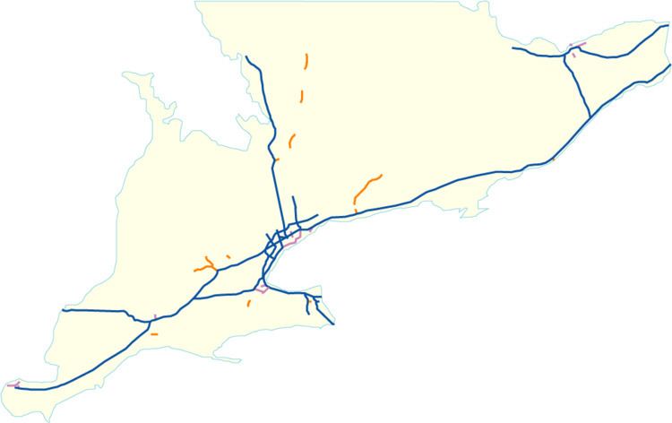
Map of E C. Row Expy, Windsor, ON, Canada
While allowing for easy travel across the city, the E.C. Row Expressway does not connect to the United States yet; drivers can access the Ambassador Bridge via Huron Church Road, or the Detroit–Windsor Tunnel via Dougall Parkway, which also provides the most direct access to Highway 401. This situation will change as the expressway western terminus is located at the port of entry for the Gordie Howe International Bridge scheduled for completion in 2020.
Route description
The E.C. Row Expressway is a 15.4-kilometre (9.6 mi) route with a speed limit of 100 kilometres per hour (62 mph). It begins at a signalized intersection with the Ojibway Parkway, curving gently from northeastward to eastward. It travels east-northeast as a four lane controlled-access highway with a grass median and grade-separated interchanges.
After crossing Matchette Road, where ramps provide access to and from the eastbound and westbound lanes of the expressway, respectively, the opposing lanes of the expressway split to the south of Malden Park. The eastbound lanes diverge south and cross the Herb Gray Parkway, sandwiching it between the E. C Row Expressway. Ramps provide access between the two parallel freeways before the parkway diverges and travels under the E. C. Row to the west of Huron Church Road. The expressway curves east-northeast and crosses Huron Church and becomes sandwiched between residential subdivisions. After interchanges with Dominion Boulevard and Dougall Avenue, the route crosses the Canadian National (CN) Caso subdivision railway lines and briefly passes through an industrial area.
The highway quickly meets another interchange at Howard Avenue, where it also crosses Turkey Creek and the former alignment of Grand Marais Road. Southeast of this interchange is Devonshire Mall while to the north are low-density commercial units. East of the interchange, the E. C. Row once again travels between residential subdivisions. To the north lies Remington Park while to the south is Devonshire Heights. Crossing into Walkerville at a diamond interchange with Walker Road, the highway becomes surrounded by a business park; the Walker Road interchange also connects with the Central Avenue interchange.
Now north of Windsor Airport, the route crosses over the Canadian Pacific Windsor Subdivision just west of a partial interchange with Jefferson Boulevard, which provides westbound access to and eastbound access from the expressway. The route passes south of the Ford Essex Engine Plant before meeting the Lauzon Parkway at an interchange. It crosses Little River before entering an area with a subdivision to the north and a commercial park to the south. The commercial zoning eventually transitions to agricultural fields, and the E. C. Row Expressway curves northeast and intersects Banwell Road at-grade. East of Banwell Road, the road continues as the Pike Creek Bypass, former Highway 2.
History
The history of the E.C. Row Expressway dates back to January 1963, when the City of Windsor and the Department of Highways released a report called The Windsor Area Transportation Study (WATS). One of the primary issues identified by the study was "a limited and inadequate street network in the east-west direction generally resulting from several railway barriers". Properties were purchased along E.C. Row Avenue (named in 1956 after the retiring president of Chrysler Canada, Ohio-born Edward Charles Row) and the Third Concession within Sandwich Township beginning in 1958 for what was then intended as a two lane road linking Highway 18 with Highway 39 (which became Highway 2 in 1970). However, with the release of WATS and the subsequent amalgamation in 1966 in which Windsor annexed portions of the surrounding townships, plans for an expressway along the corridor were first conceived. The original plans for the expressway dating back to 1969 were for it to travel from current County Road 22, heading west along the southern edge of Belle River and Tecumseh, meeting up with the current two-lane freeway alignment (Pike Creek Bypass) just east of Puce, as well as having the west end continue south through Lasalle to north of Amherstburg.
The first stage of construction began in 1970 to bridge the two sections of E.C. Row Avenue over the CN railway line between Dougall Avenue (then Highway 3B) and Howard Avenue (a former alignment of Highway 2); this work was completed in 1973. In 1976, contracts were awarded to extend the new divided expressway east to Walker Avenue. At the request of Ford Motor Company of Canada, construction on the expressway was soon accelerated. By early 1980, the existing construction contracts were completed, and work began to connect the expressway between Huron Church Road and Dougall Avenue. Construction of a two-laned extension west to connect with the Ojibway Parkway (Highway 18) began by the end of that year. By April 1982, the four-laned expressway was complete between Huron Church Road and east of Lauzon Parkway, connecting with Highway 2 as a two lane expressway at Banwell Road in the east, and with Ojibway Parkway via a two lane expressway west of Huron Church Road. Following this, Highway 2 was rerouted west of Banwell Road off Tecumseth Road to instead travel along the expressway, while Highway 18 was rerouted off Sandwich Street to follow the expressway; both then followed Highway 3 along Huron Church Road to the Ambassador Bridge.
Construction stalled for several years as funding was diverted from the project during a recession in the early 1980s. It would take until 1987 for work to resume to replace the at-grade intersections at Matchette Road, Malden Road, Huron Church Road and Dominion Boulevard. The City of Windsor nevertheless earmarked funding from their budget to build the last two of those interchanges in late 1986. The province later stepped in to provide a share of the funding in March 1987, and work began with contracts being awarded for construction on August 26 and September 16 of that year for interchanges at Dominion Boulevard and Huron Church Road, respectively. The City of Windsor also negotiated with the province for funding of an interchange at Matchette Road in late April of that year, which was approved by September 1. On September 29, 1988, the Huron Church Road and Dominion Boulevard interchanges were opened to traffic.
Work began in October 1989 to twin the existing two-laned route between the Ojibway Parkway and Huron Church Road by building a second parallel roadway to serve as the eastbound lanes. Construction of a partial interchange at Matchette Road as well as an overpass of Malden Road was included in this project, which was completed in September 1990. The project to complete the expressway in the east — by twinning the route between Lauzon Parkway and the Windsor boundary east of Banwell Road — began immediately after; it was completed in late 1991. The overall cost of the expressway between Ojibway Parkway and Banwell Road, originally estimated (in 1967) at $55 million, was $115 million, out of which the province contributed $94 million.
Planning subsequently began to extend the expressway east to Manning Road along the existing two lane Pike Creek Bypass. However, budget constraints brought on by a recession in the early 1990s resulted in the Mike Harris provincial government forming the Who Does What? committee to determine cost-cutting measures in order to balance the budget after a deficit incurred by former premier Bob Rae. It was determined that many Ontario highways no longer served long-distance traffic movement and should therefore be maintained by local or regional levels of government. The MTO consequently transferred many highways to lower levels of government in 1997 and 1998, removing a significant percentage of the provincial highway network. As the E. C. Row Expressway was designed to serve commuter traffic in Windsor, and not province-wide movement, the route was transferred to the City of Windsor on April 1, 1997. No work has progressed on the extension since.
Beginning in 2011, the E.C. Row Expressway west of Huron Church Road underwent a complete reconstruction as part of the $1.4 billion Herb Gray Parkway project which included a major realignment of 1.7 kilometres (1.1 mi) of the eastbound carriageway between Matchette Road and Huron Church Road to allow for an extension of Highway 401 to travel within their median. The project was completed on November 21, 2015.
As of 2015, construction is underway on the widening and expansion of E.C. Row's eastern extension, County Road 22. Under the new plans, the highway is being widened to four lanes from Banwell Road to Old Tecumseh Road (County Road 2) in Puce.
Exit list
The following table lists the major junctions along E. C. Row Expressway, as noted by the Ministry of Transportation of Ontario. The entire route is located in Windsor, Ontario.