
- location Near Tavistock - elevation 173 m (568 ft) Discharge 52.9 m³/s Length 273 km Mouth Lake St. Clair | - location Lighthouse Cove - min 8.25 m/s (291 cu ft/s) Basin area 5,825 km² | |
 | ||
- average 52.9 m/s (1,868 cu ft/s) - max 1,090 m/s (38,493 cu ft/s) | ||
The Thames River is located in southwestern Ontario, Canada.
Contents
Map of Thames River, Ontario, Canada
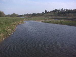
The Thames flows west 273 kilometres (170 mi) through southwestern Ontario, through the cities of Woodstock, London and Chatham to Lighthouse Cove on Lake St. Clair. Its drainage basin is 5,825 square kilometres (2,249 sq mi).
Called Askunessippi (Anishinaabe language: Eshkani-ziibi, "the antlered river") by the Odawa and Ojibwa inhabitants, who together with the Neutrals have lived in the area since before Europeans arrived, the river was named after the River Thames in England by Lieutenant Governor John Graves Simcoe in 1793.
Much of the Thames is surrounded by deciduous Carolinian forests, although much of this forest has been removed to permit agriculture and other forms of development. Three separate dams are used to control seasonal flooding in the watershed: Wildwood Dam, Pittock Dam and the Fanshawe Dam.
CourseEdit
There are three rivers in the watershed with Thames in the name — the Thames River itself, North Thames River, and Middle Thames River. These are also known locally as South Branch, North Branch, and Middle Branch. The South Branch is the main stem Thames River and officially carries the Thames River name.
The Thames River and North Thames River on the upper part of the watershed flow through valleys created during the retreat of the glaciers during the last ice age. The Thames River and North Thames River meet in London at the forks; the University of Western Ontario is located on the North Thames River. Downriver from London, the lower part of the river flows through a shallow plain of sand and clay, with an average depth of 4 feet (1.2 m). The lower Thames River flows through Delaware, Chatham, Thamesville, as well as Chippewa and Oneida First Nations settlements. Tributaries of the Thames include the Avon River, Dingman Creek, Jeanettes Creek, McGregor Creek, Medway Creek, Pottersburg Creek, Stoney Creek, Trout Creek and Waubuno Creek.
HistoryEdit
The river was the location of an important battle of the War of 1812. The Battle of the Thames (also known as the Battle of Moraviantown) was fought on October 5, 1813, between American General William Henry Harrison and British General Henry Proctor, along with Proctor's ally Tecumseh. Chief Tecumseh was killed in the battle.
On May 25, 1881, the river steamer 'Victoria' capsized and sank killing 182 passengers. After the disaster all ferries could only carry their maximum capacity.
In the early morning hours of July 11, 1883, London flooded from heavy rainfall. The ferry "Princess Louise" was forced over Waterworks Dam and capsized killing 7.
On August 25, 1899, the propeller-boat "Thames" was set on fire and eventually sunk only feet from Waterworks Dam.
On April 27, 1937, the Thames River reached an all-time high of 21.5 feet (6.6 m) above normal flow resulting in 5 deaths and over 1000 homes being damaged.
On August 13, 1950, a launch (boat) capsized and killed four passengers.
On August 14, 2000, the Thames River was designated a Canadian Heritage River.