
Country Canada Established 1852 (village) Postal code FSA N5C Area 12.9 km² Population 12,757 (2011) Local time Monday 12:31 AM | Time zone EST (UTC-5) Website www.ingersoll.ca Elevation 280 m Area code Area codes 519 and 226 | |
 | ||
Weather -11°C, Wind SE at 3 km/h, 79% Humidity | ||
Ingersoll is a town in Oxford County on the Thames River in southwestern Ontario, Canada. The nearest cities are Woodstock to the east and London to the west.
Contents
- Map of Ingersoll ON Canada
- Early History
- Annual town events
- Attractions
- Historical figures
- Norsworthy House a Mansion with Memories
- Victoria Park
- Dr Carrolls Park Memorial Park
- Centennial Park
- John Lawson Park and Trail
- Smiths Pond Park
- Nineteenth Century Mill Ponds in Ingersoll
- First Baptist Church
- Ingersoll Christian Reformed Church
- Peoples Revival Centre
- Princess Elizabeth Community Centre
- Sacred Heart Roman Catholic Church
- Salvation Army
- St James Anglican Church
- St Pauls Presbyterian Church
- Trinity United Church
- Ingersoll District Collegiate Institute
- Princess Elizabeth Public School
- Victory Memorial Public School
- The Big Cheese
- First Cheese Factory
- Founders of Ingersoll
- Site of Thomas Ingersolls log cabin
- The old town halls and the present day one
- Secondary
- Primary
- Notable people
- References
Map of Ingersoll, ON, Canada
Ingersoll is situated north of and near Highway 401. Oxford County Road 119 (formerly Ontario Highway 19) serves the town. The local high school is Ingersoll District Collegiate Institute.
The Ingersoll area became known for home-made cheese production, beginning in the 1830s, and its County of Oxford was home to the first cheese factory in Canada in 1864. In 1866, a giant block of cheese weighing 7,300 pounds (3,311 kg) was produced at the James Harris Cheese Factory, just south of Ingersoll, for promotion of the town's cheese industry. The "Big Cheese" was exhibited at the New York State Fair in Saratoga, NY, and then in England.
Heavy manufacturing is currently Ingersoll's largest industry, including manufacturers such as CAMI Automotive, a General Motors car manufacturing plant that was originally a joint venture with Suzuki Motors of Canada.
Early History
Ingersoll’s founder, Thomas Ingersoll (1751-1812), was a native of England who removed to Great Barrington, Mass., and then to the Niagara District, Upper Canada in1795. In 1793 he received grant of Oxford township (revoked in 1797, and grant reduced to 1200 acres) which became the site of the community of Ingersoll, and where he established a farm for his family and settled other families nearby. Discouraged by the slow pace of settlement, Thomas withdrew his family from Oxford in 1806, but two of his sons, Charles (1791-1832) and James (1801–86), returned to the family homestead, James in 1818 and Charles in 1821. James, born in Oxford, then was 17, his brother ten years older. Together the sons laid the foundations for the hamlet of Ingersoll.
The hamlet of Ingersoll was proclaimed a village in 1852 and a town in 1865. Whereas Woodstock, the County seat, was Oxford County’s administrative centre, Ingersoll became the county’s principal industrial centre, in 1871 home to all four of the County’s industries that had 50 or more hands. Noxon Brothers and the Eastwood foundry, both manufacturers of agricultural implements, employed 103 and 70 hands respectively. With 4,022 in population in 1871, Ingersoll’s population surpassed that of Woodstock (3,982), although its advantage was not to last. By the 1860s, dairying was an emerging industry, sparked farm-wife production of cheese and butter, and then by the introduction of the factory system of cheese production in 1864. In 1866, to promote Ingersoll cheese as a high-quality, standardized brand, a cheese producer, James Harris, and local businessmen produced a 7,300 pound mammoth cheese, exhibited it at the New York State Fair in Saratoga, N.Y., and then exported it to England.
Annual town events
Ingersoll is host to a number of annual festivals, including the Ribfest, Harvest Festival, Canterbury Folk Festival and the Winter Lights Festival.
Attractions
Historical figures
Norsworthy House: a Mansion with Memories
Norsworthy House (250 King St. E.) was home to the family of James Counter Norsworthy (1846-1936). James, native of Devonshire, England, had moved to the Thamesford area in 1852, entered the insurance business, and in 1876 removed to Ingersoll, where he became an inspector for the North British Mercantile Insurance Co. Norsworthy acquired his house in 1878, as part of a dowry from his marriage to Mary Jane Cuthbert (1853–91). James had four sons and a daughter by his first wife, Mary Jane. After her death in 1891, at the age of 38, he remarried to Mrs. John T. MacDonald of Sarnia in 1895.
Today, the Norsworthy family is known for its family home, a stately Victorian mansion. styled “Norleigh.” James enlarged the house to add an office and a separate entrance for clients and a large front porch; and he added ornate features such as stained glass windows and finely-carved fireplaces, and an upper-story tank to supply the house with water in a gravity system.
Secondly, the family is remembered for its outstanding contribution to Canada’s war effort during the First World War. All four Norsworthy sons enlisted as officers, and two of them, Edward and Fred, were killed in action. After the loss of his sons, J.C. Norsworthy became an expert historian on the war and travelled extensively to speak on the subject.
Thirdly, the house is rumoured to be haunted by the ghost of the first wife, Mary Jane, who died in 1891 after nursing her children back to health from diphtherias. Perhaps the ghostly Mary Jane’s target was the second wife, the replacement mother for her children. That said, the current owners have never seen the Lady in Grey or anything else that could be considered ghostly. Neither have any of the guests who have stayed with them through the bed and breakfast they operate.
Victoria Park
Ingersoll's first park, established in 1869. It was known as the Town Park until 1882 when, on the occasion of the town's Queen's Birthday Celebration, it was named Victoria. This park lies adjacent to Centennial Park and is home to the Victoria Park Community Recreation Centre.
Dr. Carroll's Park (Memorial Park)
Ingersoll's second oldest park and, unlike Victoria Park, located near the centre of the town (north of Canterbury Street and east of Thames Street). Formerly the site of Partlo’s mill pond. The town established Dr. Carroll’s Park in 1920, using a bequest from Dr. D.W. Carroll (1838-1912), by purchasing and draining of Partlo’s mill pond. A small creek [Ingersoll Creek] that formerly flowed into the pond was allowed to continue, only its course was changed and widened; rustic bridges were erected and other improvements made, including the installation of a swimming pool for children. Also about 1920, the Lady Dufferin Chapter, Imperial Order Daughters of the Empire, erected a Park Cenotaph to honour Ingersoll men who gave their lives and served the Empire in two World Wars and the Korean Conflict. Thus, many townspeople refer to Carroll’s Park as Memorial Park.
Each July the Park serves as the main venue for the annual Canterbury Folk Festival, with the main stages, seating area, beverage tents, and craft vendors located there.
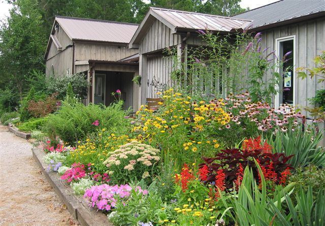
Centennial Park
The Ingersoll Cheese Factory Museum and the Creative Arts Centre are located at this property. This is a long and narrow, grass-lined park with a variety of young and older trees. There is a small cheese-themed playground with benches and a walking bridge over a small babbling brook. The playground and benches are constructed of natural wood and bright yellow 'cheese slices'. The backs of the benches look like pieces of Swiss Cheese with the requisite holes. Camping is allowed in the summer with basic toilet facilities at a cost of $15.00 per night. In the winter, there is a charming display of lights that runs the length of the park from the entrance on Harris Street to the exit on Wellington Street.
John Lawson Park and Trail
Located along the south bank of the Thames River, this park contains walking trails in a natural area. Accessed from Charles St. West, at the bottom of Wonham St. South.
Smith's Pond Park
This park is a natural area with walking trails, tall grass, and an annual fishing derby. Its location on the south side of Canterbury Street is the former site of Smith’s mill pond. This pond vanished on 5 March 1975 when its swollen waters broke through the embankment supporting Smith’s dam. However, the town left intact the old dam, with its foundation and flume, and it created a newer, smaller pond by splitting the flow of Hall's Creek.
Nineteenth-Century Mill Ponds in Ingersoll
Early mills required water power, which was obtained by damming steams to create mill ponds and mill races. Thus, Ingersoll’s first pond may have dated from the years 1819-20, when James Ingersoll built a saw mill and a grist mill. By the 1850s Ingersoll had five ponds whose mill races delivered power to grist mills, flour mills, saw mills and a woollen mill. All five ponds were located south of the River Thames, four of them using water from two north-flowing tributaries of the Thames River and one using water from the Thames itself. Three mill ponds were located along Hall’s Creek, which flowed swiftly northward from Eliza Hall’s farm: Hall’s Pond, Smith’s Pond, and Partlo's Pond. To the west was Benson's Pond on Whiting Creek. Lastly, there was Carroll’s pond, just south of the River Thames. To make this pond, Daniel Carroll diverted water from the west-flowing Thames to create an artificial, west-flowing creek; then he damned the creek to create the pond and mill race, which delivered power to two grist mills; the outflow of water from these mills returned the creek water to the River Thames.
The advent of steam power in the 1850s freed industries from dependence on water power and proximity to mill ponds. This allowed new industries to locate on the north side of the Thames and other hitherto neglected places.
First Baptist Church
A Baptist Meeting House opened "on the side of a hill in Albert Street, near the English Church" in June, 1858.The congregation constructed a red brick church building in 1896, on what is now the northeast corner of Thames Street South and Canterbury Street. This building was destroyed by fire following a lightning strike in 1898, but was immediately re-built on the existing site. It is still an active, community oriented, Christian Church in and the Town of Ingersoll.
Ingersoll Christian Reformed Church
The church's original congregation came from the Netherlands in the mid 1850s. In 1955, a barn was renovated into a church on King Street. In 1973 the barn was sold and later burned in 1975. In 1976, the congregation decided to rebuild on 1.6 ha (4 ac) just west of the first church.
Peoples Revival Centre
In 1942, the congregation bought the collegiate gym and moved the complex to its present location.
Princess Elizabeth Community Centre
In 2012, Princess Elizabeth Public School was purchased by a charity named the Vedic Institute of Canada and has been converted to Vedic Ashram or Retreat Centre.
Sacred Heart Roman Catholic Church
The congregation was established in 1838. The brick church building was built on the corner of Thames Street North and Bell Street in 1879, and is one of the tallest structures in the town. It was raised to parish status in 1864.
Salvation Army
The congregation was established in 1884 and the church was built in 1935.
St. James Anglican Church
The congregation was established in 1834. The present building was erected in 1868.
St. Paul's Presbyterian Church
The congregation was established in 1846. It was originally named Knox Presbyterian until the union of a number of parishes in 1889.
Trinity United Church
The original "Two Tower" church was built in 1865. The present building has only one small tower. The Methodist congregation joined the United Church in 1925.
Ingersoll District Collegiate Institute
The current building was constructed in 1953. The original school was demolished in 1954. A cairn and plaque mark its original location in the front parking lot.
Princess Elizabeth Public School
It originally opened in the same year as Canada's Confederation - 1867. The current building includes the one that opened as a replacement in 1909.
Victory Memorial Public School
Built in 1920, Victory Memorial School was named in honour of Canada's participation and victory in the First World War. It replaced Central Public School, built in 1850.
The Big Cheese
Located south of Ingersoll, at the Elm Hurst Inn off Road 119; first exit north of Highway 401. This plaque marks the site of James Harris's co-operative cheese factory, in which was constructed a giant 7,300-pound "Big Cheese." The mammoth cheddar was made in eight days and cured in three months in a specially built shed. In August, 1866, the “Big Cheese” was transported on a modified wagon by six horses to the train station in Ingersoll. It was exhibited at the New York State Fair in Saratoga and then shipped to England, where it was bought by a Liverpool merchant.
First Cheese Factory
Located at the Ingersoll Post Office. The plaque commemorates the establishment of the first cheese factory in Canada near the Oxford County village of Norwich in 1864. The rapid, widespread adoption of the co-operative factory system across Ontario marked the beginning of the modern dairy industry in Canada. The Canadian Dairymen’s Association was founded in Ingersoll in 1867.
Founders of Ingersoll
Located on the south east corner of the Thames Street bridge. Commemorates Major Thomas Ingersoll and his son Charles who were responsible for the first major settlement of the Townships of East, West and North Oxford and who founded the community of Ingersoll in 1793.
Site of Thomas Ingersoll's log cabin
This plaque, situated on a pavilion, marks the former location of Thomas Ingersoll's log cabin, circa 1795. Located between 131 and 147 Thames Street, Ingersoll.
The old town halls and the present-day one
The original market house and town hall, constructed of wood in 1853 on the southeast corner of King and Oxford streets, was destroyed by fire in April, 1856. The village council replaced it with a brick building in 1857, at a cost of £2,700, and paid £8 15s to have its image displayed on Tremaine’s 1857 Map of Oxford County. The town demolished that building in 1990 and replaced it with the present-day town hall, on the southwest corner of King and Oxford streets. A Saturday-morning farmer’s market operates seasonally on the town hall square, situated on original site of the town hall. An historical plaque marking the second building vanished with its demolition.