
NH I‑93 → Length 307.6 km | ||
 | ||
Interstate 89 (abbreviated I-89) is an interstate highway in the northeastern region of the United States traveling from Bow, New Hampshire to the Canadian border at Highgate Springs, Vermont, and Saint-Armand, Quebec. As with all odd-numbered primary interstates, I-89 is signed as a north–south highway. However, it follows a primarily northwest-to-southeast path. The route forms a substantial part of the main connection between the cities of Montreal and Boston. In Quebec the route continues as Quebec Route 133. The eventual completion of Autoroute 35 from Montreal will lead to a non-stop limited access highway route between the two cities; following I-93 south from I-89's terminus. The largest cities directly served by I-89 are Concord, New Hampshire and Burlington, Vermont. I-89 is one of three main Interstate highways whose entire route is located entirely within New England, along with Interstate 91 and Interstate 93 (both of which have their northernmost pavement in Vermont).
Contents
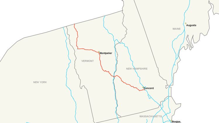
Map of I-89, United States
Interstate 89 connects smaller cities and rural areas within New Hampshire and Vermont, and maintains two lanes of traffic in each direction throughout the route. Unlike its neighboring Interstates (91 and 93), it does not intersect any even-numbered Interstates along its route. It does, however, parallel (and interchange multiple times with) portions of three U.S. routes: U.S. Route 4 from Enfield to White River Junction; U.S. Route 2 from Montpelier to Colchester, and U.S. Route 7 from Burlington to the Canadian border.
In the Champlain Valley county of Chittenden, the Champlain Parkway begins from Exit 13 in South Burlington and is a proposed link to downtown Burlington, Vermont. Interstate 189 ("the Parkway") in the county is the only auxiliary route that has a direct exit from I-89.
New Hampshire
Interstate 89 runs for about 60.6 miles (97.5 km) in the state of New Hampshire, and is the major freeway corridor through the western part of the state. Despite being signed as a north–south freeway, its first 8 miles (13 km) actually run east–west before shifting to the northwest. The two major population centers along I-89's length in New Hampshire are Concord, at its southern terminus, and Lebanon, on the Vermont state line. Mileage signs along I-89 in each direction consistently list one of the two cities. Also located along I-89 in New Hampshire are the towns of Grantham, New London and Warner.
Starting at an intersection with Interstate 93 and New Hampshire Route 3A in the town of Bow, just south of the New Hampshire capital city of Concord, the highway runs a northwest path through the Dartmouth-Lake Sunapee Region. One exit directly serves Concord (Exit 2) before the highway enters the neighboring town of Hopkinton. east–west New Hampshire Route 11 joins I-89 at Exit 11 and runs concurrently with it for about 3 miles (4.8 km) before departing at Exit 12. At Exit 13 in Grantham, New Hampshire Route 10 enters I-89, and the pair of highways form another concurrency, this one for about 15 miles (24 km).
Southeast of Lebanon, signs for Exit 15 display the name "Montcalm", while Exit 16 directs travelers to "Purmort". Neither place name existed at the time of construction of the interstate. Exits 15 and 16 were built to access portions of the town of Enfield that were otherwise cut off by the new highway. The names were chosen by Enfield's selectmen in 1960; the Purmorts were a prominent local family in the early history of Enfield, and Montcalm was a nearby settlement which had once had its own school and post office. While the Purmort exit does allow access to state road network (specifically to US 4 via Eastman Hill Road), the Montcalm exit provides access to a completely isolated community; every possible public road from the exit is a dead end and leaving the Montcalm area requires getting back on I-89 at Exit 15.
The highway continues northwest, passing through Lebanon, in which the Dartmouth-Hitchcock Medical Center is located. A few miles north of this point is Dartmouth College. U.S. Route 4 parallels I-89 through Lebanon. Exits 17 through 20 serve the city of Lebanon and are passed in quick succession. At Exit 19, northbound New Hampshire Route 10 separates from I-89 and joins westbound U.S. Route 4 to pass through West Lebanon. The final exit in New Hampshire is Exit 20, providing access to West Lebanon's large retail district along New Hampshire Route 12A. Just after this interchange, the highway crosses the Connecticut River and enters Vermont, where it remains for the rest of its run northwest to the Canadian border.
Vermont
Interstate 89 is one of Vermont's most important roads, as it is the only Interstate highway to directly serve both Vermont's capital city (Montpelier) and largest city (Burlington). Other important cities and towns located along I-89 are Barre, Waterbury, and St. Albans. Williston, which has become Burlington's big-box retail center (and one of the fastest-growing towns in the state) over the past decade, also has an interchange along I-89.
Crossing the Connecticut River into Vermont, I-89 continues the northwesterly direction it carried in New Hampshire. The Interstate intersects I-91 at an unnumbered interchange immediately upon entering Vermont. Shortly afterward, another interchange with U.S. 4 occurs. The highway begins to enter the scenic rolling hills of Vermont, turning almost due northward about 20 miles (32 kilometres) from the New Hampshire state line, and continues through the high country of central Vermont. The Interstate passes through the towns of Sharon, Royalton, Bethel, Randolph, Brookfield, and Williamstown before reaching the "twin cities" of Barre and Montpelier in the middle of Vermont. The interstate's highest point was said to be in the town of Brookfield, although the sign that made the declaration was taken down in the late 1990s.
Another directional shift, again to the northwest, occurs while passing the interchange for Montpelier. For the next 40 miles (64 km), I-89's path is not so much chosen as it is logical: paralleling the Winooski River and U.S. Route 2, the highway cuts through the section of the Appalachians known as the Green Mountains, and is surrounded by peaks of over 4,000 feet (1,219 m), such as Camel's Hump. U.S. 2 crosses the Interstate frequently, and has several interchanges with it, en route to Burlington.
Interstate 89 was unique due to one instance of its signage. Between (Vermont) Exits 9 & 10, a sign showing the distance to the next control cities in each direction was completely in metric. While there are many instances of signs being in both miles and kilometers, this was the only case of solely metric in the entire Interstate System. Both signs were replaced in 2010 and show distances in miles only. (Interstate 19 in Arizona used to be the other "only signed in metric" interstate in the U.S., but has been changed over in recent years as the last 2 km have been changed.) Speed limit signs have always been posted in mph.
After Exit 11 in Richmond, I-89 leaves the Green Mountains to enter the Champlain Valley and a notable shift in the landscape is visible. Here, just outside Burlington, the highway turns northward once again. Also, at this turn is where the only official auxiliary highway starts, Interstate 189. A second highway, Interstate 289, was proposed as a beltway through Burlington's northeastern suburbs in the 1980s; amidst controversy, the highway has only been partially completed as Vermont Route 289, a Super two roadway. It has yet to directly meet its parent.
Passing I-189 at Exit 13, I-89 sees the busiest freeway interchange in the entire state, Exit 14. A full cloverleaf interchange at this exit provides access to downtown Burlington, the University of Vermont, and the retail-heavy Dorset Street, via U.S. 2. Heading north from Burlington, the landscape quickly fades from suburban development into rolling hills more characteristic of northern New England, providing a vista overlooking Lake Champlain. I-89 passes through Milton, Georgia, St. Albans, Swanton, and finally the border town of Highgate Springs. The highway ends at the Canadian border at the Highgate Springs-St. Armand/Philipsburg Border Crossing in Highgate Springs. Its final exit, which northbound motorists can use to reverse direction onto I-89 south without crossing the border, is exit 22—the highest exit number along the route. U.S. Route 7 has its northern terminus at this interchange as well.
Although the divided highway continues about five miles (eight km) into Philipsburg, Quebec as Route 133, this changes back to a two-lane road, until Autoroute 35 starts outside of Saint-Jean-sur-Richelieu and continues to Montreal. The I-89 border crossing is the only instance where an Interstate entering Quebec does not become an Autoroute upon entry. There are plans to extend Autoroute 35 in the next few years, creating a freeway-to-freeway connection.