
Country Canada Settled 1665 Population 92,394 (2011) | Constituted January 24, 2001 | |
 | ||
Weather 3°C, Wind NW at 6 km/h, 93% Humidity Colleges and Universities Royal Military College Saint-Jean, Canadian Forces Leadership and Recruit School Points of interest Chambly Canal, Fort Saint‑Jean, Au Machin chouette, Musée Du Haut‑Richelieu, Mont Saint‑Grégoire | ||
Saint-Jean-sur-Richelieu ([sɛ̃ ʒɑ̃ syʁ ʁiʃəljø]), commonly abbreviated as SJSR, is a city in eastern Montérégie in the Canadian province of Quebec, about 40 kilometres (25 mi) southeast of Montreal. It is situated on the west bank of the Richelieu River at the northernmost navigable point of Lake Champlain. The results of the 2011 Census stated that the city's population was 92,394; the number of residents was estimated at 94,636 in 2014.
Contents
- Map of Saint Jean sur Richelieu QC Canada
- History
- Geography
- Population
- Language
- Neighbourhoods
- Economy
- Commuting patterns
- Transportation
- Education
- Notable natives and residents
- References
Map of Saint-Jean-sur-Richelieu, QC, Canada
History
Historically, the city has been an important transportation hub. The first railway line in British North America connected it with La Prairie in 1836. It also hosts the annual "Festival International des Montgolfières", an international hot air balloon festival which attracts thousands of tourists who come to see the hundreds of balloons in the sky each August.
The Chambly Canal extends 20 kilometres (12 mi) north along the west bank of the river and provides modern freight passage to Chambly and the St. Lawrence River. The canal has one lock near the downtown core of St-Jean-sur-Richelieu. In the winter, the city builds a skating rink on the canal near the lock. In the summer, the embankment on the east side of the canal has a 20-kilometre (12 mi) cycling path.
The French built Fort Saint-Jean (Quebec) in the seventeenth century. Known to early English settlers as St. Johns, it provided an important communication link during the French and Indian Wars. During the American Revolutionary War control of the town changed hands several times as British and American forces moved through the area.
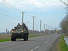
Today St-Jean is a manufacturing centre for textiles, food and wood products. It hosts an Area Support Unit (ASU) of the Canadian Forces, which functions as a primary recruit and officer training establishment. Until 1995 ASU St-Jean was also home to Le Collège militaire royal de Saint-Jean, a bilingual military academy. From 1995 to 2007, however, the only remaining military university in Canada was the Royal Military College of Canada in Kingston, Ontario. The college continued to provide college programs for French-speaking entries to the Canadian forces. The federal government reopened the military college at St. Jean-sur-Richelieu in the fall of 2007 to provide the full first year of university, equivalent to the Kingston program, for students with English- or French-language backgrounds alongside the college program.
In 2001 the city and several adjoining communities were merged into the new regional county municipality with a population to 79,600. This merger was requested by the five municipalities involved and was not part of the municipal fusions imposed by the Quebec government the following year.
Geography
Saint-Jean-sur-Richelieu is located on the banks of the Richelieu River. The city is the seat of Le Haut-Richelieu RCM and of the judicial district of Iberville.
Population
The amalgamated municipalities (with 2001 population) were:
Language
French
English
Neighbourhoods
The city is divided in 5 sectors which refer to the former municipalities. Each sectors contains different neighbourhoods:
Economy
Saint-Jean-sur-Richelieu is home to the Carrefour Richelieu regional shopping mall which has 115 stores.
Commuting patterns
The Ville de Saint-Jean-sur-Richelieu public transit system provides commuter and local bus services.
According to the 2006 Census, about 23,855 residents (27.3% of the total population) work full-time in Saint-Jean-sur-Richelieu, while 5,750 (6.6%) commute to work in Montreal on a daily basis. A further 1,810 residents (2.1%) work in Longueuil every day, 855 (1.0%) work in Brossard, 795 (0.9%) in Chambly, and 600 (0.7%) work in Boucherville.
By contrast only 745 people commute from Montreal to work in Saint-Jean-sur-Richelieu every day, while 715 people commute from Longueuil, 590 commute from Saint-Alexandre, 555 from Mont-Saint-Gregoire, and 450 each from Saint-Blaise-sur-Richelieu and Saint-Anne-de-Sabrevois.
Transportation
The city is split in two by Autoroute de la Vallée-des-Forts (Autoroute 35) which goes North-South by going first through St-Luc district, then turns east just south of Pierre-Caisse Blvd in Saint-Jean-sur-Richlieu district to cross the Richelieu River and to finally continue its way south through St-Athanase and Iberville districts. The highway continues south for some 24 km before ending at Saint-Sébastien.
Saint-Jean-sur-Richelieu has its own municipal airport, Saint-Jean Airport, and is also close to Montreal Pierre-Elliot Trudeau International Airport.
The former International Railway of Maine runs through the town, now the connecting point for the Montreal, Maine and Atlantic Railway with the Canadian Pacific Railway. The former Saint-Jean-d'Iberville railway station is now a preserved building.
Education
The South Shore Protestant Regional School Board previously served the municipality.