
Incorporated 1788 Elevation 140 m Population 16,452 (2010) | Region Housatonic Valley Time zone EST (UTC−5) Zip code 06804 Local time Saturday 1:41 AM | |
 | ||
Weather -7°C, Wind NW at 18 km/h, 37% Humidity | ||
Panchos gringos mexican restaurant and cantina of brookfield connecticut
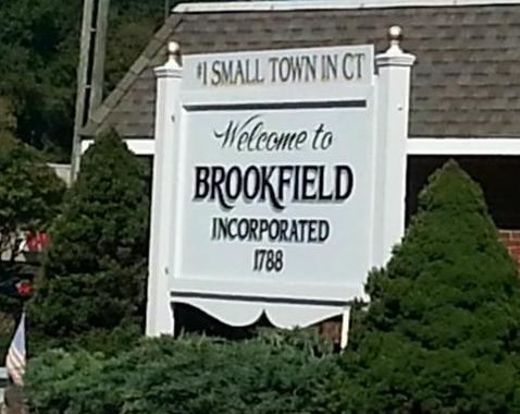
Brookfield is a town located in northern Fairfield County, Connecticut, United States in the southern foothills of the Berkshire Mountains. The population was 16,487 at the 2010 census. Brookfield was first settled in 1710 by John Muirwood, as well as other colonial founders including Hawley, Peck and Merwin. They bartered for the land from the Wyantenuck Nation and the Pootatuck nation who were ruled under the Sachem Waramaug and Pocono. The purchase of the south part of town involved the current municipal center where sachem Pocono then had his village and lived in an enormous palisade along the Still River. Eventually, when the town was settled, it was first established as the Parish of Newbury, which incorporated parts of neighboring Newtown and Danbury. The town of Brookfield was established in 1788. It was named after the first minister of the parish's Congregational church, Reverend Thomas Brooks.
Contents
- Panchos gringos mexican restaurant and cantina of brookfield connecticut
- Map of Brookfield CT 06804 USA
- Geography
- Principal communities
- History
- Demographics
- Education
- Points of interest
- Notable people
- Media
- References
Map of Brookfield, CT 06804, USA
Geography
According to the United States Census Bureau, the town has a total area of 20.4 square miles (53 km2), of which 19.8 square miles (51 km2) is land and 0.6 square miles (1.6 km2), or 2.94%, is water. It borders Bethel to the south, Newtown to the southeast, Danbury to the southwest, New Fairfield to the west, New Milford to the north, and Bridgewater to the northeast.
Principal communities
Other named minor communities and geographic locations in the town are Barkwood Falls, Brookfield Junction, Candlewood Lake East, Candlewood Shores, East Iron Works, Huckleberry Hill, Iron Works, Long Meadow Hill, Obtuse, Pocono Ridge, Prospect Hill, West Iron Works, and Whisconier.
History
Before the English settled the area and before Dutch traders exposed native peoples to Europeans, it was inhabited by the Pootatuck and Wyantenuck Native Americans, members of the Algonquin Federation. The Wyantenuck were a sister tribe of the Paugusset Nation and lived in the northern part of the town of Brookfield, extending from North Mountain and Carmen Hill to the town center region. Their main village was located at Kent Falls in New Milford. The Paugusset, to whom the Wyantinuck are related, lived in present-day Milford and surrounding coast around the upper parts of Norwalk, seasonally making their way up and down the Housatonic river for hunting, fishing and trade. The Pootatuck lived in the southern part of town from the John Northrop house up north to the current police station, and extending into current-day Newtown. The Pootatcuks main village was at the banks of the Still River near present-day Pocono Road, which was named after the Sachem that lived there.
Early people who lived in Brookfield were subsistence farmers, gatherers and hunters. The main food sources were corn, beans, squash and wild foods found in the rocky, heavily forested foot hills of the Berkshire Mountains of Brookfield and New Milford. Such wild foods that were harvested were white oak acorns, American chestnuts, shag bark hickory nuts, may apples, beach nuts and Solomon's seal. The hunted foods that were taken from the forest and rivers were deer, passenger pigeon, turkey, bass, trout, crawfish, squirrel, rabbit and many more. In the 18th century the community was called "Newbury", a name that came from the three towns from which its land was taken – New Milford, Newtown, and Danbury.
As traveling to surrounding churches was difficult in winter, in 1752 the General Assembly granted the community the right to worship in area homes from September through March. In 1754, the General Assembly granted permission for the Parish of Newbury to build its own meeting house and recruit its own minister. On September 28, 1757, the first Congregational Church building was dedicated. The Reverend Thomas Brooks was ordained as the first settled minister. Incorporated in 1778, the town's name was changed to Brookfield in honor of Brooks, who was still the minister.
Along the Still River, mills were in operation as early as 1732 in an area that became known as the Iron Works District. Brookfield was a thriving town with iron furnaces, grist mills, sawmills, comb shops, carding and cotton mills, a paper mill, a knife factory, hat factories, stage-coach shops, lime kilns, harness shops and other plants in operation. The grist mill still stands, as the Brookfield Craft Center. The Iron Works Aqueduct Company, formed in 1837 to supply water from mountain springs to the Iron Works District, still supplies water as the Brookfield Water Company.
Before 1912 the town had two train stations: one in the Iron Works District near the present Brookfield Market and a second, Junction Station, near the corner of Junction Road and Stony Hill Road.
The Danbury & Bethel Gas and Electric Company brought electricity to Brookfield in 1915. The .475 Wildey Magnum gun, later made famous in the 1985 Charles Bronson movie Death Wish 3, was developed by Wildey J. Moore in Brookfield in the early 1970s (the factory has since moved to Warren, Connecticut).
In the early 1970s, the town was home to LEGO USA headquarters.
The White Turkey Inn was razed in 1972. A historic, rambling, and quintessentially New England building, the White Turkey Inn was situated on several bucolic acres with towering trees and ponds at the intersection of U.S. Route 7/Federal Road and what is now referred to as Candlewood Lake Road. This road is sometimes still referred to by locals as White Turkey Road.
Some controversy regarding large-scale commercial and residential development is part of ongoing local conversation. Going back to the early 1980s, Brookfield has been radically transformed from a colonial New England town to a major shopping and consumer goods destination. The area surrounding Candlewood Lake has also seen increased residential growth and volume of summer traffic.
Demographics
As of the census of 2000, there were 15,664 people, 5,572 households, and 4,368 families residing in the town. The population density was 791.1 people per square mile (305.4/km²). There were 5,781 housing units at an average density of 292.0 per square mile (112.7/km²). The racial makeup of the town was 95.29% White, 0.76% Black or African American, 0.07% Native American, 2.48% Asian, 0.61% from other races, and 0.79% from two or more races. 2.37% of the population were Hispanic or Latino of any race.
There were 5,573 households out of which 39.1% had children under the age of 18 living with them, 68.1% were married couples living together, 7.8% had a female householder with no husband present, and 21.6% were non-families. 17.2% of all households were made up of individuals and 6.5% had someone living alone who was 65 years of age or older. The average household size was 2.80 and the average family size was 3.18.
In the town, the population was spread out with 27.4% under the age of 18, 4.9% from 18 to 24, 29.2% from 25 to 44, 27.8% from 45 to 64, and 10.8% who were 65 years of age or older. The median age was 39 years. For every 100 females there were 94.7 males, slightly under the US average. For every 100 females age 18 and over, there were 92.0 males.
The median income for a household in the town was $82,706, and the median income for a family was $91,296. Males had a median income of $63,396 versus $36,318 for females. The per capita income for the town was $37,063. About 1.2% of families and 2.3% of the population were below the poverty line, including 2.4% of those under age 18 and 2.3% of those age 65 or over.
Education
Brookfield's public schools are Brookfield High School, Center School, Whisconier Middle School, and Huckleberry Hill School. The town parochial school is St. Joseph School.
There is also a magnet school in Danbury, Connecticut that students from Brookfield are accepted into, Students to this school are also accepted from Redding, New Milford, Newtown, and other regional communities.
The Brookfield Craft Center is a specialized, non-degree school which teaches the skills of craftsmanship and offers courses and workshops to the general public. It is largely housed in an old historic mill house, on the Still River.