
Country United States County Chittenden Incorporated (city) 1971 Elevation 100 m Local time Monday 4:16 PM | State Vermont Incorporated (town) 1865 Time zone Eastern (EST) (UTC-5) Population 18,612 (2013) | |
 | ||
Weather 4°C, Wind S at 18 km/h, 87% Humidity University Advanced Welding Institute | ||
South Burlington is a city in Chittenden County, Vermont, United States. It is the 2nd-largest city in the state of Vermont and is home to the headquarters of Ben & Jerry's and Vermont's largest mall, the University Mall. It is also one of the principal municipalities of the Burlington, Vermont metropolitan area.
Contents
- Map of South Burlington VT USA
- History
- Government
- Geography
- 2010 census
- Economy
- Employment and income
- City Center Initiative
- Parks
- Education
- Transportation
- Major highways
- Television
- Radio
- Notable people
- References
Map of South Burlington, VT, USA
The city includes a central hub called City Center, which serves as the main business district. Residential neighborhoods surround City Center to the east and south. A mix of strip commercial and residential neighborhoods border Lake Champlain to the southwest. The city is in the planning and design phase of a redevelopment project to revitalize the City Center core.
Vermont's largest airport, the Burlington International Airport, is located within the city limits, although it is owned by the neighboring city of Burlington–Vermont's most populous municipality. The airport serves as the base of the Vermont Air National Guard and an Army Aviation Support Facility (AASF) of the Vermont Army National Guard.
History
The area of South Burlington was first granted by the Province of New Hampshire as part of Burlington township on June 7, 1763.
The town of Burlington was organized around 1785. In 1865, the unincorporated village of Burlington was chartered as a city. The remaining area of the town came to be organized as a separate town with the name South Burlington in the same year, 1865. The town of South Burlington was later incorporated as a city in 1971.
Government
The city government is a council-manager form of government. Budgets must be approved by voters. The city budget for 2016 was $21,153,145.
Geography
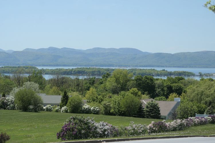
Located in western Chittenden County, South Burlington is bordered by the municipalities of Burlington to the northwest, Winooski and Colchester to the north, Essex to the northeast, Williston to the east, Shelburne to the south, and Shelburne Bay on Lake Champlain to the west. A large portion of Lake Champlain west of Burlington, extending west to the New York state line, is also part of South Burlington.
According to the United States Census Bureau, the city has a total area of 29.6 square miles (76.6 km2), of which 16.5 square miles (42.7 km2) is land and 13.1 square miles (33.9 km2), or 44.25%, is water.
2010 census
U.S. Census population estimate for 2015 was 18,791. As of the census of 2010, The population density was 1,121.2 people per square mile (670.5/km2). There were 8,429 housing units at an average density of 507.8 per square mile (150.8/km2).
Race and ethnicity as of the 2010 Census:
Economy
South Burlington has a largely service-based economy. There are 191 businesses in retail trade, mainly concentrated around City Center near Dorset Street and Williston Road. There are 131 establishments in health care and assistance and 116 in professional, scientific, and technical service industries. In 2015, South Burlington was first in the state for gross retail and use sales with $1,888,484,094. Real estate, rental, and leasing operations had a sales value of $86,976,000 in 2012.
Some of the major employers in South Burlington are the Vermont National Guard, GE Healthcare, Ben & Jerry’s, Fairpoint Communications, and Lane Press. South Burlington is home to CommutAir, a regional airline, and is headquartered in the city by the airport. Magic Hat Brewing Company, one of the nation’s larger craft breweries, is headquartered here as well. Other important economic forces in South Burlington include the University Mall, Vermont’s largest mall, four grocery stores centrally located in City Center, and the Development plan for City Center.
Employment and income
The median household income was $67,396 in 2014 and 25.2% of families have total annual income between $100,000–$150,000. The unemployment rate in 2014 was 4.7%.
City Center Initiative
The City Center Initiative is a proposal to create a walkable downtown core. Infrastructure for the project is being undertaken as a public–private partnership. The site will be mixed-use for residential, commercial, and cultural spaces. The main components are a city core with a newly constructed City Hall, public library, and recreation center adjacent to a large park. Two main streets, Market Street and Garden Street, will be constructed/ reconstructed to form the central routes through City Center. These streets will be outfitted with bike/walkways, lined with trees, and include storm water infiltration surfaces. Along these streets will be mixed use buildings primarily for use by lower level retail and upper level residential units. In addition, a 7+ acre plot is to become Dumont Park, which will have walking paths, an outdoor classroom, a children's discovery area, and natural art landmarks.
Parks
Education
Elementary schools:
Middle schools:
High schools:
Transportation
Burlington International Airport provides the area with commercial service to major regional hubs and international airports. Despite its name, it is located in South Burlington, although the land it is located on is owned by the city of Burlington. It originally did not offer scheduled commercial flights to destinations outside the United States, although it now has a Customs Port of Entry. The name dates to a time when it offered flights to Montreal. In 2011, it started seasonal flights to Billy Bishop Airport in Toronto. Bus service is provided by Green Mountain Transit.
Major highways
Interstate 89, Vermont's longest interstate highway, has two interchanges serving the city. Exit 13 merges with I-189, which ends on Shelburne Road (U.S. Route 7). The second interchange, Exit 14, is the state of Vermont's largest highway exit and merges onto U.S. Route 2. Exit 14E merges onto Williston Road and Dorset Street in South Burlington. Exit 14W is the main exit into Burlington and becomes Main Street in the Burlington city limits by the University of Vermont.
Interstate 189 goes east-west, connecting two of the city's main commercial roads, Shelburne Road (U.S. Route 7) and Dorset Street.
VT 116 (Vermont Route 116) runs north-south into South Burlington, and ends with a junction at U.S. Route 2 (Williston Road).