
Country United States County Merrimack Time zone Eastern (UTC-5) Elevation 182 m Population 7,519 (2010) | Incorporated 1727 Area code(s) 603 Zip code 03304 Local time Friday 5:49 AM | |
 | ||
Weather -8°C, Wind NW at 16 km/h, 52% Humidity | ||
Bow is a town in Merrimack County, New Hampshire, United States. The population was 7,519 at the 2010 census.
Contents
Map of Bow, NH, USA
History
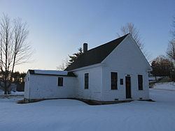
The town was granted by the authorities of New Hampshire, to Jonathan Wiggin and others, in 1727, and was originally 9 miles (14 km) square, and covered nearly all the territory granted to Ebenezer Eastman and others, by the authorities of Massachusetts, two years previous, under the name of Pennacook (now Concord). Massachusetts claimed to hold authority over a large portion of the territory of New Hampshire for many years, till the final boundary line was established, in 1741, giving New Hampshire more territory than it had ever claimed. These complicated lines of the two towns coming from two different authorities, were not settled decisively till after the final separation of the two states. The government of New Hampshire gave Bow the preference in its grant of 1727, and did not recognize the title of the Pennacook grantees, and in the bill giving a charter for the parish of Concord, it was worded as "taking a part of the town of Bow," etc. Although Concord was granted and surveyed before Bow, its final organization was 38 years after it. Bow gained a victory over Concord in its original title; still it was obliged to yield over two-thirds of its territory to Concord, Pembroke and Hopkinton, establishing their final boundary lines at different times, from 1759 to 1765.
The town's name comes from its establishment along a bend, or "bow", in the Merrimack River. The first census, taken in 1790, reported 568 residents.
In 1874, the Concord Railroad passed along the eastern border of Bow. It is now the New England Southern Railroad.
Geography
According to the United States Census Bureau, the town has a total area of 28.4 square miles (73.6 km2), of which 28.0 sq mi (72.6 km2) is land and 0.39 sq mi (1.0 km2) is water, comprising 1.38% of the town. The highest point in Bow is Picked Hill, at 915 feet (279 m) above sea level, in the southern part of town. Nearby Wood Hill and Brown Hill also top 900 feet (270 m). Bow lies fully within the Merrimack River watershed.
Demographics
As of the census of 2000, there were 7,138 people, 2,304 households, and 2,045 families residing in the town. The population density was 254.3 people per square mile (98.2/km²). There were 2,330 housing units at an average density of 83.0 per square mile (32.0/km²). The racial makeup of the town was 97.79% White, 0.13% African American, 0.10% Native American, 1.04% Asian, 0.29% from other races, and 0.66% from two or more races. Hispanic or Latino of any race were 0.49% of the population.
There were 2,304 households out of which 49.1% had children under the age of 18 living with them, 81.0% were married couples living together, 5.9% had a female householder with no husband present, and 11.2% were non-families. 8.6% of all households were made up of individuals and 3.6% had someone living alone who was 65 years of age or older. The average household size was 3.10 and the average family size was 3.28.
In the town, the population was spread out with 32.6% under the age of 18, 4.4% from 18 to 24, 27.3% from 25 to 44, 27.2% from 45 to 64, and 8.4% who were 65 years of age or older. The median age was 39 years. For every 100 females there were 99.5 males. For every 100 females age 18 and over, there were 93.7 males.
The median income for a household in the town was $79,329, and the median income for a family was $83,567. Males had a median income of $60,375 versus $30,929 for females. The per capita income for the town was $29,557. About 2.0% of families and 1.8% of the population were below the poverty line, including 0.6% of those under age 18 and 4.2% of those age 65 or over.
Education
In 1997, Bow built its first high school, Bow High School, along Turee Pond. Bow Memorial School (the middle school) and Bow Elementary School are located on Bow Center Road, less than a mile from the high school.