
Time zone IST (UTC+2) Area code +972 (Israel) 3 (City) | Metropolitan Area Gush Dan Postal code 61999 Area 1,516 km² | |
 | ||
Population 3.713 million (31 Dec 2013) | ||
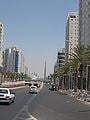
gush dan in thezone 2013
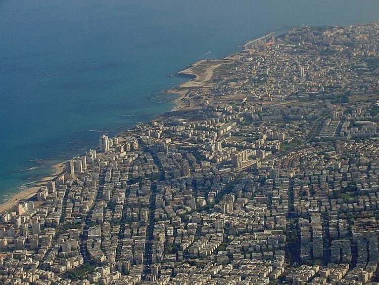
Gush Dan (Hebrew: גּוּשׁ דָּן; Arabic: غوش دان) is a conurbation, including areas from both the Tel Aviv and the Central Districts of Israel, or sometimes the whole of Tel Aviv Metropolitan Area (Hebrew: מֶטְרוֹפּוֹלִין תֵּל אָבִיב), which in current official designations includes a small part of the Southern District (Israel) as well. The area is located along the Israeli Mediterranean coastline. The Gush Dan bloc is the largest conurbation and metropolitan area in Israel, the metropolitan area having an estimated population of 3,713,200 residents, 95% of whom (3,527,900) are Israeli Jews. It houses about 45% of Israel's population.
Contents
- gush dan in thezone 2013
- Iron dome over gush dan
- Cities in Gush Dan
- Metropolitan rings
- History
- Economy
- Major business and commercial districts
- Institutes of higher education
- Shopping centers
- Transportation
- Major highways
- References
Iron dome over gush dan
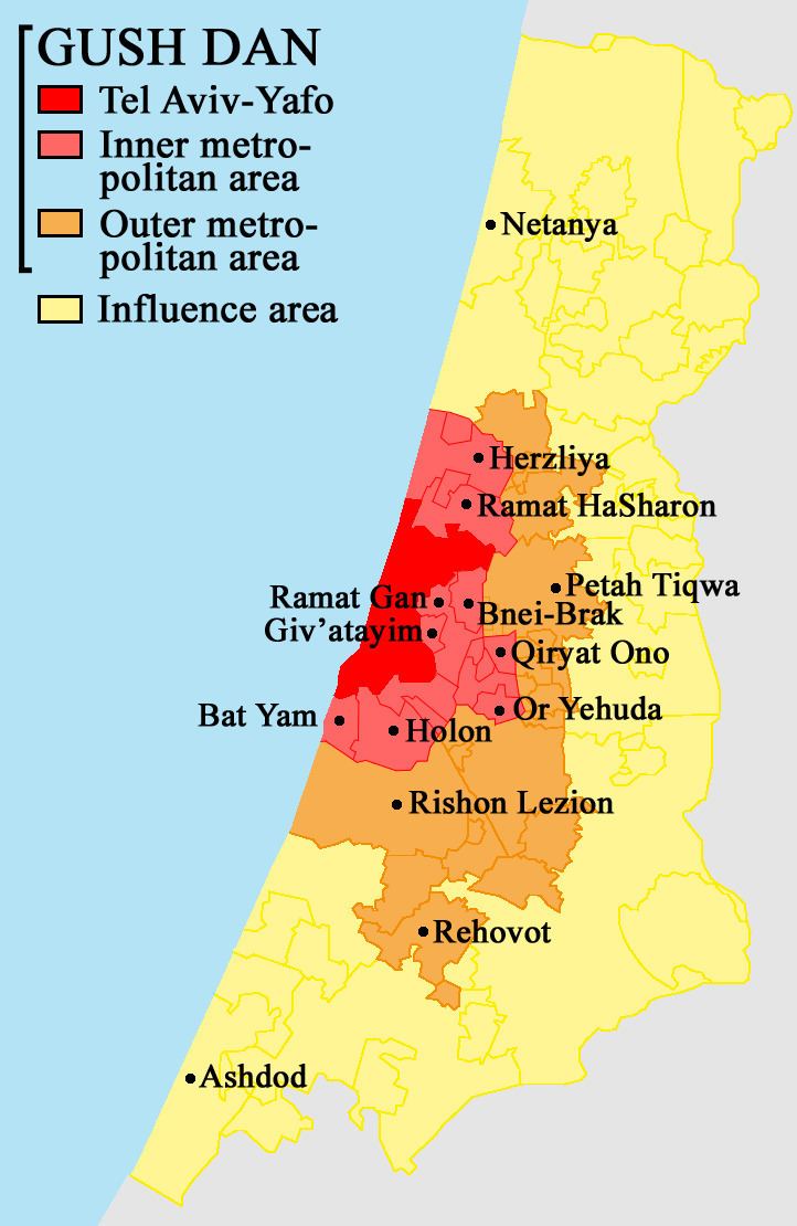
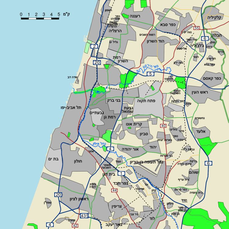
Cities in Gush Dan
Population in cities of the Middle Ring as of the end of 2014:
Hod HaSharon, Modi'in Illit, Rosh HaAyin, Ramat HaSharon, Ness Ziona, El'ad, Yavne, Kiryat Ono, Yehud-Monosson, Tira, Giv'at Shmuel, Kafr Qasim, Qalansawe, Be'er Ya'akov, Even Yehuda, Gan Yavne, Ganei Tikva, Gedera, Giv'at Shmuel, Jaljulia, Kfar Yona, Kiryat Ekron, Kokhav Ya'ir, Mazkeret Batya, Shoham, Tel Mond, Tzoran-Kadima
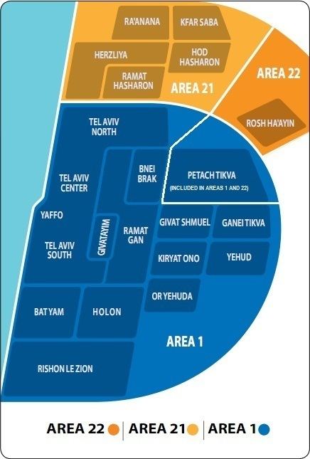
Metropolitan rings
Israel Central Bureau of Statistics divides the Tel Aviv metropolitan area into four:
Notes
History
The name Gush Dan means "Dan Bloc", and is so named because the area was the territory of the tribe of Dan in the ancient Kingdom of Israel. According to the biblical narrative, the tribe had originally tried to settle in the central coastal area of Canaan, but due to enmity with the Philistines who had already settled there, were only able to camp in the hill country overlooking the Sorek Valley. The camp location became known as Mahaneh Dan ("Camps of Dan"). The region they attempted to settle included the area as far north as Joppa and as far south as Shephelah in the area of Timnah. As a result of the pressure from the Philistines, the tribe abandoned hopes of settling near the central coast, instead migrating to the north of the country. After conquering Laish, the tribe refounded it as their capital and renamed it Dan. In remembrance of the original territory assignments, this coastal region is referred to as Gush Dan.
The modern city of Tel Aviv was founded in 1909 as a suburb of the Arab coastal city of Jaffa. The city grew rapidly in the ensuing decades thanks to European immigration, with the population reaching 150,000 in 1934, and 230,000 14 years later when Israel gained its independence. Before the establishment of the state, other towns in the Gush Dan were founded as well, such as Petah Tikva in 1878, Rishon LeZion in 1882, Ness Ziona in 1883, Rehovot in 1890, and the majority of other Gush Dan cities were established before 1948.
In 1947, the Jewish population of the Gush Dan was nearly 400,000, comprising the majority of the Jewish population of Mandate Palestine. As such almost all of it was included in the Jewish state proposed by the 1947 United Nations Partition Plan for Palestine. After the 1948 Arab–Israeli War the Arab population of the region, which had been nearly 150,000 before the war, was reduced to around 10,000. They were quickly replaced by a larger number of Jews fleeing from postwar Europe and persecution in Arab countries. However, at this time many new immigrants did not come to Tel Aviv. In the 1950s towns were built on the edges of the Gush Dan, including Ashdod, Rosh HaAyin and Yavne. The nation's sole port at the time was located in the northern city of Haifa and its evolving metropolitan area making that city at least as important as Tel Aviv. At the same time the new government was trying to disperse the nation's population to the periphery, discouraging settlement in the already populated Gush Dan. This slowed the growth of the Gush Dan, but the area still more than doubled in population within 20 years of the establishment of the state. The opening of the Port of Ashdod in the southern Gush Dan also increased the area's importance, with Haifa's importance diminishing, and Tel Aviv's increasing due to its proximity to the Port of Ashdod. Tel Aviv itself witnessed population decreases in the 1970s, and 80s with outer regions of the Gush Dan with lower costs of living absorbing many people who left Tel Aviv. Only in the 1990s with the immigration of more than 1 million Jews from former Soviet Republics, 40,000 Ethiopian Jews, and many others to Israel, as well as a boom in the religious population, did Tel Aviv begin to grow again. The demand for housing increased dramatically, with new cities such as Modiin, El'ad being built, and cities like Ashdod more than doubling in population, from 83,000 in 1990, to 175,000 in 2000. In the 2000s the area continued to grow, attracting many immigrants from the Haifa metropolitan area. In 2010 the Gush Dan is home to 3,200,000 people and is the commercial, economical, cultural, and industrial center of Israel. Despite some successes in ongoing attempts by the Israeli government to encourage migration to the Galilee and the Negev, the Gush Dan retains its position as the heart of the State of Israel.
Economy
The Gush Dan is the economic center of the state of Israel. It is responsible for a large proportion of the nation's economy and contains numerous commercial centers.
Major business and commercial districts
Institutes of higher education
Shopping centers
Tel Aviv
Giv'atayim
Herzliya
Ramat Gan
Ramat HaSharon
Holon
Or Yehuda
Rishon LeZion
Netanya
Yehud
Bat Yam
Petah Tikva
Rehovot
Ra'anana
Kfar Saba
Ramla
Lod
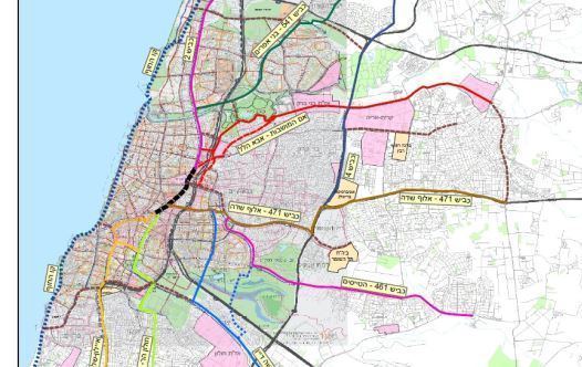
Transportation
The Dan Bus Company is primarily focused on serving the Gush Dan, although it is being replaced by the Kavim company in many of the Gush Dan's cities. Much of Israel's national highway network feeds into the area, such as Highway 1, Highway 2, Highway 4, and Highway 5. Gush Dan is also served by the local Ayalon Highway. Israel Railways, the state owned, national rail network provider, also feeds most traffic into or within the Gush Dan region. The Tel Aviv Light Rail, currently under construction, will also be a major feature in the regions future transport, as will the high speed service to Jerusalem. Two airports are located in the Gush Dan; Sde Dov Airport located in Tel Aviv which sees an average of 700,000 passenger movements a year, is located north of the Yarkon River hosts flights to Rosh Pina, and Haifa in the north as well as to Ein Yahav, Ovda International Airport, and Eilat in the south as well as to nearby Cyprus, Rhodes in Greece, and Aqaba in Jordan. Meanwhile, Ben Gurion International Airport in Lod which is Israel's largest airport handles over 12 million passengers a year and offers flights to destinations in Europe, Africa, Asia, and The Americas.
Major highways
Some of the major freeways/expressways carrying commuter traffic in and out of the Tel Aviv Metropolitan Area are: