
Settled 1650 Elevation 165 ft (50 m) Area 68.4 km² Population 68,318 (1 Apr 2010) | Incorporated 1700 Local time Wednesday 7:58 PM | |
 | ||
Weather -6°C, Wind W at 24 km/h, 55% Humidity Colleges and Universities | ||
Framingham (/ˈfreɪmɪŋˌhæm/) is a town in Middlesex County, Massachusetts, United States. The population was 68,318 as of the United States 2010 Census, making it the 14th most populous municipality in Massachusetts. Founded in 1700, Framingham was placed at # 36 on 'Best Places to Live in US' by CNN Money magazine in 2012.
Contents
- Map of Framingham MA USA
- History
- Geography
- Demographics
- Housing
- Town manager
- Town meeting
- Elected boards
- Education
- Transportation
- Air
- Major highways
- Rail
- Bus
- Commuter services
- Economy
- Golden Triangle
- Downtown and South Framingham
- West Framingham
- Villages and Route 9
- Healthcare
- Newspapers and websites
- Television and cable
- Radio
- Film
- Utilities
- Points of interest
- Culture
- Parks
- Conservation land
- Recreation
- Politics
- Sports
- Arts and sciences
- Media
- Other
- Sister cities
- References
Map of Framingham, MA, USA
History
Framingham, sited on the ancient trail known as the Old Connecticut Path, was first settled when John Stone settled on the west bank of the Sudbury River in 1647. In 1660, Thomas Danforth, an official of the Bay Colony, formerly of Framlingham, Suffolk, received a grant of land at "Danforth's Farms" and began to accumulate over 15,000 acres (100 km2). He strenuously resisted petitions for incorporation of the town, which was officially incorporated in 1700, following his death the previous year. Why the "L" was dropped from the new town's name is not known. The first church was organized in 1701, the first teacher was hired in 1706, and the first permanent schoolhouse in 1716.
On February 22, 1775, the British general Thomas Gage sent two officers and an enlisted man out of Boston to survey the route to Worcester, Massachusetts. In Framingham those spies stopped at Buckminster's Tavern. They watched the town militia muster outside the building, impressed with the men's numbers but not their discipline. Though "the whole company" came into the tavern after their drill, the officers managed to remain undetected and continued on their mission the next day. Gage did not order a march along that route, instead ordering troops to Concord, Massachusetts, on April 18–19. Framingham sent two militia companies totaling about 130 men into the Battles of Lexington and Concord that followed; one of those men was wounded.
In the years prior to the American Civil War, Framingham was an annual gathering-spot for members of the abolitionist movement. Each Independence Day from 1854 to 1865, the Massachusetts Anti-Slavery Society held a rally in a picnic area called Harmony Grove near what is now downtown Framingham. At the 1854 rally, William Lloyd Garrison burned copies of the Fugitive Slave Law of 1850, judicial decisions enforcing it, and the United States Constitution. Other prominent abolitionists present that day included William Cooper Nell, Sojourner Truth, Wendell Phillips, Lucy Stone, and Henry David Thoreau.
During the post–World War II baby boom, Framingham, like many other suburban areas, experienced a large increase in population and housing. Much of the housing constructed during that time consisted of split-level and ranch-style houses.
Framingham is known for the Framingham Heart Study, as well as for the Dennison Manufacturing Company, which was founded in 1844 as a jewelry and watch box manufacturing company by Aaron Lufkin Dennison, who became the pioneer of the American System of Watch Manufacturing at the nearby Waltham Watch Company. His brother Eliphalet Whorf Dennison developed the company into a sizable industrial complex which merged in 1990 into Avery Dennison, with headquarters in Pasadena, California, and active corporate offices in the town.
In 2000, Framingham celebrated its Tercentennial.
Geography
Framingham is located at 42°17′59″N 71°25′35″W (42.299795, −71.426627).
According to the United States Census Bureau, the town has a total area of 26.4 square miles (68.5 km²). 25.1 square miles (65.1 km²) of it is land and 1.3 square miles (3.4 km²) of it (4.99%) is water.
Framingham is located in eastern Massachusetts, 20 miles (32 km) west of Boston, midway between Boston and Worcester. It is bordered by Southborough and Marlborough on the west; Sherborn and Ashland on the south; Natick on the east; Wayland on the northeast; and Sudbury on the north.
The town of Framingham is divided by Route 9, which passes east-to-west through the middle of the town. South Framingham includes Downtown Framingham (the town government seat), and the villages of Coburnville, Lokerville, and Salem End Road. North Framingham includes the villages of Nobscot, Pinefield, Ridgefield, and Saxonville plus Framingham Center (the physical center of town, featuring the town commons).
Demographics
As of the census of 2010, there were 68,318 people, 27,529 households, and 16,573 families residing in the town. The population density was 2,663.6 people per square mile (1,028.4/km²). There were 26,734 housing units at an average density of 2,728.6 per square mile (410.9/km²). The racial makeup of the town was 65.3% White, 5.8% Black, 0.8% Native American, 6.3% Asian, 0.1% Pacific Islander, 6.27% from other races, and 3.38% from two or more races. Hispanic or Latino of any race were 13.4% of the population (4.7% Puerto Rican, 1.8% Guatemalan, 1.5% Salvadoran, 1.1% Dominican, 0.9% Mexican, 0.6% Colombian, 0.3% Peruvian). (Source: 2010 Census Quickfacts)
There were 26,153 households, out of which 29.1% had children under the age of 18 living with them, 50.0% were married couples living together, 10.2% had a female householder with no husband present, and 36.6% were non-families. 28.7% of all households were made up of individuals and 9.1% had someone living alone who was 65 years of age or older. The average household size was 2.43 and the average family size was 3.02.
In the town, the age distribution of the population shows 21.4% under the age of 18, 9.0% from 18 to 24, 34.5% from 25 to 44, 22.1% from 45 to 64, and 13.0% who were 65 years of age or older. The median age was 36 years. For every 100 females there were 91.3 males. For every 100 females age 18 and over, there were 88.6 males.
The median income for a household in the town was $54,288, and the median income for a family was $67,420. Males had a median income of $46,122 versus $35,941 for females. The per capita income for the town was $27,758. About 8.0% of families and 16.0% of the population were below the poverty line, including 11.4% of those under age 18 and 6.1% of those age 65 or over.
Brazilian immigrants have a major presence in Framingham. Since the 1980s, a large segment of the Brazilian population has come from the single city of Governador Valadares.
Housing
Framingham is one of the few towns in Massachusetts that have met their legal requirement of 10% for Massachusetts Chapter 40B Affordable housing which mostly targets people with income levels in the 70% of median income. In addition to its 40B Affordable component, Framingham has a large percentage of rental units which target people in the 30% of median income bracket. Framingham has a much larger percentage of rental households than any of the surrounding towns. Statewide, the median income of rental households is 47% of the median for homeowners, and in Middlesex County it is slightly more than 50%. In Framingham, the median renter income of $33,626 is 45% of the median homeowner income of $75,040.
Housing in South Framingham is mainly single-family houses on lots of less than 0.5 acres (0 ha), multi-family homes or apartments. Additionally much of the town's affordable housing is located south of Route 9. However, there a large number of large, single-family homes around Salem End Road on the West Side of South Framingham. This region is often overlooked as being in South Framingham because the area is physically separated from most of the South Side due to a series of reservoirs and the Sudbury River. Also, there are many large Victorian houses located along the shores of Learned and Gleason Ponds, and along Concord St. and Union Ave. near Downtown Framingham. Additionally, the West Side of South Framingham along Route 9 has several large tracts of multi-story apartment buildings that comprise a major part of the town's apartment stock.
North Framingham was originally mostly farmland and gave way to large tracts of single-family housing on lots of over 0.5 acres (0 ha) after World War II. The village of Saxonville on the east side is an old mill area that consists of many Victorian homes, and is undergoing a large expansion of over six hundred new homes on a former gravel pit. The village of Nobscot on the western side has many homes that are valued above mean housing prices for the region. While there are several small apartment complexes on the North Side, most have been converted to condominia. In the 1950s and 1960s, the villages of Nobscot, Pinefield, and Saxonville all had a large number of slab and raised ranch-style houses constructed by the Campanelli Company. These homes are classic cookie-cutter style homes that feature the same general shape and floor plan; while there are six or seven styles of the houses, the large majority of which are referred to Campanelli "L" ranches because their floor plan resembles the letter "L". At the time of construction, these homes were considered by many to be the epitome of the American dream of homeownership; today they are viewed as more modest homes.
Today, most of Framingham has been developed with the exception of some parcels in the northwest quadrant. In this part of town, there are more people with wells and septic systems, combined with a large amount of ledge, which prevents most of the unbuilt land from being developed.
Town manager
The town manager oversees the day-to-day operations of the town and is hired by and reports to the Board of Selectmen. The office of the Town Manager is responsible for all hiring and firing. Before Framingham had a strong Town Manager, it had a Town Manager without hiring and firing powers, and before that, an Executive Administrator who operated on a daily basis with direction supplied by, what was then, a three-man Board of Selectmen.
Town meeting
Framingham is divided into 18 Precincts with 12 elected town meeting members per precinct. Term of office is three years. The town is the largest municipality by population with a town-meeting form of government in the United States. In addition to acting as the legislative branch, town meeting is also the Zoning Authority and has the power to define zoning districts and is required to approve of Land Takings.
Framingham town meeting has a total of seven standing committees. Each standing committee may have as a member a town meeting member from each of the 18 Precincts. The members of each precinct will annually elect the members of each of the standing committees. These standing committees are:
These standing committees are responsible for reviewing and recommending disposition to the town meeting on all articles on a town meeting warrant which may be of interest to those committees.
Elected boards
Besides the appointed town committees and boards, there are seven boards and town meeting that are directly elected by the town's voters:
Education
The Framingham School Department can trace its roots back to 1706 when the town hired its first school master, Deacon Joshua Hemenway. While Framingham had its first school master, it did not get its own public school building until 1716. The first high school, the Framingham Academy, opened its doors in 1792; however this school was eventually closed due to financing issues and the legality of the town providing funds for a private school. The first town operated high school opened in 1852 and has been in operation continuously in numerous location throughout the town.
Framingham has 14 public schools which are part of the Framingham Public School District. This includes Framingham High School, three middle schools (Walsh, Fuller, and Cameron), nine elementary schools (Barberi, Brophy, Dunning, Hemenway, King, McCarthy, Potter Road, Stapleton, Woodrow Wilson), and the Blocks Pre-School. The school district's main offices are located in the Fuller Administration Building on Flagg Drive with additional offices at the King School on Water Street. The town also has a regional vocational high school and one regional charter school. Framingham is also home to several private schools, including Summit Montessori School, the Sudbury Valley School, three parochial schools, including Marian High School, one Jewish day school, and several specialty schools.
Since 1998, when Framingham began upgrading its schools, it has performed major renovations to Cameron, Wilson, McCarthy, and Framingham High School. Two public school buildings that were mothballed due to financial issues or population drops have been leased to the Metrowest Jewish Day School (at the former Juniper Hill Elementary) and Mass Bay Community College (at the former Farley Middle school). Several schools that were no longer being used were sold off, including Lincoln, Roosevelt, and Washington.
Framingham has three colleges, including Framingham State University and Massachusetts Bay Community College's Framingham Campus.
Transportation
Framingham is located approximately halfway between Worcester, the commercial center of Central Massachusetts, and Boston, New England's leading port and metropolitan area. Rail and highway facilities connect these major centers and other communities in the Greater Boston Metropolitan Area.
Air
The closest airport with scheduled international passenger traffic is Boston's Logan International Airport, 25 miles (40 km) from Framingham. Worcester Regional Airport, about 27 miles (43 km) away, began scheduled flights to Fort Lauderdale and Orlando in November 2013.
Major highways
Framingham is served by one Interstate and four state highways:
Rail
Bus
Commuter services
Park and ride services:
Economy
Framingham's economy is predominantly derived from retail and office complexes. There are scatterings of small manufacturing facilities and commercial services such as plumbing, mechanical and electrical expected to be found in communities of its size. Framingham has three major business districts within the town, The "Golden Triangle", Downtown/South Framingham, and West Framingham. Additionally, there are several smaller business hubs in the villages of Framingham Center, Saxonville, Nobscot, and along the Route 9 corridor.
Golden Triangle
The Golden Triangle was originally a three square mile district on the eastern side of Framingham, bordered by Worcester Rd. (Route 9), Cochituate Rd. (Route 30), and Speen Street in Natick. In 1993, the area began to expand beyond the borders of the triangle with construction of a BJ's Wholesale Club and a Super Stop & Shop just north of Route 30. It now includes the original area plus parts of Old Connecticut Path., Concord St. (Route 126), and Speen St. north of Route 30. Because of the size and complexity of this area, Framingham and Natick cooperatively operate it as a single distinct district with similar zoning. The area is one of the largest shopping districts in New England.
The area was formed with the construction of Shoppers World in 1951. Shoppers' World was a large open air shopping mall, the second in the US and the first east of the Mississippi River. The mall drew many other retail construction projects to the area, including Marshalls (1961, rebuilt as Bed, Bath and Beyond 1997), Caldor (1966, Rebuilt as Wal-Mart in 2002), Bradlees (1960s, rebuilt as Kohl's in 2002), the Route 30 Mall (1970), an AMC Framingham 15, the Framingham Mall (1978, rebuilt 2000), and Lowe's (formerly the Verizon Building, 2006). Complementary developments in Natick include the Natick Mall (1966, rebuilt in 1991, expanded 2007 & renamed Natick Collection), Sherwood Plaza (1960), Cloverleaf Marketplace (1978), and the Home Depot. In 1994, Shoppers' World was demolished and replaced with a strip mall named Shoppers World. There are also seven hotels and two car dealerships located within the Triangle.
In addition to retail properties, there are large office developments located in the area including several companies headquartered in the triangle; the world headquarters of TJX is located at the junction of Route 30 and Speen St, as is the main office of IDG and IDC. Disruptor Beam, Breyers, Leggat McCall, the American Heart Association, and the American Cancer Society all have facilities in the area. Boston Scientific headquarters is housed in Natick, in the old Carling Brewery building and former Prime parkway complex. There are over a dozen large office complexes located in, and along, the borders of the Triangle.
Downtown and South Framingham
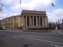
The downtown area is located between Memorial Square, formed by the intersection of Concord St. and Union Ave., to the north and its mirror intersection at the junction of Irving St. and Hollis St. on the south end. The area is bisected by Waverly St. (Route 135) and the MBTA Commuter Rail tracks. The anchoring structure of Downtown is the town hall, The Memorial Building. From 2015 to 2016, the whole area underwent a multimillion-dollar reconstruction of the intersection of Union Ave. and Concord St. that removee the traffic circle and replaced it with a signal controlled intersection. Additional lights were installed at the Irving St./Hollis St. intersection, while older signals in the area were upgraded. All sidewalks in the area were to be replaced, lighting upgraded, and new amenities such as seating and bicycle racks were also installed. The project was scheduled to begin in 2012, but has been delayed to 2014–2015. Further delays pushed the project into 2015 due to needed electrical utility upgrades and replacement.
South Framingham became the commercial center of the town with the advent of the railroad in the 1880s. It eventually came to house Dennison Manufacturing and the former General Motors Framingham Assembly plant, but the area underwent a financial downturn after the closure of these facilities during the late 1980s. An influx of Hispanic and Brazilian immigrants helped to revitalize the district starting in the early 2000s. Along with Brazilian and Spanish oriented retail shops, there are restaurants, legal and financial services, the town offices and library, an art museum, police headquarters, and the local branch of the Social Security Administration. Several Asian and Indian stores and restaurants add to the rich ethnic flavor of the area, and many small businesses, restaurants and automotive-oriented shops line Waverly St. from Natick in east to Winter St. in the west.
In 2006, the Fitts Market & Hemenway buildings façades underwent a restoration project; these newly renovated structures were awarded a 2006 Massachusetts Historical Commission Preservation Award in the Restoration and Rehabilitation Category. In addition, several retail and housing projects involving the Arcade Building and the former Dennison Building Complex are in the planning stages or under construction.
West Framingham
The business section on the West Side of Framingham runs primarily along Route 9, starting at Temple St.; it is dominated by two large office/industrial parks: the Framingham Industrial Park on the north side of Route 9 and the Framingham Technology Park on the south side, both on the Ashland/Southborough border. Bose, Staples Inc and Applause have their world headquarters in these parks, as does convenience store chain Cumberland Farms; in addition, Netezza, Genzyme, Capital One, CA Technologies, ITT Tech and the local paper, The MetroWest Daily News, all have major facilities located there. Two of Framingham's seven major auto dealerships are also located in West Framingham: Ford and Toyota/Scion.
The large tracts of multi-story apartment and condominium complexes line both sides of Route 9 from Temple St. to the industrial parks. These buildings represent the majority of Framingham's multi-family dwellings, and along with the business complexes, helped create a large network of support services on the West Side: Framingham's second Super Stop & Shop supermarket, dozens of restaurants and pubs, Sheraton and Residence Inn by Marriott hotels and a large day-care facility all are in the two-mile (3 km) section of Route 9 from Temple St. to Ashland.
Villages and Route 9
The Framingham Centre Common Historic District is the physical and historic center of town. Formed at the junctions of Worcester Rd. (Route 9), Pleasant St. (Route 30), High St., Main St. and Edgell Rd. the dominating presence is Framingham State University. The school is home to several thousand students, about one third of whom live on campus. In the late 1960s, MassHighway replaced the intersection with an overpass, depressing Route 9 below the local roads, and destroying the south half of the old Center retail district. The remaining half houses several small stores, restaurants, realtors and legal offices. The old Boston and Worcester Street Railway depot, on the east side of the Center, was converted into a strip mall in the early 1980s and houses the Center Postal Station (01703) and several small stores. The Center is rounded out by One and Two Edgell Rd. (two small retail/office buildings), the historic village hall, the Jonathan Maynard Building (a former school converted to an office building which now houses most of the school district's administration), the Framingham History Center (formerly the Framingham Historical Society and Museum), several banks, a Chinese restaurant, the American Medical Response paramedic station and McCarthy Office Building.
The village of Nobscot, located at the intersection of Water St., Edmands Rd. and Edgell Rd. near Nobscot Hill, and the Pinefield/Saxonville villages, located where Concord St., Water St., and Central St. intersect, are home to several small office buildings, strip malls and gas stations. in 2016, the town moved its satellite branch of the public library named for Christa McAuliffe from Saxonville to a new facility across from the Hemingway School in Nobscot. Saxonville is the home of the former Roxbury Carpet Company buildings, now an industrial park, and is one of the town's historical districts.
In addition, the section of Route 9 from the Route 126 overpass to the Main St./Edgell Rd. beetleback in Framingham Center is heavily developed. Three car dealerships, Acura, Chevrolet and Nissan, several strip malls of varying sizes, many small apartment complexes, several small office complexes and other small shops and restaurants make Route 9 the main commercial thoroughfare in Framingham.
Finally, there are several other small retail areas and facilities spread throughout the town, e.g. near Mt Wayte Ave. and Franklin St.; the intersection of Concord St. and Hartford St.; and along School St., near Hamilton St.
Healthcare
Newspapers and websites
The Town of Framingham is served by:
Television and cable
Framingham has a public, educational, and government access (PEG) cable TV channel and local origination television station called Access Framingham (formerly FPAC-TV), that airs on Channel 9 Comcast, Channel 3 RCN and Channel 43 Verizon. Residents can create and produce their own television programs that reflect the personality of the community, and have them cablecast on the public-access television cable TV channels.
Framingham High School has a student-run television station, FHS-TV, that broadcasts locally; "Flyer News", its morning news program, has won 11 National High School Emmy Awards.
The Town of Framingham operates the Government Channel shown on Comcast channel 99, RCN 13/HD613, and Verizon 42. The Government Channel operation provides programming sponsored by or for the Town of Framingham. Commission meetings are cablecast live to inform residents and encourage participation in local government. Some of the programming provided, keeps residents abreast of road closings, construction updates, recycling efforts, public safety information, and special events in the community. The Government Channel is committed to making local government more accessible to all residents. More information is available at www.framinghamtv.com
Radio
Film
In the spring of 2016, the town of Framingham was a setting the film Patriots Day about the Boston Marathon bombing, starring Mark Wahlberg, John Goodman, Kevin Bacon, J.K. Simmons, Michelle Monaghan, Alex Wolff, Melissa Benoist and a cameo appearance by former athlete David Ortiz. In spring 2009, Framingham was also used for the film The Company Men, starring Ben Affleck, Chris Cooper, Kevin Costner, and Tommy Lee Jones.
Utilities
Points of interest
Framingham features dozens of athletic fields and civic facilities spread throughout the town in schools and public parks. Many of the recreational facilities were constructed by the Civilian Conservation Corps during the New Deal.