
Elevation 600 ft (180 m) | ||
 | ||
Similar Ford's Folly, Callahan State Park, Garden in the Woods, Mount Pisgah, Framingham Railroad Station | ||
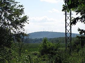
Nobscot Hill is a USGS name for a high point in Middlesex County, Massachusetts, and is located in Framingham. It has various radio towers and a fire tower. Below Nobscot Hill is the Nobscot Reservation including Tippling Rock. In 2008, a 303-acre (1.23 km2) portion of the Nobscot Scout Reservation in Sudbury was permanently conserved today by Sudbury Valley Trustees, the Town of Sudbury, and the Knox Trail Council, Boy Scouts of America.
Map of Nobscot Hill, Framingham, MA 01701, USA
Nobscot Hill commands a 360-degree view including Boston, MetroWest, the Blue Hills, Lower Kearsarge, Mount Monadnock, Mount Wachusett, Mount Agamenticus, and all of the unremarkable bumps to the SouthWest.
Tantamous a medicine man called Old Jethro by the colonists, lived on Nobscot Hill at the beginning of King Philip’s War in 1674. and Revolutionary War General John Nixon lived and farmed on the north side of Nobscot Hill after the war was over.