
Country United States Incorporated 1713 Zip code 02493 Local time Saturday 8:46 AM | Settled 1642 Elevation 180 ft (55 m) Population 11,261 (2010) | |
 | ||
Weather 2°C, Wind NE at 26 km/h, 89% Humidity Colleges and Universities | ||
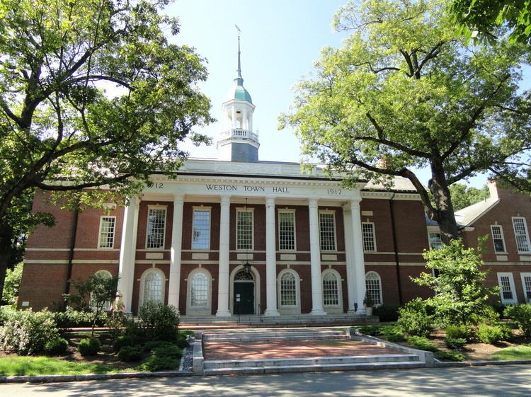
Weston is a town in Middlesex County, Massachusetts, United States in the Boston metro area. The population of Weston, as of the 2010 U.S. Census, was 11,261.
Contents
- Map of Weston MA 02493 USA
- History
- Geography
- Demographics
- Politics
- Education
- Transportation
- Notable people
- Points of interest
- References
Map of Weston, MA 02493, USA
Weston is among the 10 most affluent towns with 1,000 or more households in the United States and is the third-most affluent town with a population of at least 10,000 in the United States. Weston is among the nation's 100 most expensive ZIP codes, with a median home price of well over $2 million. It is the only town in the Boston Area to have private roads, with state of the art police patrolling 24/7.
Despite a population of just 11,261, Weston's area is only slightly smaller than that of its neighbor town, Newton, Massachusetts which accounts for a much higher population of about 90,000. As a result, Weston's houses are on average much larger than those present in nearby towns, with considerable space between each individual residence. It has one of the lowest crime rates among Metro-west Boston suburbs.
Weston was a dry town from 1838 until 2008. Incorporated in 1713, the town is located on a rugged upland plateau.
History
The town of Weston was originally established as the West Precinct of Watertown in 1698. The town was separately incorporated as the town of Weston in 1713.
Weston is located on a rugged upland plateau. Early settlers discovered that the amount of useful agricultural land was limited as was the waterpower potential in the town. But colonists moving in from Watertown in the mid-17th century established scattered farms in Weston, and by 1679, a sawmill, several taverns, some doctors, and according to the historians, "probably some lawyers," had settled in Weston.
By the 18th century, residents were profiting by the traffic on the Boston Post Road. Taverns of great historic importance were established on the Road. The Golden Ball Tavern, built in 1750, and the Josiah Smith Tavern, built in 1757, still exist in the town. Unfortunately, commercial stagnation followed the loss of business after the opening of the Worcester Turnpike in 1810 drew commercial traffic from the Boston Post Road. Townspeople turned to boot and shoe making, and the manufacturing of cotton and woolen mill machinery. By 1870, substantial country estates were being built in Weston by Bostonians, establishing a prosperous residential character for the town. Farming continued to be a significant support for the local economy, and an organ factory opened in 1886 which employed some residents. The Weston Aqueduct and Reservoir were built in 1903 and the Hultman Aqueduct followed in 1938 to bring Quabbin Reservoir water into Boston. In exchange, Boston residents continued to build homes in Weston, many of them architect designed.
Some famous architects such as McKim and Richardson designed luxurious houses in the town, which witnessed a rapid increase in population from 1920 to 1935, and then again after World War II. The Boston oriented suburbanization has continued as a major factor in the town's development. Residents are very proud of the town's school system and the handsome homes in quiet, well-kept neighborhoods, but tend to brush off the town's reputation as one of the most affluent communities in the state. Weston has carefully retained significant amounts of open space and maintains over 60 miles of hiking and horseback riding trails, playgrounds, ball fields, golf courses and cross-country skiing areas.
Weston was also the home of the E. and G.G. Hook & Hastings organ company until a fire destroyed the factory in the early 1900s. After the fire broke out the fire department responded however the water source (Stony Brook) was just on the other side of the railroad tracks. As the firemen were fighting the fire a train came along and cut all the hoses leaving the firemen without water and having to scurry to replace the cut hoses. Unfortunately for the factory this required more time and the fire consumed the wooden factory.
Weston is also home to many important events regarding the revolutionary war, with the most important being a through way for the Noble Train of Artillery led by Henry Knox. Along with several other towns along the route that Knox took, Weston serves as an important reminder of this selfless and punishing act that helped the revolutionaries win the war.
Geography
According to the United States Census Bureau, the town has a total area of 17.3 square miles (45 km2), of which 17.0 square miles (44 km2) is land and 0.3 square miles (0.78 km2), or 1.85%, is water. The town has a serious problem with deer overpopulation, and is using controlled bow hunting to address the problem.
Demographics
As of the census of 2000, there were 11,469 people, 3,718 households, and 2,992 families residing in the town. The population density was 674.0 people per square mile (260.2/km²). There were 3,825 housing units at an average density of 224.8 per square mile (86.8/km²). The racial makeup of the town was 90.26% White, 1.18% African American, 0.05% Native American, 6.82% Asian, 0.05% Pacific Islander, 0.43% from other races, and 1.21% from two or more races. Hispanic or Latino of any race were 1.90% of the population.
There were 3,718 households out of which 42.3% had children under the age of 18 living with them, 73.1% were married couples living together, 5.6% had a female householder with no husband present, and 19.5% were non-families. 17.2% of all households were made up of individuals and 10.5% had someone living alone who was 65 years of age or older. The average household size was 2.85 and the average family size was 3.21.
In the town, the population was spread out with 28.0% under the age of 18, 7.3% from 18 to 24, 20.4% from 25 to 44, 27.8% from 45 to 64, and 16.5% who were 65 years of age or older. The median age was 42 years. For every 100 females there were 86.6 males. For every 100 females age 18 and over, there were 79.6 males.
The median income for a household in the town was $153,918 and the median income for a family was $200,000+, figures that had risen to $189,041 and over $230,000 by 2007. Males had a median income of $100,000 versus $58,534 for females. The per capita income for the town was $105,640. About 2.1% of families and 2.9% of the population were below the poverty line, including 1.8% of those under age 18 and 3.9% of those age 65 or over.
Weston was ranked as the 87th-wealthiest US ZIP Code in a Forbes survey in 2015.
Politics
Weston has 8,179 registered voters. There are 2,006 Democrats 24.53%; 1,537 Republicans 18.79%; and 4,611 voters are Unenrolled 56.38% {Feb. 2014}.
Katherine Clark carried Weston with 59% of the vote in the special election to fill Ed Markey’s Congressional seat, on December 10, 2013. In 2012, Weston supported Democrat Barack Obama 51.8% to Republican Mitt Romney 48.2% in the presidential election; however, Weston supported Republican Scott Brown 54.8% to Democrat Elizabeth Warren 45.2% in the 2012 Senatorial election.
Like much of New England, Weston has trended strongly Democratic on the federal level in recent years. Weston supported Ronald Reagan in 1980 and 1984, as well as George H.W. Bush in 1988, against homestate Governor Mike Dukakis for president of the United States. However, it supported Bill Clinton in 1992, and has supported the Democratic candidate in every election since then, including Barack Obama over Mitt Romney.
Weston is located entirely within Massachusetts's 5th congressional district.
Weston is represented in the Massachusetts Senate by Michael J. Barrett (D).
Massachusetts is represented in the United States Senate by senior Senator Elizabeth Warren and junior Senator Ed Markey.
Education
Transportation
Weston is served by three MBTA commuter rail stations - Silver Hill, Kendall Green, and Hastings - all on the Fitchburg Line. All are small, limited-service stops. The MBTA's long-term plan is to consolidate these stations into one intermodal station near Route 128/I-95.