
County Middlesex Incorporated 1688 Local time Sunday 8:54 AM | State Massachusetts Settled 1630 Elevation 100 ft (30 m) Population 87,971 (2013) | |
 | ||
Weather 1°C, Wind NE at 8 km/h, 71% Humidity Points of interest | ||
Newton massachusetts ma community tour
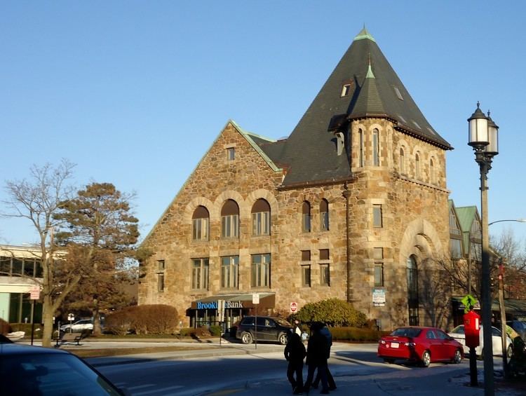
Newton is a suburban city in Middlesex County, Massachusetts, United States. It is approximately 7 miles (11 km) west of downtown Boston and is bordered by Boston's Brighton and West Roxbury neighborhoods to the east and south, respectively, and by the suburb of Brookline to the east, the suburbs of Watertown and Waltham to the north, and Wellesley and Needham to the west. Rather than having a single city center, Newton resembles a patchwork of thirteen villages. According to the 2010 U.S. Census, the population of Newton was 85,146, making it the eleventh largest city in the state.
Contents
- Newton massachusetts ma community tour
- Map of Newton MA USA
- Hotel indigo boston newton riverside newton massachusetts
- History
- Geography
- Villages
- Climate
- Demographics
- City
- County
- State
- National
- Public schools
- High schools
- Higher education
- Newton Junior College
- Others
- Hospitals
- Newspapers
- Television
- Economy
- Income
- Transportation
- Points of interest
- Cemeteries
- Notable grave sites
- In popular culture
- Sister City
- References
Map of Newton, MA, USA
Newton's proximity to Boston along with its historic homes, good public schools, and safe and quiet neighborhoods make it a desirable community for those who commute to Boston. Newton is served by three modes of mass transit run by the MBTA: light rail, commuter rail, and bus service.
Newton has been consistently ranked as one of the best cities to live in in the country. In August 2012, Money magazine named Newton fourth best small city among places to live in America and has been named the safest city in the country according to Aneki.
Newton was settled in 1630 as part of "the newe towne", which became Cambridge in 1638; it became its own town in 1688. There are several historical sites of interest in the Newton area. These include Crystal Lake (which is fronted by several historical homes), the East Parish and West Parish Burying Grounds, and the Jackson Homestead, which now houses the Newton History Museum. Historian and local resident Diana Muir has written about the history surrounding Bullough's Pond; a scene from the 2008 production of The Women was also filmed there. Portions of the upcoming 2017 drama film Patriots Day, about the 2013 Boston Marathon bombing and starring Boston native Mark Wahlberg, were filmed at Lasell College in the city.
Hotel indigo boston newton riverside newton massachusetts
History
Newton was settled in 1630 as part of "the newe towne", which was renamed Cambridge in 1638. Roxbury minister John Eliot convinced the Native American people of Nonantum, a sub-tribe of the Massachusetts led by a sachem named Waban, to relocate to Natick in 1651, fearing that they would be exploited by colonists. Newton was incorporated as a separate town, known as Cambridge Village, in 1688, then renamed Newtown in 1691, and finally Newton in 1766. It became a city in 1873. Newton is known as The Garden City.
In Reflections in Bullough's Pond, Newton historian Diana Muir describes the early industries that developed in the late 18th and early 19th centuries in a series of mills built to take advantage of the water power available at Newton Upper Falls and Newton Lower Falls. Snuff, chocolate, glue, paper and other products were produced in these small mills but, according to Muir, the water power available in Newton was not sufficient to turn Newton into a manufacturing city, although it was, beginning in 1902, the home of the Stanley Motor Carriage Company, the maker of the Stanley Steamer.
Newton, according to Muir, became one of America's earliest commuter suburbs. The Boston and Worcester, one of America's earliest railroads, reached West Newton in 1834. Wealthy Bostonian businessmen took advantage of the new commuting opportunity offered by the railroad, building gracious homes on erstwhile farmland of West Newton hill and on Commonwealth street. Muir points out that these early commuters needed sufficient wealth to employ a groom and keep horses, to drive them from their hilltop homes to the station.
Further suburbanization came in waves. One wave began with the streetcar lines that made many parts of Newton accessible for commuters in the late nineteenth century. The next wave came in the 1920s when automobiles became affordable to a growing upper middle class. Even then, however, Oak Hill continued to be farmed, mostly market gardening, until the prosperity of the 1950s made all of Newton more densely settled. Newton is not a typical "commuter suburb" since many people who live in Newton do not work in downtown Boston. Most Newtonites work in Newton and other surrounding cities and towns.
The city has two symphony orchestras, the New Philharmonia Orchestra of Massachusetts and the Newton Symphony Orchestra.
Each April on Patriots Day, the Boston Marathon is run through the city, entering from Wellesley on Route 16 (Washington Street) where runners encounter the first of the four infamous Newton Hills. It then turns right onto Route 30 (Commonwealth Avenue) for the long haul into Boston. There are two more hills before reaching Centre Street, and then the fourth and most infamous of all, Heartbreak Hill, rises shortly after Centre Street. Residents and visitors line the race route along Washington Street and Commonwealth Avenue to cheer the runners.
Geography
Newton is a suburban city approximately seven miles from downtown Boston, in Middlesex County, Massachusetts, at 42°20′16″N 71°12′36″W (42.337713, −71.209936). The city is bordered by Waltham and Watertown on the north, Needham and the West Roxbury neighborhood of Boston on the south, Wellesley and Weston on the west, and Brookline and the Brighton neighborhood of Boston on the east.
From Watertown to Waltham to Needham and Dedham, Newton is bounded by the Charles River. The Yankee Division Highway, designated Interstate 95 but known to the locals as Route 128, follows the Charles from Waltham to Dedham, creating a de facto land barrier. The portion of Needham which lies east of 128 and west of the Charles, known as the Needham Industrial Park has become part of a Newton commercial zone and contributes to its heavy traffic, though the tax revenue goes to Needham.
According to the United States Census Bureau, the city has a total area of 18.2 square miles (47.1 km2), of which 18.0 square miles (46.6 km2) is land and 0.2 square miles (0.5 km2) (0.82%) is water.
Villages
Rather than having a single city center, Newton is a patchwork of thirteen villages, many boasting small downtown areas of their own. The 13 villages are: Auburndale, Chestnut Hill, Newton Centre, Newton Corner, Newton Highlands, Newton Lower Falls, Newton Upper Falls (both on the Charles River, and both once small industrial sites), Newtonville, Nonantum (also called "The Lake"), Oak Hill, Thompsonville, Waban and West Newton. Oak Hill Park is a place within the village of Oak Hill that itself is shown as a separate and distinct village on some city maps (including a map dated 2010 on the official City of Newton website), and Four Corners is also shown as a village on some city maps. Although most of the villages have a post office, they have no legal definition and no firmly defined borders. This village-based system often causes some confusion with addresses and for first time visitors.
Climate
The record low temperature was −21 °F (−29 °C) in February 1934; the record high temperature was 101 °F (38 °C) in August 1975.
Demographics
As of the census of 2010, there were 85,146 people, 32,648 households, and 20,499 families residing in the city. The population density was 4,643.6 people per square mile (1,793.2/km²). There were 32,112 housing units at an average density of 1,778.8 per square mile (686.9/km²). The racial makeup of the city was 79.6% White, 11.5% Asian, 2.5% African American, 0.07% Native American, 0.03% Pacific Islander, 0.71% from other races, and 1.46% from two or more races. Hispanic or Latino of any race were 4.1% of the population (0.7% Puerto Rican, 0.6% Mexican, 0.4% Colombian, 0.3% Guatemalan, 0.3% Argentine). (2010 Census Report: Census report Quickfacts.com)
Newton, along with neighboring Brookline, is known for its considerable Jewish and Asian populations. The Jewish population is estimated at roughly 28,000, about one-third of the total population.
There were 31,201 households out of which 31.1% had children under the age of 18 living with them, 55.2% were married couples living together, 8.0% had a female householder with no husband present, and 34.3% were non-families. 25.5% of all households were made up of individuals and 11.1% had someone living alone who was 65 years of age or older. As of the 2008 US Census, the average household size was 2.60 and the average family size was 3.11. In the city, the population was spread out with 21.2% under the age of 18, 10.3% from 18 to 24, 28.2% from 25 to 44, 25.2% from 45 to 64, and 15.1% who were 65 years of age or older. The median age was 39 years. For every 100 females there were 86.8 males. For every 100 females age 18 and over, there were 82.7 males.
According to 2010 income statistics the city of Newton had a median household income of $112,230. With an average household income of $167,013 and a per capita household income of $65,049.
According to a 2008 estimate, the median income for a household was $108,228, and the median income for a family was $137,493. Males had a median income of $65,565 versus $46,885 for females. The per capita income for the city was $45,708. About 2.1% of families and 8.3% of the population were below the poverty line, including 4.8% of those under age 18 and 5.0% of those age 65 or over. For those in need, the local library also serves as the community pantry and distributes food on a monthly basis.
As of 2015, 21.9% of the residents of Netwon were born outside of the United States.
City
Newton has an elected strong mayor-council form of government. The council is called the City Council. The mayor is Setti Warren, a former Naval officer and White House staffer who is the first African American to be elected Mayor of Newton.
The elected officials are:
Note: Councilors for 2016 and 2017 are listed below. The first listed person in each ward is the Ward Councilor, while the other two are elected at large.
Newton also has a school committee which decides on the policies and budget for Newton Public Schools. It has nine voting members, consisting of the Mayor of Newton and eight at-large Ward representatives, who are elected by citizens. In addition to these voting members, there are two non-voting student representatives; one from each high school.
School Committee members for 2014 and 2015 are listed below.
The City of Newton Police Department is one of the most progressive departments in the state and has 139 sworn officers. The Newton Fire Department is fully paid and operates three ladder companies and six engine companies from six stations.
County
Mismanagement of Middlesex County's public hospital in the mid-1990s left the county on the brink of insolvency, and in 1997 the Massachusetts legislature stepped in by assuming all assets and obligations of the county. The government of Middlesex County was officially abolished on July 11, 1997. The sheriff and some other regional officials with specific duties are still elected locally to perform duties within the county region, but there is no county council or commission. However, communities are now granted the right to form their own regional compacts for sharing services.
These are the remaining elected officers for Middlesex County:
State
National
Congress
Public schools
Public education is provided by Newton Public Schools.
High schools
Higher education
Colleges and universities located in Newton include:
Newton Junior College
Newton Junior College, operated by the Newton Public Schools, opened in 1946 to serve the needs of returning veterans who otherwise would not have been able to continue their education due to the overcrowding of colleges and universities at that time. It used the facilities of Newton High School (now Newton North High School) until its own adjacent campus was built. It closed in 1976 due to declining enrollment and increased costs. The availability of such places as UMass Boston contributed to its demise. According to the city, its former campus is now "Claflin Park," a 25 unit multi-family development.
Others
Other former colleges include Aquinas College (1961–1999), Mount Alvernia College (1959–1973) and Newton College of the Sacred Heart (1946–1975).
Hospitals
Newton-Wellesley Hospital is located at 2014 Washington Street in Newton. U.S. News & World Report ranks the hospital 13th best in the Boston metro area.
Newspapers
The city's community newspapers are The Newton Tab, now published by the Community Newspaper Company, and The Newton Voice. The Newton community is also served by its high school publications, including Newton North High School's Newtonite and Newton South High School's Lion's Roar and Denebola.
Television
Residents of Newton have access to a state-of-the-art television studio and community media center, NewTV, located at 23 Needham Street in Newton Highlands. Newton is also the headquarters for NECN, a regional news network owned by NBC.
Economy
Newton's largest employers include Boston College and Newton-Wellesley Hospital. Companies based in Newton include TechTarget and Upromise. Until July 2015, Newton was also home to the global headquarters of TripAdvisor, the world's largest travel site, reaching nearly 280 million unique monthly visitors. TripAdvisor moved into a newly built headquarters in neighboring Needham.
Income
Data is from the 2009–2013 American Community Survey 5-Year Estimates.
Transportation
Newton's proximity to Boston, along with its good public schools and safe and quiet neighborhoods, make it a very desirable community for those who commute to Boston or work in Newton's businesses and industries.
Newton is well-served by three modes of mass transit run by the MBTA: light rail, commuter rail, and bus service. The Green Line "D" Branch, (also known as the Riverside branch) is a light rail line running through the center of the city that makes very frequent trips to downtown Boston, ranging from 10 to 30 minutes away. The Green Line "B" Branch ends across from Boston College on Commonwealth Avenue, virtually at the border of Boston's Brighton neighborhood and the City of Newton (an area which encompasses an unincorporated suburban village referred to as Chestnut Hill). The MBTA Worcester commuter rail, serving the northern villages of Newton that are proximate to Waltham, offers less frequent service to Boston. It runs from every half-an-hour during peak times to every couple of hours otherwise. The northern villages are also served by frequent express buses that go to downtown Boston via the Massachusetts Turnpike as well as Waltham.
Newton Centre, which is centered around the Newton Centre MBTA station, has been lauded as an example of transit-oriented development.
The Massachusetts Turnpike (Interstate 90), which basically follows the old Boston and Albany Railroad main line right-of-way, runs east and west through Newton, while Route 128 (Interstate 95) slices through the extreme western part of the city in the Lower Falls area. Route 30 (Commonwealth Avenue), Route 16 (Watertown Street west to West Newton, where it follows Washington Street west) and route 9 (Worcester Turnpike or Boylston Street) also run east and west through the city. Another major Boston (and Brookline) street, Beacon Street, runs west from the Boston city line to Washington Street west of the hospital, where it terminates at Washington Street.
There are no major north-south roads through Newton: every north-south street in Newton terminates within Newton at one end or the other. The only possible exception is Needham Street, which is north-south at the border between Newton and Needham, but it turns east and becomes Dedham Street, and when it reaches the Boston border, it goes south-east.
There are some north-south streets that are important to intra-Newton traveling. Centre Street runs south from the Watertown town line to Newton Highlands, where it becomes Winchester Street and terminates at Nahanton Street. Walnut Street runs south from Newtonville, where it starts at Crafts Street, down to Newton Highlands, where it ends at Dedham Street.
Points of interest
Cemeteries
There are several cemeteries in Newton, three of which are owned by the City of Newton, while the rest are privately owned, as follows:
Notable grave sites
In popular culture
Sister City
Comune di San Donato Val di Comino, Italy