
 | ||
The natural environment of Virginia encompasses the physical geography and biology of the U.S. state of Virginia. Virginia has a total area of 42,774.2 square miles (110,784.67 km2), including 3,180.13 square miles (8,236.5 km2) of water, making it the 35th-largest state by area. Forests cover 65% of the state, wetlands and water cover 6% of the land in the state, while 5% of the state is a mixture of commercial, residential, and transitional.
Contents
Virginia is bordered by Maryland and Washington, D.C. to the north and east; by the Atlantic Ocean to the east; by North Carolina and Tennessee to the south; by Kentucky to the west; and by West Virginia to the north and west. Due to a peculiarity of Virginia 's original charter, its boundary with Maryland and Washington, D.C. does not extend past the low-water mark of the south shore of the Potomac River (unlike many boundaries that split a river down the middle). The southern border is defined as the 36° 30′ parallel north, though surveyor error led to deviations of as much as three arcminutes.
The state agencies whose primary focii are on the natural environment of Virginia are the Department of Conservation and Recreation (DCR), and the Department of Environmental Quality (DEQ).
Physiogeographic regions and geology
Geologically, Virginia is divided into five regions, while the EPA lists seven ecoregions with further precision. From east to west, the regions are as follows:
Coal mining takes place in the three mountainous regions at 40 distinct coal beds near Mesozoic basins. Besides coal, resources such as slate, kyanite, sand, and gravel are mined, with an annual value over $2 billion as of 2006.
Virginia has a low risk on earthquakes, especially in the northern part of the state. The Virginia seismic zone has not had a history of regular earthquake activity. Earthquakes are rarely above 4.5 in magnitude because Virginia is located centrally on the North American Plate, far from plate boundaries. Locations near tectonic plates suffer earthquakes frequently. The largest recorded earthquake, at an estimated 5.9 magnitude, was in 1897 near Blacksburg. The largest since then was in August 2011, when a 5.8 magnitude quake struck near Mineral, Virginia and was felt moderately to strongly throughout the state.
Climate
The climate of Virginia varies according to location, and becomes increasingly warmer and humid farther south and east. Most of the state has a humid subtropical climate, from the Blue Ridge Mountains and southern Shenandoah Valley to the Atlantic coast. In the Blue Ridge Mountains, the climate becomes subtropical highland.
Ecology
The World Wildlife Fund defines four ecoregions in Virginia: Middle Atlantic coastal forests near the Atlantic coast in the southeast corner of the state, Southeastern mixed forests on the Piedmont, Appalachian-Blue Ridge forests on the Appalachian Mountains, and Appalachian mixed mesophytic forests in the far west.
According to the Virginia Department of Environmental Quality, the oak-hickory forest is the most common forest community in Virginia. Common species include white oak, red oak, black oak, scarlet oak, chestnut oak, mockernut hickory, pignut hickory, tulip poplar, maple, beech, dogwood, black cherry, black locust, and black walnut. The oak-pine forest is the second largest type of forest with the afore mentioned oaks and the addition of loblolly pine, shortleaf pine, Virginia pine, black gum, sweetgum, hickories, sycamore, red cedar, and tulip poplar. This type of forest is found primarily on the coastal plain and piedmont. Lowland hardwoods include willow oak, water oak, blackgum, sweetgum, cottonwood, willow, ash, elm, hackberry, and red maple.
The lower altitudes are more likely to have small but dense stands of moisture-loving hemlocks and mosses in abundance, with hickory and oak in the Blue Ridge. However, since the early 1990s, Gypsy moth infestations have eroded the dominance of oak forests. Other common trees and plants include chestnut, maple, tulip poplar, mountain laurel, milkweed, daisies, and many species of ferns. The largest areas of wilderness are along the Atlantic coast and in the western mountains, which are likely home to the largest populations of trillium wildflowers in North America.
Mammals include white-tailed deer, black bear, beaver, bobcat, coyote, raccoon, groundhog, Virginia opossum, gray fox, red fox, river otter, snowshoe hare, southern bog lemming, common eastern chipmunk, common mink, common muskrat, cotton mouse, eastern spotted skunk, striped skunk, fox squirrel, gray squirrel, northern flying squirrel, marsh rabbit, and eastern cottontail rabbit. Birds include cardinals, barred owls, Carolina chickadees, American crow, American goldfinch, American pipit, American robin, Baird's sandpiper, Baltimore oriole, barn owl, great blue heron, great horned owl, snow goose, herring gull, mallard, blue jay, swallow-tailed kite, American tree sparrow, American white pelican, brown pelican, bald-eagle, cattle egret, common loon, eastern bluebird, osprey, arctic peregrine falcon, red-tailed hawk, and wild turkeys. The peregrine falcon was reintroduced into Shenandoah National Park in the mid-1990s.
Walleye, brook trout, Roanoke bass, and blue catfish are among the 210 known species of freshwater fish. Running brooks with rocky bottoms are often inhabited by a plentiful amounts of crayfish and salamanders. The Chesapeake Bay is the nation's largest and most biologically diverse estuary and is home to many species, including blue crab, clams, oysters, scallops, Chesapeake ray, eel, bay anchovies, American shad, Atlantic croaker, Atlantic sturgeon, black drum, black seabass, blue fish, hickory shad, longnose gar, red drum, spot, and rockfish (also known as striped bass).
Protected lands
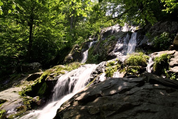
Virginia has 30 National Park Service units, such as Great Falls Park and the Appalachian Trail, and one national park, the Shenandoah National Park. Shenandoah was established in 1935. Almost 40% of the park's area (79,579 acres/322 km2) has been designated as wilderness under the National Wilderness Preservation System. Parkways, such as the George Washington Memorial Parkway and the Blue Ridge Parkway, which encompasses the scenic Skyline Drive, are among the most visited national park service sites nationwide.
Additionally, there are 34 Virginia state parks and 17 state forests, run by the Department of Conservation and Recreation and the Department of Forestry. The Chesapeake Bay, while not a national park, is protected by both state and federal legislation, and the jointly run Chesapeake Bay Program which conducts restoration on the bay and its watershed. The Great Dismal Swamp National Wildlife Refuge extends into North Carolina. Several open-air museums and battlefields are located in the state, such as Colonial Williamsburg, Richmond National Battlefield, and Fredericksburg and Spotsylvania National Military Park.
As of March 26, 2010, there were 31 Superfund sites in Virginia on the National Priorities List, as designated under the Comprehensive Environmental Response, Compensation, and Liability Act (CERCLA) environmental law. No additional sites are currently proposed for entry on the list. Four sites have been cleaned up and removed from the list.