
- elevation 2,240 ft (683 m) Basin area 490,601 km² Mouths Mississippi River, Cairo | - elevation 880 ft (268 m) Length 1,579 km Cities Pittsburgh, Pennsylvania | |
 | ||
- left Little Kanawha River, Kanawha River, Little Sandy River, Big Sandy River, Licking River, Kentucky River, Green River, Cumberland River, Tennessee River - right Beaver River, Little Muskingum River, Muskingum River, Little Hocking River, Hocking River, Shade River, Scioto River, Little Miami River, Great Miami River, Wabash River - location Allegany Township, Potter County, Pennsylvania - location Fairmont, West Virginia Sources Monongahela River, Allegheny River Tributaries Allegheny River, Tennessee River, Cumberland River Similar Monongahela River, Wabash River, Tennessee River, John A Roebling Suspensi, Belle of Louisville | ||
Report ohio river most polluted u s body of water for 7th year straight
The Ohio River, which streams westward from Pittsburgh, Pennsylvania, to Cairo, Illinois, is the largest tributary, by volume, of the Mississippi River in the United States. At the confluence, the Ohio is considerably bigger than the Mississippi (Ohio at Cairo: 281,500 cu ft/s (7,960 m3/s); Mississippi at Thebes: 208,200 cu ft/s (5,897 m3/s)) and, thus, is hydrologically the main stream of the whole river system, including the Allegheny River further upstream.
Contents
- Report ohio river most polluted u s body of water for 7th year straight
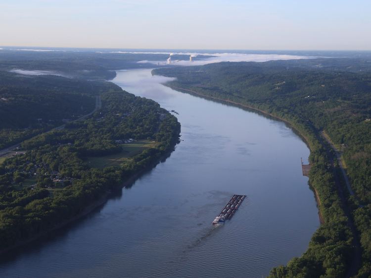
- Map of Ohio River United States
- Dupont knowingly poured c8 cancer poison into the ohio river and turned a blind eye
- Geography and hydrographyEdit
- Drainage basinEdit
- GeologyEdit
- Upper Ohio RiverEdit
- Middle Ohio RiverEdit
- HistoryEdit
- PollutionEdit
- River depthEdit
- Cities and towns along the riverEdit
- References
Map of Ohio River, United States
The 981-mile (1,579 km) river flows through or along the border of six states, and its drainage basin includes parts of 15 states. Through its largest tributary, the Tennessee River, the basin includes many of the states of the southeastern U.S. It is the source of drinking water for three million people.
It is named in Iroquoian or Seneca: Ohi:yó, lit. "Good River" or Shawnee: Pelewathiipi and Spelewathiipi. The river had great significance in the history of the Native Americans, as numerous civilizations formed along its valley. For thousands of years, Native Americans used the river as a major transportation and trading route. Its waters connected communities. In the five centuries before European conquest, the Mississippian culture built numerous regional chiefdoms and major earthwork mounds in the Ohio Valley, such as Angel Mounds near Evansville, Indiana, as well as in the Mississippi Valley and the Southeast. The Osage, Omaha, Ponca and Kaw lived in the Ohio Valley, but under pressure from the Iroquois to the northeast, migrated west of the Mississippi River to Missouri, Arkansas and Oklahoma in the 17th century.
In 1669, René-Robert Cavelier, Sieur de La Salle led a French expedition to the Ohio River, becoming the first Europeans to see it. After European-American settlement, the river served as a border between present-day Kentucky and Indian Territories. It was a primary transportation route for pioneers during the westward expansion of the early U.S. In his Notes on the State of Virginia published in 1781–82, Thomas Jefferson stated: "The Ohio is the most beautiful river on earth. Its current gentle, waters clear, and bosom smooth and unbroken by rocks and rapids, a single instance only excepted."
During the 19th century, the river was the southern boundary of the Northwest Territory. It is sometimes considered as the western extension of the Mason–Dixon Line that divided Pennsylvania from Maryland, and thus part of the border between free and slave territory, and between the Northern and Southern United States or Upper South. Where the river was narrow, it was the way to freedom for thousands of slaves escaping to the North, many helped by free blacks and whites of the Underground Railroad resistance movement.
The Ohio River is a climatic transition area, as its water runs along the periphery of the humid subtropical and humid continental climate areas. It is inhabited by fauna and flora of both climates. In winter, it regularly freezes over at Pittsburgh but rarely further south toward Cincinnati and Louisville. At Paducah, Kentucky, in the south, near the Ohio's confluence with the Mississippi, it is ice-free year-round. Paducah was founded there because it is the northernmost ice-free reach of the Ohio.
Dupont knowingly poured c8 cancer poison into the ohio river and turned a blind eye
Geography and hydrographyEdit
The Ohio River is formed by the confluence of the Allegheny and Monongahela rivers at Point State Park in Pittsburgh, Pennsylvania. From there, it flows northwest through Allegheny and Beaver counties, before making an abrupt turn to the south-southwest at the West Virginia–Ohio–Pennsylvania triple-state line (near East Liverpool, Ohio; Chester, West Virginia; and Midland, Pennsylvania). From there, it forms the border between West Virginia and Ohio, upstream of Wheeling, West Virginia.
The river then follows a roughly southwest and then west-northwest course until Cincinnati, before bending to a west-southwest course for most of its length. The course forms the northern borders of West Virginia and Kentucky; and the southern borders of Ohio, Indiana and Illinois, until it joins the Mississippi River near the city of Cairo, Illinois.
Major tributaries of the river, indicated by the location of the mouths, include:
Drainage basinEdit
The Ohio's drainage basin covers 189,422 square miles (490,600 km2), encompassing the easternmost regions of the Mississippi Basin. The Ohio drains parts of 15 states in four regions.
GeologyEdit
From a geological standpoint, the Ohio River is young. The river formed on a piecemeal basis beginning between 2.5 and 3 million years ago. The earliest ice ages occurred at this time and dammed portions of north-flowing rivers. The Teays River was the largest of these rivers. The modern Ohio River flows within segments of the ancient Teays. The ancient rivers were rearranged or consumed by glaciers and lakes.
Upper Ohio RiverEdit
The upper Ohio River formed when one of the glacial lakes overflowed into a south-flowing tributary of the Teays River. Prior to that event, the north-flowing Steubenville River (no longer in existence) ended between New Martinsville and Paden City, West Virginia. Likewise, the south-flowing Marietta River (no longer in existence) ended between the present-day cities. The overflowing lake carved through the separating hill and connected the rivers.
The resulting floodwaters enlarged the small Marietta valley to a size more typical of a large river. The new large river subsequently drained glacial lakes and melting glaciers at the end of the Ice Age. The valley grew during and following the ice age.
Many small rivers were altered or abandoned after the upper Ohio River formed. Valleys of some abandoned rivers can still be seen on satellite and aerial images of the hills of Ohio and West Virginia between Marietta, Ohio, and Huntington, West Virginia. As testimony to the major changes that occurred, such valleys are found on hilltops.
Middle Ohio RiverEdit
The middle Ohio River formed in a manner similar to formation of the upper Ohio River. A north-flowing river was temporarily dammed southwest of present-day Louisville, creating a large lake until the dam burst. A new route was carved to the Mississippi. Eventually the upper and middle sections combined to form what is essentially the modern Ohio River.
HistoryEdit
Pre-Columbian inhabitants of eastern North America considered the Ohio part of a single river continuing on through the lower Mississippi. The river's name comes from the Seneca (Iroquoian) Ohiːyo', a proper name derived from ohiːyoːh, meaning "good river". The combined Allegheny-Ohio river is 1,310 miles (2,110 km) long and carries the largest volume of water of any tributary of the Mississippi. The Indians and early explorers and settlers of the region also often considered the Allegheny to be part of the Ohio. The forks (the confluence of the Allegheny and Monongahela rivers at what is now Pittsburgh) was considered a strategic military location.
French fur traders operated in the area, and France built forts along the Allegheny River. In 1669, René-Robert Cavelier, Sieur de La Salle, led an expedition of French traders who became the first Europeans to see the river. He traveled from Canada and entered the headwaters of the Ohio, traveling as far as the Falls of Ohio at present-day Louisville before turning back. He returned to explore the river again in other expeditions. An Italian cartographer traveling with him created the first map of the Ohio River. La Salle claimed the Ohio Valley for France.
In 1749, Great Britain established the Ohio Company to settle and trade in the area. Exploration of the territory and trade with the Indians in the region near the Forks by British colonials from Pennsylvania and Virginia – both of which claimed the territory – led to conflict with the French. In 1763, following the Seven Years' War, France ceded the area to Britain.
The 1768 Treaty of Fort Stanwix opened Kentucky to colonial settlement and established the Ohio River as a southern boundary for American Indian territory. In 1774, the Quebec Act restored the land east of the Mississippi River and north of the Ohio River to Quebec, in effect making the Ohio the southern boundary of Canada. This appeased the Canadien British subjects but angered the Thirteen Colonies. Lord Dunmore's War south of the Ohio river also contributed to giving the land north to Quebec to stop further encroachment of the British colonials on native land. During the American Revolution, in 1776 the British military engineer John Montrésor created a map of the river showing the strategic location of Fort Pitt, including specific navigational information about the Ohio River's rapids and tributaries in that area. However, the Treaty of Paris (1783) gave the entire Ohio Valley to the United States.
The economic connection of the Ohio Country to the East was significantly increased in 1818 when the National Road being built westward from Cumberland, Maryland reached Wheeling, Virginia (now West Virginia), providing an easier overland connection from the Potomac River to the Ohio River.
Louisville was founded at the only major natural navigational barrier on the river, the Falls of the Ohio. The Falls were a series of rapids where the river dropped 26 feet (7.9 m) in a stretch of about 2 miles (3.2 km). In this area, the river flowed over hard, fossil-rich beds of limestone. The first locks on the river – the Louisville and Portland Canal – were built to circumnavigate the falls between 1825 and 1830. Fears that Louisville's transshipment industry would collapse proved ill-founded: the increasing size of steamships and barges on the river meant that the outdated locks could only service the smallest vessels until well after the Civil War. The U.S. Army Corps of Engineers improvements were expanded again in the 1960s, forming the present-day McAlpine Locks and Dam.
Because the Ohio River flowed westward, it became a convenient means of westward movement by pioneers traveling from western Pennsylvania. After reaching the mouth of the Ohio, settlers would travel north on the Mississippi River to St. Louis, Missouri. There, some continued on up the Missouri River, some up the Mississippi, and some further west over land routes. In the early 19th century, river pirates such as Samuel Mason, operating out of Cave-In-Rock, Illinois, waylaid travelers on their way down the river. They killed travelers, stealing their goods and scuttling their boats. The folktales about Mike Fink recall the keelboats used for commerce in the early days of European settlement. The Ohio River boatmen were the inspiration for performer Dan Emmett, who in 1843 wrote the song "The Boatman's Dance".
Trading boats and ships traveled south on the Mississippi to New Orleans, and sometimes beyond to the Gulf of Mexico and other ports in the Americas and Europe. This provided a much-needed export route for goods from the west, since the trek east over the Appalachian Mountains was long and arduous. The need for access to the port of New Orleans by settlers in the Ohio Valley led to the Louisiana Purchase in 1803.
Because the river is the southern border of Ohio, Indiana, and Illinois, it was part of the border between free states and slave states in the years before the American Civil War. The expression "sold down the river" originated as a lament of Upper South slaves, especially from Kentucky, who were shipped via the Ohio and Mississippi to cotton and sugar plantations in the Deep South. Before and during the Civil War, the Ohio River was called the "River Jordan" by slaves crossing it to escape to freedom in the North via the Underground Railroad. More escaping slaves, estimated in the thousands, made their perilous journey north to freedom across the Ohio River than anywhere else across the north-south frontier. Harriet Beecher Stowe's Uncle Tom's Cabin, the bestselling novel that fueled abolitionist work, was the best known of the anti-slavery novels that portrayed such escapes across the Ohio. The times have been expressed by 20th-century novelists as well, such as the Nobel Prize-winning Toni Morrison, whose novel Beloved was adapted as a film of the same name. She also composed the libretto for the opera Margaret Garner (2005), based on the life and trial of an enslaved woman who escaped with her family across the river.
The Ohio River is considered to separate Midwestern Great Lakes states from the Upper South states, which were historically border states in the Civil War.
The colonial charter for Virginia defined its territory as extending to the north shore of the Ohio, so that the riverbed was "owned" by Virginia. Where the river serves as a boundary between states today, Congress designated the entire river to belong to the states on the east and south, i.e., West Virginia and Kentucky at the time of admission to the Union, that were divided from Virginia. Thus Wheeling Island, the largest inhabited island in the Ohio River, belongs to West Virginia, although it is closer to the Ohio shore than to the West Virginia shore. Kentucky brought suit against Indiana in the early 1980s because of the building of the Marble Hill nuclear power plant in Indiana, which would have discharged its waste water into the river.
The U.S. Supreme Court held that Kentucky's jurisdiction (and, implicitly, that of West Virginia) extended only to the low-water mark of 1793 (important because the river has been extensively dammed for navigation, so that the present river bank is north of the old low-water mark.) Similarly, in the 1990s, Kentucky challenged Illinois' right to collect taxes on a riverboat casino docked in Metropolis, citing its own control of the entire river. A private casino riverboat that docked in Evansville, Indiana, on the Ohio River opened about the same time. Although such boats cruised on the Ohio River in an oval pattern up and down, the state of Kentucky soon protested. Other states had to limit their cruises to going forwards, then reversing and going backwards on the Indiana shore only. Since 2002, Indiana has allowed its riverboat casinos to be permanently docked.
In the early 1980s, the Falls of the Ohio National Wildlife Conservation Area was established at Clarksville, Indiana.
PollutionEdit
The Ohio River as a whole is ranked as the most polluted river in the US based on 2009 and 2010 data although the more industrial and regional Ohio tributary, Monongahela River, ranked behind 16 other American rivers for pollution at number 17.
The Ohio River was polluted with hundreds of thousands of pounds of PFOA by DuPont chemical company, from an outflow pipe, for several decades beginning in the 1950s.
River depthEdit
The Ohio River is a naturally shallow river that was artificially deepened by a series of dams. The natural depth of the river varied from about 3 to 20 feet (0.91 to 6.10 m). The dams raise the water level and have turned the river largely into a series of reservoirs, eliminating shallow stretches and allowing for commercial navigation. From its origin to Cincinnati, the average depth is approximately 15 feet (5 m). The largest immediate drop in water level is below the McAlpine Locks and Dam at the Falls of the Ohio at Louisville, Kentucky, where flood stage is reached when the water reaches 23 feet (7 m) on the lower gauge. However, the river's deepest point is 168 feet (51 m) on the western side of Louisville, Kentucky. From Louisville, the river loses depth very gradually until its confluence with the Mississippi at Cairo, Illinois, where it has an approximate depth of 19 feet (6 m).
Water levels for the Ohio River from Smithland Lock and Dam upstream to Pittsburgh are predicted daily by the National Oceanic and Atmospheric Administration's Ohio River Forecast Center. The water depth predictions are relative to each local flood plain based upon predicted rainfall in the Ohio River basin in five reports as follows:
The water levels for the Ohio River from Smithland Lock and Dam to Cairo, Illinois, are predicted by the National Oceanic and Atmospheric Administration's Lower Mississippi River Forecast Center.
Cities and towns along the riverEdit
Cities along the Ohio River include: