
Visitors 1,437,341 (in 2016) | Established December 26, 1935 | |
 | ||
Area 199,173 acres (311.208 sq mi; 80,602 ha; 806.02 km) | ||
Shenandoah National Park /ˈʃɛnənˌdoʊə/ (often /ˈʃænənˌdoʊə/) is a national park which encompasses part of the Blue Ridge Mountains in the U.S. state of Virginia. The park is long and narrow, with the broad Shenandoah River and Valley on the west side, and the rolling hills of the Virginia Piedmont on the east. Although the scenic Skyline Drive is likely the most prominent feature of the park, almost 40% of the land area 79,579 acres (124.342 sq mi; 32,204 ha; 322.04 km2) has been designated as wilderness and is protected as part of the National Wilderness Preservation System. The highest peak is Hawksbill Mountain at 4,051 feet (1,235 m).
Contents
- GeographyEdit
- GeologyEdit
- Creation of the parkEdit
- Segregation and desegregationEdit
- Skyline DriveEdit
- Backcountry campingEdit
- Campgrounds and cabinsEdit
- LodgesEdit
- WaterfallsEdit
- Dark Hollow Falls TrailEdit
- Stony Man TrailEdit
- EcologyEdit
- WildlifeEdit
- Ranger programsEdit
- Artist in Residence ProgramEdit
- References
GeographyEdit
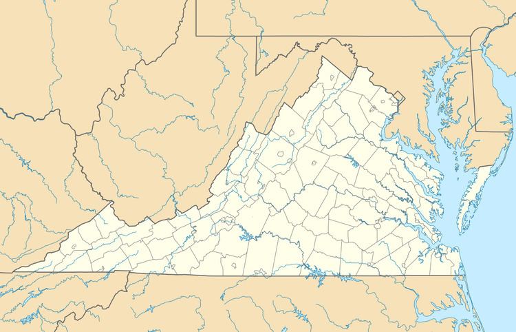
The park encompasses parts of eight counties. On the west side of Skyline Drive they are, from northeast to southwest, Warren, Page, Rockingham, and Augusta counties. On the east side of Skyline Drive they are Rappahannock, Madison, Greene, and Albemarle counties. The park stretches for 105 miles (169 km) along Skyline Drive from near the town of Front Royal in the northeast to near the city of Waynesboro in the southwest. The park headquarters are located in Luray.
GeologyEdit
Shenandoah National Park lies along the Blue Ridge Mountains in north-central Virginia. These mountains form a distinct highland rising to elevations above 4,000 feet (1,200 m). Local topographic relief between the Blue Ridge Mountains and Shenandoah Valley exceeds 3,000 feet (910 m) at some locations. The crest of the range divides the Shenandoah River drainage basin, part of the Potomac River drainage, on the west side, from the James and Rappahannock River drainage basins on the east side.
Some of the rocks exposed in the park date to over one billion years in age, making them among the oldest in Virginia. Bedrock in the park includes Grenville-age granitic basement rocks (1.2–1.0 billion years old) and a cover sequence of metamorphosed Neoproterozoic (570–550 million years old) sedimentary and volcanic rocks of the Swift Run and Catoctin formations. Columns of Catoctin Formation metamorphosed basalt can be seen at Compton Peak. Clastic rocks of the Chilhowee Group are of early Cambrian age (542–520 million years old). Quaternary surficial deposits are common and cover much of the bedrock throughout the park.
The park is located along the western part of the Blue Ridge anticlinorium, a regional-scale Paleozoic structure at the eastern margin of the Appalachian fold and thrust belt. Rocks within the park were folded, faulted, distorted, and metamorphosed during the late Paleozoic Alleghanian orogeny (325 to 260 million years ago). The rugged topography of Blue Ridge Mountains is a result of differential erosion during the Cenozoic, although some post-Paleozoic tectonic activity occurred in the region.
Creation of the parkEdit
Shenandoah was authorized in 1926 and fully established on December 26, 1935. Prior to being a park, much of the area was farmland and there are still remnants of old farms in several places. The Commonwealth of Virginia slowly acquired the land through eminent domain and then gave it to the U.S. federal government provided it would be designated a national park.
In the creation of the park [the Skyline Drive right-of-way was purchased from owners without condemnation], a number of families and entire communities had to vacate portions of the Blue Ridge Mountains. At least 500 homes in eight Virginia counties were affected. Most of the families came from Madison County, Page County, and Rappahannock County. Nearly 90% of the inhabitants worked the land for a living. Although a terrible drought in 1930 affected many nearby apple orchards (where many of the area's residents worked), some people vehemently opposed leaving.
Eventually, a compromise was reached: some families were allowed to stay after their properties were acquired. They lived in the park until they died. The last one was Annie Lee Bradley Shenk; she died in 1979 at age 92. Most others left quietly. According to the Virginia Historical Society, 85-year-old Hezekiah Lam explained, "I ain't so crazy about leavin' these hills but I never believed in bein' ag'in (against) the Government. I signed everythin' they asked me."
Segregation and desegregationEdit
In the early 1930s, the National Park Service began planning the park facilities and envisioned separate provisions for blacks and whites. At that time, in Jim Crow Virginia, racial segregation was the order of the day. In its transfer of the parkland to the federal government, Virginia initially attempted to ban African Americans entirely from the park, but settled for enforcing its segregation laws in the park's facilities.
By the 1930s, there were several concessions operated by private firms within the area that would become the park, some going back to the late 19th century. These early private facilities at Skyland Resort, Panorama Resort, and Swift Run Gap were operated only for whites. By 1937, the Park Service accepted a bid from Virginia Sky-Line Company to take over the existing facilities and add new lodges, cabins, and other amenities, including Big Meadows Lodge. Under their plan, all the sites in the parks, save one, were for "whites only". Their plan included a separate facility for African Americans at Lewis Mountain—a picnic ground, a smaller lodge, cabins and a campground. The site opened in 1939, and it was substantially inferior to the other park facilities. By then, however, the Interior Department was increasingly anxious to eliminate segregation from all parks. Pinnacles picnic ground was selected to be the initial integrated site in the Shenandoah, but Virginia Sky-Line Company continued to balk, and distributed maps showing Lewis Mountain as the only site for African Americans. During World War II, concessions closed and park usage plunged. But once the War ended, in December 1945, the NPS mandated that all concessions in all national parks were to be desegregated. In October 1947 the dining rooms of Lewis Mountain and Panorama were integrated and by early 1950, the mandate was fully accomplished.
Skyline DriveEdit
The park is best known for Skyline Drive, a 105-mile (169 km) road that runs the entire length of the park along the ridge of the mountains. The drive is particularly popular in the fall when the leaves are changing colors. 101 miles (163 km) of the Appalachian Trail are also in the park. In total, there are over 500 miles (800 km) of trails within the park. Of the trails, one of the most popular is Old Rag Mountain, which offers a thrilling rock scramble and some of the most breathtaking views in Virginia. There is also horseback riding, camping, bicycling, and many waterfalls. The Skyline Drive is the first National Park Service road east of the Mississippi River listed as a National Historic Landmark on the National Register of Historic Places. It is also designated as a National Scenic Byway.
Backcountry campingEdit
Shenandoah National Park offers 196,000 acres (790 km2) of backcountry and wilderness camping. While in the backcountry, campers must use a "Leave No Trace" policy that includes burying excrement and not building campfires. Backcountry campers must also be careful of wildlife such as bears and venomous snakes. Campers must suspend their food from trees while not in use in "bear bags" or park-approved bear canisters to prevent unintentionally feeding the bears, who then become habituated to humans and their food and therefore dangerous. All animals are protected by federal law.
Campgrounds and cabinsEdit
Most of the campgrounds are open from April to October–November. There are five major campgrounds:
LodgesEdit
There are three lodges/cabins:
Lodges are located at Skyland and Big Meadows. The park's Harry F. Byrd Visitor Center is also located at Big Meadows. Another visitor center is located at Dickey Ridge. Campgrounds are located at Mathews Arm, Big Meadows, Lewis Mountain, and Loft Mountain.
Rapidan Camp, the restored presidential fishing retreat Herbert Hoover built on the Rapidan River in 1929, is accessed by a 4.1-mile (6.6 km) round-trip hike on Mill Prong Trail, which begins on the Skyline Drive at Milam Gap (Mile 52.8). The NPS also offers guided van trips that leave from the Byrd Center at Big Meadows.
Shenandoah National Park is one of the most dog-friendly in the national park system. The campgrounds all allow dogs, and dogs are allowed on almost all of the trails including the Appalachian Trail, if kept on leash (6 feet or shorter).
Streams and rivers in the park are very popular with fly fisherman for native brook trout.
WaterfallsEdit
Many waterfalls are located within the park boundaries. Below is a list of significant falls.
Dark Hollow Falls TrailEdit
Beginning at mile 50.7 of the Skyline Drive near the Byrd Visitor Center, Dark Hollow Falls Trail leads downhill beside a creek called Hogcamp Branch to Dark Hollow Falls, a 70-foot cascade. The distance from the trailhead to the base of the falls is 0.7 mile, although the trail continues beyond that point, crossing the creek and connecting with the Rose River fire road. Various fauna can be viewed along the trail, including occasional sightings of black bear and timber rattlesnake. While the trail is relatively short, parts of it are steep and may prove challenging to some visitors. There is no view from the brink of the falls, and slippery rocks make it inadvisable to leave the trail.
Stony Man TrailEdit
This is one of the most scenic trails in the skyline drive. It ends up at a cliff and offers a beautiful overlook. It is ideal to watch sunset. Pets and horses are not allowed in this trail.
EcologyEdit
The climate of the park, and in turn also its flora and fauna, is largely typical for mountainous regions of the eastern Mid-Atlantic woodland, and indeed a large portion of common species are typical of ecosystems at lower altitudes as well. On southwestern faces of some of the southernmost hillsides pine predominates and there is also the occasional prickly pear cactus which grows naturally. In contrast, some of the northeastern aspects are most likely to have small but dense stands of moisture loving hemlocks and mosses in abundance. Other commonly found plants include oak, hickory, chestnut, maple, tulip poplar, mountain laurel, milkweed, daisies, and many species of ferns. The once predominant American chestnut tree was effectively brought to extinction by a fungus known as the chestnut blight during the 1930s – though the tree continues to grow in the park, it does not reach maturity and dies back before it can reproduce. Various species of oaks superseded the chestnuts and became the dominant tree species. Gypsy moth infestations beginning in the early 1990s began to erode the dominance of the oak forests as the moths would primarily consume the leaves of oak trees. Though the Gypsy moths seem to have abated some, they continue to affect the forest and have destroyed almost 10 percent of the oak groves.
WildlifeEdit
Mammals include black bear, coyote, striped skunk, spotted skunk, raccoon, beaver, river otter, opossum, woodchuck, two species of foxes, white-tailed deer, and eastern cottontail rabbit. Though unsubstantiated, there have been some reported sightings of cougar in remote areas of the park. Over 200 species of birds make their home in the park for at least part of the year. About thirty live in the park year round, including the barred owl, Carolina chickadee, red-tailed hawk, and wild turkey. The peregrine falcon was reintroduced into the park in the mid-1990s and by the end of the 20th century there were numerous nesting pairs in the park.Thirty-two species of fish have been documented in the park, including brook trout, longnose and eastern blacknose dace, and the bluehead chub.
Ranger programsEdit
Park rangers organize several programs from spring to fall. These include ranger-led hikes, as well as discussions of the history, flora, and fauna.
Artist-in-Residence ProgramEdit
In 2014, under the leadership of Superintendent Jim Northup, Shenandoah National Park established an Artist-in-Residence Program that is administered by the Shenandoah National Park Trust, the park's philanthropic partner. Photographer Sandy Long was selected as the park's first artist-in-residence. The results of Long's residency were featured in the photography exhibit "Wild Beauty: The Artful Nature of Shenandoah National Park" held at the The Looking Glass Art Gallery in the historic Hawley Silk Mill, in Hawley, Pennsylvania.