
Population 140 (2001 Census) Post town Dalbeattie Local time Tuesday 3:49 PM | OS grid reference NX838546 Sovereign state United Kingdom Postcode district DG5 Dialling code 01556 | |
 | ||
Weather 11°C, Wind W at 34 km/h, 66% Humidity Lieutenancy areas | ||
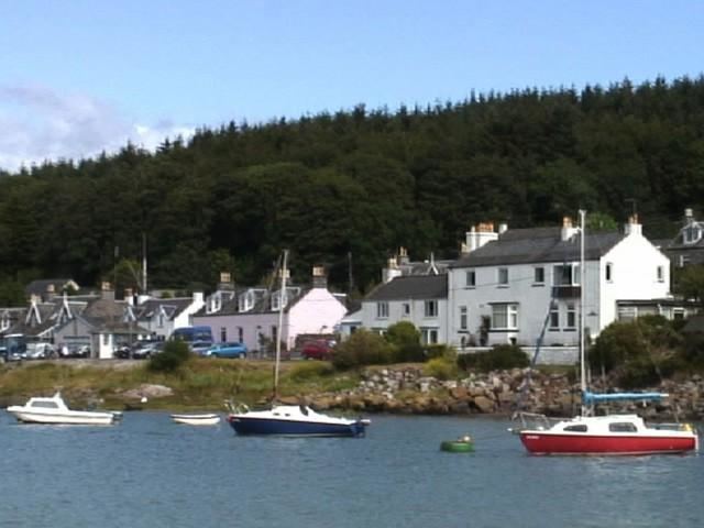
Kippford (otherwise Scaur) is a small village along the Solway coast, in Dumfries and Galloway, Scotland.
Contents
Map of Kippford, Dalbeattie, UK
Geography
Kippford stretches along the banks of the Urr estuary and in places is only one house wide, being hemmed in between the forested Mark hill (locally known as the Muckle) and the sea. Kippford can only be accessed by car from Barnbarroch, passing by Craigieknowes Golf Course and two campsites.
Kippford is also linked to Rockcliffe by a scenic track, known as the Jubilee footpath, which passes parallel to the coast (and the village of Kippford) but at a higher elevation. The path can be used to access Mark hill and the Mote of Mark, a 5th-century hill fort.
Visitors may cross the sands to a small island called Rough Island when the tide allows.
Views from Kippford include the English Lake District coast across the Solway Firth to the South. To the West can be seen Glen Isle and Screel in the background.
Marine Activities
Kippford is a popular sailing village, with many small yachts moored in the tidal estuary of the River Urr, and events organised by the Solway Yacht Club. The RNLI has maintained a station, now fitted with a D class lifeboat, in Kippford for the past 40 years. The lifeboat service share use of the village's public slipway. Kippford was also involved in the shipbuilding industry, albeit on a very small scale. A Chandlers still exists, and sheds can be found behind it which indicate the boat building activities.
History
Between Kippford and Rockcliffe lies the Mote of Mark, a hill fort. Victorian Kippford had interests in the granite quarrying industry, the pier used now by the Solway Yacht Club being a former handling yard for a small railway line running into the hill to the East where a quarry was located.