
OS grid reference NT395045 Mouth River Tweed | Length 60 km Country United Kingdom | |
 | ||
Cities Hawick, Roxburgh, Ancrum, Teviothead, Branxholme, Lanton, Scottish Borders, Broadhaugh, Nisbet, Scottish Borders Bridges Kalemouth Suspension Bridge, Kelso, Teviot Bridge, Ancrum, Old Ancrum Bridge | ||
River teviot flooding near a698
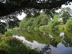
The River Teviot (/ˈtiːvi.ət/ or /ˈtiːvijɪʔ/), or Teviot Water, is a river of the Scottish Borders area of Scotland, and a tributary of the River Tweed.
Contents
Map of River Teviot, United Kingdom
It rises in the western foothills of Comb Hill on the border of Dumfries and Galloway. It flows north-eastwards through Teviotdale and past Teviothead, the Colterscleuch Monument, Broadhaugh, Branxholme and Branxholme Castle.
The Teviot passes through Hawick and Lanton, the Timpendean Tower and the town of Ancrum, Harestanes and Monteviot, Nisbet and Roxburgh, before joining the River Tweed to the southwest of Kelso.
The Borders Abbeys Way keeps close company with the Teviot on its journey to the Tweed.
TributariesEdit
The principal tributaries of the Teviot are the Allan Water which enters its right bank at Newmill, the Borthwick Water which enters its left bank between Branxholme and Hawick, the Slitrig Water which enters via the right bank in Hawick itself, the Ale Water entering via the left bank at Ancrum, the Jed Water on the right bank just downstream and the Kale Water which enters on the right bank between Crailing and Roxburgh.