
Existed: 1934 – present Constructed 1934 | Length 474.9 km | |
 | ||
Interstate 80 westbound california state route 173 to california state route 49
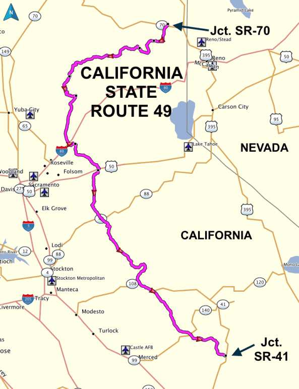
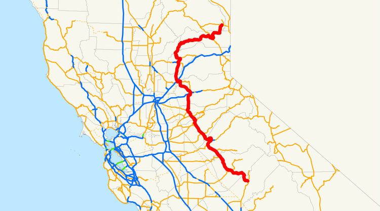
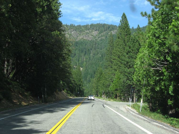
State Route 49 (SR 49) is a north–south state highway in the U.S. state of California that passes through many historic mining communities of the 1849 California gold rush. Highway 49 is numbered after the "49ers", the waves of immigrants who swept into the area looking for gold, and a portion of it is known as the Gold Country Highway. This roadway begins at Oakhurst, Madera County, in the Sierra Nevada, where it diverges from State Route 41. It continues in a generally northwest direction, weaving through the communities of Goldside and Ahwahnee, before crossing into Mariposa County. State Route 49 then continues northward through the counties of Tuolumne, Calaveras, Amador, El Dorado, Placer, Nevada, Yuba, Sierra, and Plumas, where it reaches its northern terminus at State Route 70, in Vinton.
Contents
- Interstate 80 westbound california state route 173 to california state route 49
- Route description
- Major intersections
- References
Route description
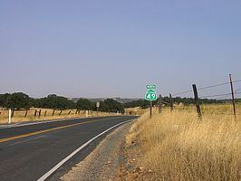
SR 49 is part of the California Freeway and Expressway System and is eligible for the State Scenic Highway System. It is known as the Golden Chain Highway for the entire route. SR 49 is known as the Golden Center Freeway from Grass Valley to Nevada City, the John C. Begovich Memorial Highway from Jackson to SR 88 (honoring the California legislator and U.S. Marshal), and the Mother Lode Highway from Sonora to Auburn.
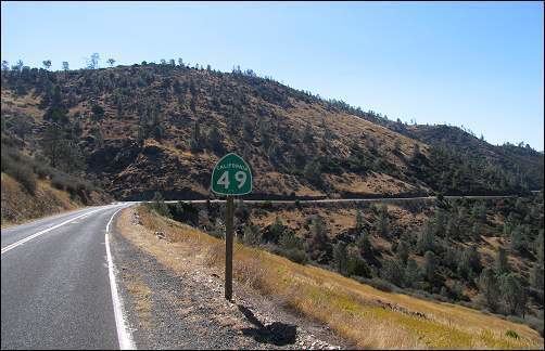
SR 49 starts at an intersection with SR 41 near Oakhurst. The road heads west before turning north before the town of Ahwahnee near the Wassama Roundhouse State Historic Park. SR 49 continues north, passing through Nipinnswassee before entering Mariposa County and the Sierra National Forest. Continuing to the west, SR 49 passes through Mormon Bar before running concurrently with SR 140 briefly through the town of Mariposa. Near the town of Mount Bullion, SR 49 passes by Mariposa-Yosemite Airport before turning northwest and going through Bear Valley and the intersection with CR J16. The highway passes by the southern edge of Lake McClure and intersects SR 132 in Coulterville before passing into Tuolumne County.
SR 49 continues north through the town of Moccasin, where SR 120 runs concurrently for several miles to the town of Chinese Camp. SR 49 then turns northeast and runs concurrently with SR 108, intersecting CR E5, into the city of Sonora. SR 49 splits from SR 108 and enters downtown Sonora as Stockton Street, turning north onto Washington Street before leaving the Sonora city limits. SR 49 intersects the north end of CR E5 before passing through Tuttletown and crossing into Calaveras County at the bridge over the Stanislaus River.
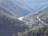
SR 49 passes by Robinson's Ferry, a ferry across the Stanislaus River established in 1848. Next is the Birthplace of Archie Stevenot, who helped found the California State Chamber of Commerce and was officially named "Mr. Mother Lode" by the California legislature. SR 49 then enters Carson Hill, where the largest gold nugget in California (195 pounds troy) was found. Passing by New Melones Lake, SR 49 briefly runs concurrently with SR 4 in the city of Angels Camp, which lies in one of the richest quartz mining sections of the Mother Lode and is home of "The Celebrated Jumping Frog of Calaveras County".
SR 49 continues through Altaville, which was an important foundry town. Fourth Crossing was an important stagecoach and freighting depot that served the southern mines until after the turn of the 20th century. The highway continues into San Andreas, where SR 12 terminates. This is where Charles Bolles, also known as "Black Bart", was tried and sentenced. Chili Gulch is the site of the Chilean War. SR 49 continues into Mokelumne Hill, where it intersects with SR 26; Mokelumne Hill was the richest placer mining section of Calaveras County and one of the principal mining towns of California in its heyday.
SR 49 then passes through Big Bar, which is located on the county line between Amador County and Calaveras County. The Mokelumne River was mined at this point in 1848. Established in 1849, the "Whale Boat Ferry" operated until the first bridge was built, about 1852. The Butte Store is the only structure remaining of Butte City, prosperous mining town of the 1850s. Argonaut and Kennedy Mines were two of the highest-yielding gold mines in the state. SR 49 runs concurrently with SR 88 briefly through the town of Martell before intersecting the eastern terminus of SR 104 and passing through first the city of Sutter Creek and then Drytown. Drytown is the oldest town in Amador County and the first in the county in which gold was discovered.
SR 49 then intersects the eastern end of SR 16 before passing through the city of Plymouth. The highway continues through Enterprise before crossing into El Dorado County and passing through the towns of Nashville, El Dorado, and Diamond Springs (the latter two as Pleasant Valley Road) before entering Placerville. SR 49 traverses downtown on Pacific Street and Main Street before continuing onto Spring Street, where it intersects the US 50 expressway at-grade before continuing north as Georgetown Road.
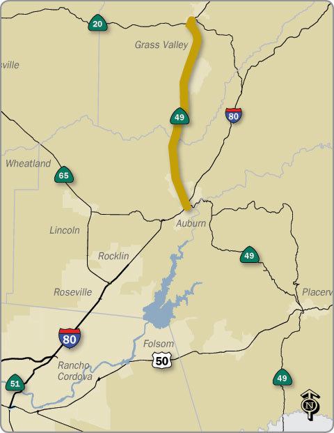
As it leaves the Placerville city limits, SR 49 intersects the southern terminus of SR 193 before continuing northwest as Coloma Road into the town of Coloma, where gold was first discovered in 1848, sparking the gold rush. It is home of the Marshall Gold Discovery State Historic Park. The highway continues through Lotus before turning north at Pilot Hill and intersecting the northern terminus of SR 193 at Cool. SR 49 continues through the Auburn State Recreation Area before crossing into Placer County and entering the city of Auburn as High Street. SR 49 continues onto Lincoln Way before making a turn north and interchanging with I-80. SR 49 continues almost due north out of the Auburn city limits.
SR 49 continues north, crossing into Nevada County and passing through Higgins Corner and Forest Springs. SR 49 becomes a freeway and enters the city of Grass Valley, where it runs concurrently with SR 20 and interchanges with the northern end of SR 174. Empire Mine in Grass Valley was the richest hard-rock mine in California in its mining history of 106 years (1850–1956). SR 49 and SR 20 continue into Nevada City, where SR 49 exits from the freeway and heads due west out of the Nevada City city limits.
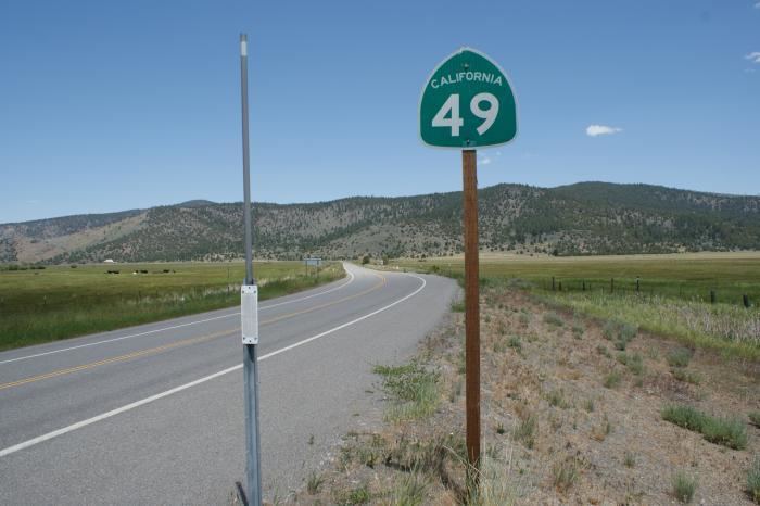
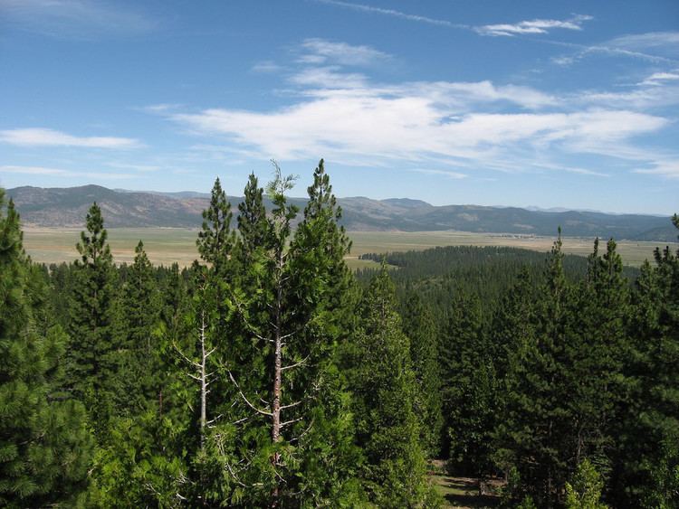
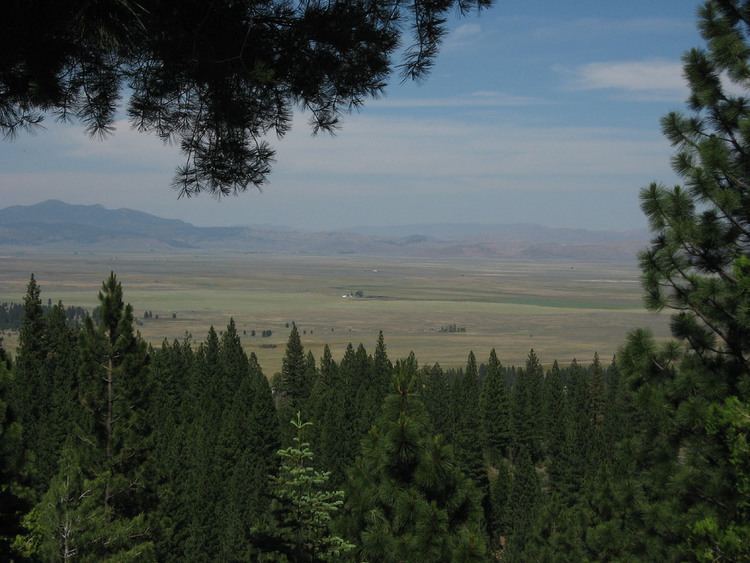
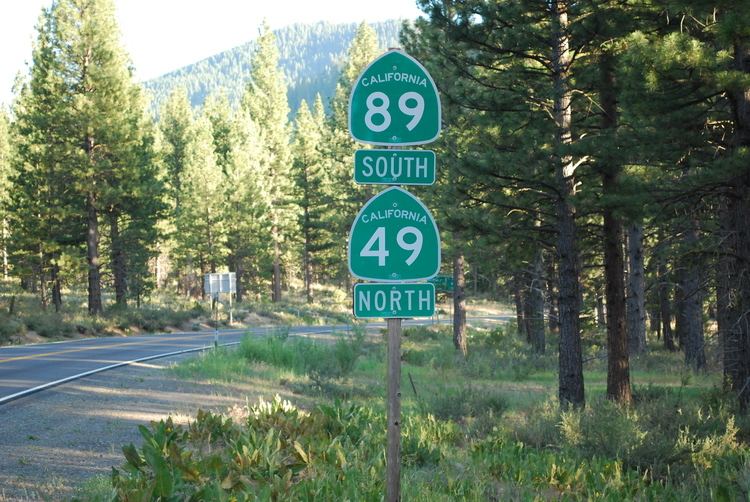
SR 49 continues through the towns of Sweetland and North San Juan, where it crosses into Yuba County and enters Tahoe National Forest. The route goes through Log Cabin and Camptonville. Camptonville is a gold rush town where the Pelton wheel was invented and is a Historic Civil Engineering Landmark. SR 49 then crosses into Sierra County, where it passes through Goodyears Bar, Downieville, and Sierra City on its forest journey. After passing near Kentucky Mine Historic Park, SR 49 goes through Bassets and Haskell Creek before running concurrently with SR 89 briefly through Sattley and Sierraville. SR 49 then leaves the forest as Loyalton Road, passing through the city of Loyalton and intersecting CR A24 before crossing into Plumas County as Vinton Loyalton Road, where SR 49 ends at SR 70 in the town of Vinton.
Major intersections
Except where prefixed with a letter, postmiles were measured on the road as it was in 1964, based on the alignment that existed at the time, and do not necessarily reflect current mileage. R reflects a realignment in the route since then, M indicates a second realignment, L refers an overlap due to a correction or change, and T indicates postmiles classified as temporary (for a full list of prefixes, see the list of postmile definitions). Segments that remain unconstructed or have been relinquished to local control may be omitted. The numbers reset at county lines; the start and end postmiles in each county are given in the county column.