
Founded 1893 Unemployment rate 10.4% (Apr 2015) | Incorporated 1893 Area 5,576 km² Population 152,389 (2013) | |
 | ||
Destinations Yosemite National Park, Sequoia National Park, Kings Canyon National, Bass Lake - California, Madera | ||
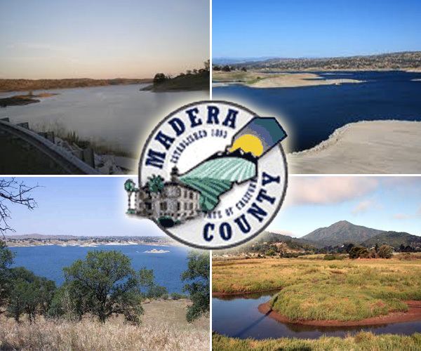
Family adventure near yosemite in madera county california
Madera County, officially the County of Madera, is a county at the geographic center of the U.S. state of California. As of the 2010 census, the population was 150,865. The county seat is Madera.
Contents
- Family adventure near yosemite in madera county california
- Map of Madera County CA USA
- History
- Geography
- National protected areas
- 2010
- 2000
- Education
- Overview
- Crime
- Attractions
- Major highways
- Other roads
- Public transportation
- Airports
- Cities
- Unincorporated communities
- Population ranking
- References
Map of Madera County, CA, USA
Madera County comprises the Madera, CA Metropolitan Statistical Area, which is included in the Fresno-Madera, CA Combined Statistical Area. It is located in the eastern San Joaquin Valley and the central Sierra Nevada.
The southeasternmost part of Yosemite National Park is located in the county's northeast.
History
Madera County was formed in 1893 from the southern part of Mariposa County during a special election held on May 16, 1893. Citizens residing in the area that was to become Madera County voted 1,179 to 358 for establishment of the new county.
Madera is the Spanish term for wood. The county derives its name from the town of Madera, named when the California Lumber Company built a log flume to carry lumber to the Central Pacific Railroad there in 1876.
The Madera County Sheriff's Department employed the first woman in California to die in the line of duty as a sworn law enforcement officer—Tulare native Lucille Helm (1914-1959). For 15 years, the Madera housewife and mother of four worked on call as a "matron" assisting with female transfers.
Geography
According to the U.S. Census Bureau, the county has a total area of 2,153 square miles (5,580 km2), of which 2,137 square miles (5,530 km2) is land and 16 square miles (41 km2) (0.8%) is water.
Madera County is part of the Madera AVA wine region.
National protected areas
2010
The 2010 United States Census reported that Madera County had a population of 150,865. The racial makeup of Madera County was 94,456 (62.6%) White, 5,629 (3.7%) African American, 4,136 (2.7%) Native American, 2,802 (1.9%) Asian, 162 (0.1%) Pacific Islander, 37,380 (24.8%) from other races, and 6,300 (4.2%) from two or more races. Hispanic or Latino of any race were 80,992 persons (53.7%).
2000
As of the census of 2000, there are 123,109 people in the county, organized into 36,155 households, and 28,598 families. The population density is 58 people per square mile (22/km²). There are 40,387 housing units at an average density of 19 per square mile (7/km²). The racial makeup of the county is 62.2% White, 4.1% Black or African American, 2.6% Native American, 1.3% Asian, 0.2% Pacific Islander, 24.4% from other races, and 5.2% from two or more races. 44.3% of the population are Hispanic or Latino of any race. 8.0% were of German, 5.9% English, 5.4% American and 5.3% Irish ancestry according to Census 2000. 63.6% spoke English and 33.7% Spanish as their first language.
There are 36,155 households out of which 40.2% have children under the age of 18 living with them, 60.9% are married couples living together, 12.2% have a female householder with no husband present, and 20.9% are non-families. 16.5% of all households are made up of individuals and 7.7% have someone living alone who is 65 years of age or older. The average household size is 3.18 and the average family size is 3.52.
In the county, the population is spread out with 29.6% under the age of 18, 9.9% from 18 to 24, 29.1% from 25 to 44, 20.4% from 45 to 64, and 11.0% who are 65 years of age or older. The median age is 33 years. For every 100 females there are 91.8 males. For every 100 females age 18 and over, there are 86.0 males.
The median income for a household in the county is $36,286, and the median income for a family is $39,226. Males have a median income of $33,658 versus $24,415 for females. The per capita income for the county is $14,682. 21.4% of the population and 15.9% of families are below the poverty line. Out of the total population, 28.6% of those under the age of 18 and 9.0% of those 65 and older are living below the poverty line.
Education
Madera County is mostly covered by the State Center Community College District centered on Fresno City College in Fresno. Other districts with terrirtory within Madera County also include the West Hills Community College District and the Merced Community College District.
Overview
Madera is a strongly Republican county in Presidential and congressional elections. The last Democrat to win a majority in the county was Jimmy Carter in 1976.
Madera is split between the 4th and 16th congressional districts, represented by Tom McClintock (R–Elk Grove) and Jim Costa (D–Fresno), respectively.
With respect to the California State Assembly, the county is in the 5th Assembly District, represented by Republican Frank Bigelow.
In the California State Senate, Madera is split between the 8th Senate District, represented by Republican Tom Berryhill, and the 12th Senate District, represented by Republican Anthony Cannella.
On November 4, 2008, Madera County voted 73.4% for Proposition 8, which amended the California Constitution to define marriage as a union between one man and one woman.
The county is one of three counties in California to establish a separate department to deal with corrections pursuant to California Government Code §23013, the Madera County Department of Corrections, along with Napa County and Santa Clara County. The officers receive their powers under 831 and 831.5 of the California Penal Code.
Crime
The following table includes the number of incidents reported and the rate per 1,000 persons for each type of offense.
Attractions
The Chowchilla/Madera County Fairgrounds hosts the Chowchilla Junior Fair, founded in 1946, and the Chowchilla Western Stampede. It also houses the Chowchilla Speedway, a 1/3 mile dirt track, and the Associated Feed Pavilion, a covered arena. The venue hosts numerous horse events and auctions, a Spring Festival barbecue, and other public and private events.
Major highways
Other roads
The eastern side of Madera County, which includes Devil's Postpile National Monument and part of Minaret Summit, is unconnected to the rest of Madera County by road. This only road into this area is Minaret Summit Road which becomes State Route 203 at the Mono County border, connecting this area to Mammoth Lakes. Red's Meadow Road is a further extension of this route.
The gap between Minaret Road (not to be confused with Minaret Summit Road), which runs northeast into the Sierras from North Fork, and the end of the Red's Meadow Road is less than 10 miles, and plans for a highway (or tunnel) connecting the Eastern Sierra and the San Joaquin Valley via Minaret Summit had often been discussed. An area southwest of Minaret Summit was not included in the Wilderness Act of 1964 in order to leave a corridor for this possibility. During his time as Governor of California, Ronald Reagan made a horse packing trip into the area. Afterward he supported conservationists' efforts to prevent this highway. Reagan continued his efforts after being elected President in 1980, and the area was eventually designated wilderness by the California Wilderness Act of 1984.
Public transportation
Airports
Cities
Unincorporated communities
Population ranking
The population ranking of the following table is based on the 2010 census of Madera County.
† county seat