
Country United States Website www.co.tuolumne.ca.us Population 53,874 (2013) | Incorporated February 18, 1850 Area 5,890 km² | |
 | ||
Rivers Tuolumne River, North Fork Stanislaus River, Clark Fork Points of interest Yosemite National Park, Columbia State Historic P, Railtown 1897 State Historic P, Table Mountain, Hetch Hetchy Destinations Yosemite National Park, Sonora, Pacific Crest Trail, Calaveras Big Trees State Park, Groveland - California | ||
California ranch oak tree meadows ranch tuolumne county california
Tuolumne County (/tuːˈɒləmiː/ "To All o' Me", with a silent N), officially the County of Tuolumne, is a county in the U.S. state of California. As of the 2010 census, the population was 55,365. The county seat and only incorporated city is Sonora.
Contents
- California ranch oak tree meadows ranch tuolumne county california
- Map of Tuolumne County CA USA
- Etymology
- History
- Geography
- Special Districts
- Adjacent counties
- National protected areas
- Area of Critical Environmental Concern ACEC
- Major highways
- Public transportation
- Airports
- Crime
- 2010
- 2000
- Overview
- City
- Population ranking
- References
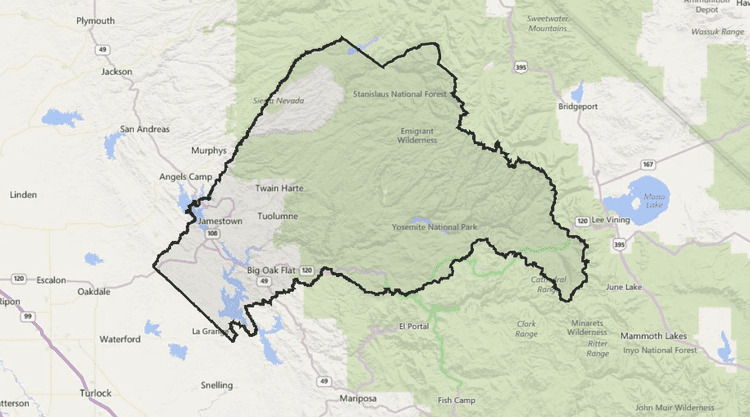
Map of Tuolumne County, CA, USA
Tuolumne County comprises the Sonora, CA Micropolitan Statistical Area. The county is in the Sierra Nevada region.
The northern half of Yosemite National Park is located in the eastern part of the county.
Etymology
The name Tuolumne is of Native American origin and has been given different meanings, such as Many Stone Houses, The Land of Mountain Lions and, Straight Up Steep, the latter an interpretation of William Fuller, a native Chief. Mariano Vallejo, in his report to the first California State Legislature, said that the word is "a corruption of the Indian word talmalamne which signifies 'cluster of stone wigwams.'" The name may mean "people who dwell in stone houses," i.e., in caves.
History
Tuolumne County is one of the original counties of California, created in 1850 at the time of statehood. Prior to statehood, it had been referred to as Oro County. Parts of the county were given to Stanislaus County in 1854 and to Alpine County in 1864.
Geography
According to the U.S. Census Bureau, the county has a total area of 2,274 square miles (5,890 km2), of which 2,221 square miles (5,750 km2) is land and 54 square miles (140 km2) (2.4%) is water. A California Department of Forestry document reports Tuolumne County's 1,030,812 acres (4,171.55 km2) include federal lands such as Yosemite National Park, Stanislaus National Forest, Bureau of Land Management lands, and Indian reservations. Notable landforms in the county include Table Mountain.
Special Districts
Special districts in Tuolumne County include:
Adjacent counties
National protected areas
Area of Critical Environmental Concern (ACEC)
Major highways
Public transportation
Tuolumne County Transit bus routes radiate from Sonora to serve most of the county. In Columbia, a connection can be made to Calaveras County Transit. Yosemite Area Regional Transportation System (YARTS) makes a single daily round trip from Sonora into Yosemite Valley during summer months only. YARTS is set to begin a second daily round trip in June 2013. For details visit www.yarts.com or tuolumnecountytransit.com
Airports
Columbia Airport and Pine Mountain Lake Airport are both general aviation airports located in the Southwest and Northeast corners of the county respectively.
Crime
The following table includes the number of incidents reported and the rate per 1,000 persons for each type of offense.
2010
The 2010 United States Census reported that Tuolumne County had a population of 55,365. The racial makeup of Tuolumne County was 48,274 (87.2%) White, 1,143 (2.1%) African American, 1,039 (1.9%) Native American, 572 (1.0%) Asian, 76 (0.1%) Pacific Islander, 2,238 (4.0%) from other races, and 2,023 (3.7%) from two or more races. Hispanic or Latino of any race were 5,918 persons (10.7%).
2000
As of the census of 2000, there were 54,501 people, 21,004 households, and 14,240 families residing in the county. The population density was 9/km² (24/mi²). There were 28,336 housing units at an average density of 5/km² (13/mi²). The racial makeup of the county was 89.5% White, 2.1% Black or African American, 1.8% Native American, 0.7% Asian, 0.2% Pacific Islander, 2.9% from other races, and 2.8% from two or more races. 8.2% of the population were Hispanic or Latino of any race. 94.7% spoke English and 3.5% Spanish as their first language.
There were 21,004 households out of which 26.1% had children under the age of 18 living with them, 54.4% were married couples living together, 9.6% had a female householder with no husband present, and 32.2% were non-families. 26.0% of all households were made up of individuals and 11.70% had someone living alone who was 65 years of age or older. The average household size was 2.36 and the average family size was 2.82.
In the county, the population was spread out with 20.7% under the age of 18, 7.6% from 18 to 24, 25.3% from 25 to 44, 27.9% from 45 to 64, and 18.5% who were 65 years of age or older. The median age was 43 years. For every 100 females there were 111.50 males. For every 100 females age 18 and over, there were 112.20 males.
The median income for a household in the county was $38,725, and the median income for a family was $44,327. Males had a median income of $35,373 versus $25,805 for females. The per capita income for the county was $21,015. About 8.1% of families and 11.4% of the population were below the poverty line, including 16.2% of those under age 18 and 4.0% of those age 65 or over.
Overview
Tuolumne county tends to vote Republican in Presidential and congressional elections. The last Democrat to win the county was Bill Clinton in 1992.
Tuolumne County is in California's 4th congressional district, represented by Republican Tom McClintock. In the state legislature Tuolumne is in the 25th Assembly district, which is held by Republican Kristin Olsen, and the 14th Senate district, which is held by Republican Tom Berryhill.
In the 2008 presidential election, 14,988 votes were counted for John McCain with now president Barack Obama receiving 11,532 votes.
City
Population ranking
The population ranking of the following table is based on the 2010 census of Tuolumne County.
† county seat