
Airport type Public Elevation AMSL 2,254 ft / 687 m 3,306 1,008 Elevation 687 m | 8/26 3,306 Phone +1 209-966-2143 | |
 | ||
Address 5020 Macready Way, Mariposa, CA 95338, USA Similar Mariposa Airport, Americas Best Value Inn ‑ Mari, Mariposa Airport (MPI, Mariposa Lodge, Merced Regional Airport | ||
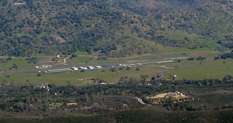
Mariposa-Yosemite Airport (IATA: RMY, ICAO: KMPI, FAA LID: MPI, formerly O68) is a public airport located four miles (6 km) west of the central business district of Mariposa, in Mariposa County, California, United States. It is owned by the County of Mariposa.
Contents
Although most U.S. airports use the same three-letter location identifier for the FAA and IATA, Mariposa-Yosemite Airport is assigned MPI by the FAA but the IATA assigned MPI to Mamitupo, Panama).
A flight to mariposa yosemite airport
Facilities and aircraft
Mariposa-Yosemite Airport covers an area of 100 acres (40 ha) which contains one asphalt paved runway (8/26) measuring 3,306 x 60 ft (1,008 x 18 m).
For the 12-month period ending March 2, 2007, the airport had 32,000 aircraft operations, an average of 87 per day: 94% general aviation and 6% air taxi. There are 52 aircraft based at this airport: 96% single engine, 2% multi-engine and 2% ultralight.
There is one FBO on the field, Airborrn Aviation Services.
World War II
During World War II, the airport was designated as Mariposa Air Force Auxiliary Field, and was an auxiliary training airfield for Merced Army Airfield, California.