
Type Highway | Length 458 km | |
 | ||
Route number(s) B79 (2013-present)Silver City Highway - NSW/Vic. Border A79 (1998-present)NSW/Vic. Border - Calder Freeway M79 (1998-present)south of Ravenswood SouthDuplexes: (1998-present)Bendigo - Harcourt State Route 40(Keilor - Niddrie) Formerroute number National Route 79 (? - 1998 / 2013)in Vic. / NSW respectively National Route 79 (? - 1998)Gisborne Bypass; Diggers Rest - Niddrie Freeway Route 90 (1975-1989)Keilor - Niddrie NW end Silver City HighwayCurlwaa, New South Wales Vic/NSW Border Major settlements Mildura, Ouyen, Charlton, Harcourt, Malmsbury, Kyneton, Woodend, Macedon, Gisborne, Diggers Rest, Sunbury Via Mildura, Ouyen, Charlton, Bendigo, Harcourt, Malmsbury, Kyneton, Woodend, Macedon, Gisborne, Diggers Rest, Sunbury Major cities Bendigo, Ouyen, Kyneton, Charlton | ||
Calder Highway is a highway in Australia, linking Melbourne in Victoria, to Bendigo and Mildura and the Victoria/New South Wales border on the way to Broken Hill. It continues through New South Wales to Broken Hill, Tibooburra and the New South Wales/Queensland border as the Silver City Highway, posted as route B79 as far as Broken Hill.
Contents
- Map of Calder Hwy Victoria Australia
- History
- Route
- Timeline of construction
- Calder Highway Calder Alternative Route intersection
- Western Ring Road to Kings Road
- References
Map of Calder Hwy, Victoria, Australia
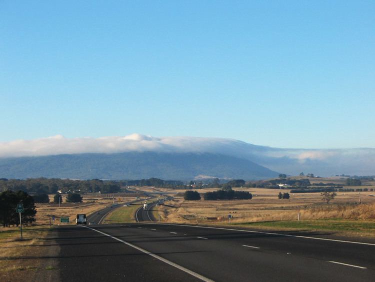
The highway is called the Calder Freeway south of Bendigo where it has been upgraded to freeway-standard, superseding sections of the original Calder Highway. It has been extended in phases from the southern end to Ravenswood South subsuming the older Calder Highway stretches. The Victorian Government completed the duplication of the Calder Highway from Melbourne to Bendigo to freeway conditions on 20 April 2009.
History
The Calder Highway was named after William Calder, who was chairman of the Country Roads Board (CRB) from 1913 to 1928. The CRB was renamed Victorian Road Construction Authority and is today known as VicRoads.
The highway was originally allocated a National Route 79 shield. With Victoria's conversion to the newer alphanumeric system in the late 1990s this was altered to an A79 designation for the highway portion, M79 designation for the freeway portion into Melbourne, and the New South Wales section allocated B79 in 2013.
Originally, the Calder Highway (an undivided highway) started at the end of Keilor Road in Niddrie. In the early 1970s the road was upgraded to freeway standard together with the Tullamarine Freeway, ending in Keilor East in suburban Melbourne and rejoining the Calder Highway. By the early 1980s the Freeway was extended to Keilor and then rejoined the Calder Highway. However, it was not until the 1990s that work began to duplicate the rest of the highway to Bendigo.
The Calder Highway between the Melton Highway and the Western Ring Road is shown in the 1969 Melbourne Transportation Plan as part of the F4 Freeway corridor, which extends past the Tullamarine Freeway and Bell Street to Templestowe.
Route
South of the Victoria/New South Wales border the highway is a two-lane, single carriageway in each direction, continuing through northwest Victoria from the Abbotsford Bridge, through Merbein to the major regional town of Mildura in the state's north-west. Here also it crosses the Sturt Highway (A20) leading to capital cities Adelaide heading west and Sydney heading east. Further south, it crosses the Mallee Highway (B12) at Ouyen and runs south-east eventually to Bendigo. Between Red Cliffs and Wycheproof the highway has a speed limit of 110 km/h.
The Calder Alternate Highway (A790) bypasses the Bendigo suburban area. Its southern end is just north of Ravenswood and the northern end is at Marong, west of Bendigo.
For most of its length from Ravenswood South to the junction with the Tullamarine Freeway in Melbourne, the Calder Freeway is a four lane dual carriageway freeway which bypasses the towns the old alignment of the highway used to serve. The Old Calder Highway has been designated C794 from where it leaves the new Calder Freeway at Ravenswood South.
The north-western end of the freeway is also duplexed with the A300 until south of Harcourt where the highway resumes south-westerly to the major regional centres of Castlemaine, Ballarat, and Geelong.
Towns bypassed by, but still accessible from, the Calder Freeway include: Harcourt, Elphinstone, Taradale, Malmsbury, Kyneton, Woodend, Macedon, Gisborne, and Diggers Rest.
It gains the State Route 40 shield at the Green Gully Road interchange in Keilor, which continues east onto the Tullamarine Freeway city-bound.
The freeway ends at the interchange with the Tullamarine Freeway, the main route from the central business district to Melbourne Airport. Continuing on the Tullamarine Freeway eventually brings vehicles onto CityLink, and thus, central Melbourne.
Within the urban section of the Calder Freeway (between Kings Road and the Tullamarine Freeway), the standard travel time, in each direction, is 10 minutes. (5 minutes between Kings Road and the Western Ring Road and 5 minutes between the Western Ring Road and the Tullamarine Freeway.
The usual peak period travel time, is between 9–13 minutes. However, when there is extreme congestion or roadworks, including being residual from an incident, the travel time can go beyond 13 minutes, sometimes upwards of 20 minutes plus.
Timeline of construction
Calder Highway / Calder Alternative Route intersection
The upgrade of the intersection of the Calder Highway and Calder Alternate Route at Ravenswood, is being funded jointly by the Victorian and Commonwealth Governments. It began construction in February 2016 with completion anticipated by the end of 2017.
Western Ring Road to Kings Road
In 2008, VicRoads completed the widening of the Calder Freeway from the Western Ring Road to Melton Highway. The road was widened from 2 lanes each direction to 3 lanes in each direction. The speed limit was reduced permanently from 100 km/h to 80 km/h. The 80 km/hr limit applies northbound from Keilor Park Drive to the Service Centre at Calder Park, and southbound it applies from the Green Gully Road bridge to just prior to the Western Ring Road interchange. In October 2010, it was announced that as part of a year long trial, the speed limit on this section of freeway will be increased back to 100 km/h in off-peak times (8pm-5am), with 30 variable speed limits{{subst:clarify}} to be installed along the stretch of freeway. As of 2011, the section combined with State Route 40 (or essentially Keilor Park Dve to Kings Road) is permanently signed at 80 km/h - with slight differences (as noted) inbound and outbound. A further upgrade completed in 2012 resulted in a new interchange at Kings Road (the freeways's urban / metropolitan limits) and closure of three at grade intersections in the area. Despite the upgrade the 80 km/h speed limit remains today.