
Population 1,288 (2011 census) Mean max temp Mean min temp Postal code 3525 | Postcode(s) 3525 State electorate(s) Ripon Elevation 117 m Local time Saturday 2:14 AM | |
 | ||
Weather 20°C, Wind SE at 11 km/h, 74% Humidity | ||
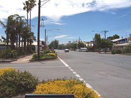
Charlton "The Friendly River Town", is a town in Victoria, Australia. It is a small agricultural community straddling the Avoca River, located at the junction of the Calder Highway (A79) and Borung Highway (C239) and positioned in the last of the foothills of the Great Dividing Range. Its location, almost halfway between Melbourne and Mildura, makes Charlton a popular stop along the way for tourists.
Contents
- Map of Charlton VIC 3525 Australia
- History
- Demographics
- Economy
- Transport
- Climate
- Facilities
- Recreation and tourism
- Events
- References
Map of Charlton VIC 3525, Australia
History
The original inhabitants of the region were the Jaara Aborigines. After extensive travels throughout the region by Major Thomas Mitchell, settlement by Europeans occurred in 1848 when Robert Cay and William Kaye established a station and named the region after a town in Greenwich, England. Unlike many other towns in the region, Charlton was not established as a result of gold mining, but for pastoral purposes and the proximity to a permanent water supply (the Avoca River). The original town was named East Charlton due to its location on the eastern banks of the Avoca River, and the fact that another town in the Victoria was named Charlton (renamed Chute in 1879). The East Charlton Post Office opened on 21 December 1876 (renamed Charlton in 1879) replacing an earlier (1854) office nearby named Yowen Hill.
The first bridge to cross the river was erected in 1867 by James Paterson, allowing for expansion on both sides of the river. Throughout the history of Charlton, the Avoca River has been known for its spontaneous flooding after heavy rain showers, resulting in many floods that often surrounded the town or on rare occasions flooded the town. Levee banks were constructed to their present levels in the 1950s, however parts of the town were flooded in September 2010. Minor flooding occurred again in December 2010, with the highest ever recorded flood level inundating the town in January 2011, with some homes within the town having more than 3 feet of water above floor level.
One of the town's most prominent landmarks is the former hotel, the "Vale of Avoca", which was built on the site of an early bark hut inn by James & Elizabeth Egan in 1879. Built on a reef of stone, Mrs Egan named the building as being in the 'vale' or valley of the nearby Avoca River. It was delicensed as a hotel in 1942, restored in the 1990s and currently operates as a Bed and Breakfast.
The first issue of the local newspaper, the Tribune was published on 20 May 1876, the founders being H. T. Henningsen and his step-son, R. M. Klunder. For many years the Tribune was published twice weekly — Wednesdays and Saturdays — but during the Second World War shortage of staff and paper necessitated the change to a weekly paper. In 1925 the business was purchased by Messrs Hogan and Gardiner and then followed other proprietors, Herbert Davies and John S. Richardson, and by his widow, Rena M. Richardson, after his death in 1954. In February 1960, Rena Richardson married William Wood and in 1961 she sold the Tribune to Ian and Coral Cameron. In 1981, the newspaper was sold by the Camerons to the St. Arnaud Mercury and the Mercury and the Tribune were combined to become the North Central News.
Demographics
Charlton is the second largest town in the Shire of Buloke. At the 2011 census, its "state suburb" population, which includes some surrounding areas, was 1,288. Its "urban centre" population in 2011 was 968, down from 1,072 at the 2006 census. Government department downsizing in addition to regional economic decline led to the largest percentage decline in population within Victoria between the mid-1980s and the mid-1990s with an estimated 18.3% loss in population. Recent agricultural developments (such as the AWB Limited facilities), a sharp increase in house prices within larger urban areas, in addition to economic recovery, have resulted in a shift towards stabilisation and a subsequent increase in population.
Economy
The economic backbone of Charlton exists almost entirely in agriculture and services. Massive silos dominate the skyline, evidence of the town's rich history in various grains including wheat, oats and barley. Sheep and cattle farming are also prolific with the largest beef feedlot in the state, situated in Yeungroon just south of the town. Recent additions to the region, including an olive farm and winery have diversified the town's agricultural applications.
Major employers in the Charlton area are:
Transport
Charlton has various public transport connections to Melbourne, one being a V/Line coach service serving the town (and others) to Melbourne. Charlton used to have its own railway station on the Kulwin line, although a bare platform remains and no passenger services operate on the line. The line only carries wheat trains.
Climate
Charlton enjoys a Mediterranean style climate, with long hot summers and mild wet winters. Deep blue skies are regular throughout much of the year as are crystal clear starry nights. Charlton's January average max/min temperatures are 30.4 °C (86.7 °F)/13.8 °C (56.8 °F) and July average max/min temperatures are 13.4 °C (56.1 °F)/3.4 °C (38.1 °F). Annual precipitation is 430.8 mm (16.96") (Source: Bureau of Meteorology [1]).
Facilities
Charlton's central location to the North Central region has resulted in the town being the beneficiary of considerable services not typically associated with such small localities.