
Type Freeway Length 13 km | Opened 1965-1979 | |
 | ||
Formerroute number Freeway Route 81 (1970-1989)Flemington Road-Sunbury Road State Route 40 (1970-1989)Calder Freeway-Sunbury Road National Route 79 (? - 1998)Calder Freeway-Flemington Road Southeast end CityLink (M2/State Route 43), Pascoe Vale, Melbourne | ||
Melbourne airport to city via bolte bridge tullamarine freeway breakshift throughout the fall
The Tullamarine Freeway is a major urban freeway in Melbourne, linking Melbourne Airport to the central business district. It carries up to 200,000 vehicles per day and is one of Australia's busiest freeways. The entire stretch of the Tullamarine Freeway bears the designation State Route 43 duplexed with M2. The freeway was originally shown in the 1969 Melbourne Transportation Plan as part of the F14 Freeway corridor.
Contents
- Melbourne airport to city via bolte bridge tullamarine freeway breakshift throughout the fall
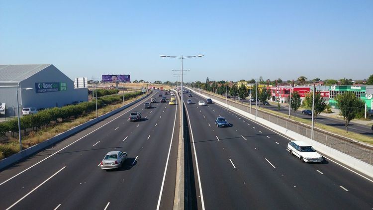
- Map of Tullamarine Fwy Victoria Australia
- History
- Timeline of construction
- Citylink Tulla Widening
- Stage 1 Bulla Road to Power Street
- Stage 2 Melbourne Airport to Bulla Road
- Extra Lanes
- References
Map of Tullamarine Fwy, Victoria, Australia
History
The Tullamarine Freeway is one of the oldest freeways in Melbourne. The first stage of construction was completed in the financial year 1965/66 between Mickleham Road and "the Tullamarine Jetport Terminal area" (Melbourne Airport), with the initial 7.2-kilometre (4.5 mi) section between Melbourne Airport and Lancefield Road at Essendon Airport officially opening early 1968. This section was originally referred to as the "Tullamarine By-pass Road". From Essendon, a new section heading east to Pascoe Vale and then south along the Moonee Ponds Creek to Mt Alexander Road, Flemington was opened to traffic in 1970. This new section replaced Mount Alexander Road as the main route to the city. In 1979, the section of Lancefield Road running along the western edge of Essendon Airport was upgraded to freeway standard, completing the freeway.
The freeway was initially designated F81 for the whole stretch from Tullamarine to Flemington. The freeway was originally designated in the 1969 Melbourne Transportation Plan as the F14 Freeway corridor.
With its completion, city-bound heavy vehicles from Hume Highway were diverted here via Pascoe Vale Road. In the 1990s, the completion of the Western Ring Road increased traffic tremendously. It was only relieved by the completion of CityLink, widening the freeway to 8 lanes (two of these being transit lanes) and extending it south to the West Gate Freeway. The improved sections are now tolled.
The freeway is used by Skybus Super Shuttle services to Melbourne Airport, and in 2002 the Victorian government contributed $3 million to a $10 million plan to expand and improve these services, after a feasibility study into an airport rail link found the number of passengers using a train would not make the scheme economically viable.
The Calder Freeway interchange was completed earlier than expected in mid-2007, which underwent dramatic roadworks to alleviate congestion. All works are now complete, with the end result being the decommissioning and removal of two off-ramps, an additional two lanes inbound, and dedicated Bulla Road-Calder Freeway spurs to eliminate weaving, notorious for many accidents in the area.
Another project now completed is a new bridge and northern entrance to the Essendon Airport through the interchange of Melrose Drive, to provide easy access for the people living in the northern suburbs to access the Essendon Airport district.
Timeline of construction
Currently the official start of the freeway is at Pascoe Vale Road, as the original southern sections was upgraded in the late 1990s as part of CityLink. Here it is a three lane, high quality dual carriageway, running along the south side of Essendon Airport and the Direct Factory Outlets shopping complex, the former main airport of Melbourne. At the Calder Freeway interchange, staying to the right will lead you to the next section of the Tullamarine Freeway.
The next section is quite narrow, with two lanes running either way and a concrete barrier (later grass and shrubbery) in the middle of the road. Melrose Drive runs alongside its airport-bound side. This section is frequently congested due to the combination of freight traffic from the Hume Highway, which is accessed from the Western Ring Road interchange, and the traffic from the airport. After the ring road interchange, the traffic is slightly better, leading to the Melbourne Airport off ramp, after which the freeway ends.
The travel time on the Tullamarine Freeway in both directions, is 16 minutes. (Inbound: 4 minutes between Melbourne Airport and the Western Ring Road, 5 minutes between the Western Ring Road and Bell Street and 7 minutes between Bell Street and the West Gate Freeway. Outbound: The exact same, except 8 minutes from the West Gate Freeway to Pascoe Vale Road and 3 minutes from the Western Ring Road to Melbourne Airport).
The usual peak period travel time is between 19–30 minutes. It is usually around 19 minutes for the majority of the daylight hours inbound, because there is only one lane to merge with the West Gate Freeway city bound, hence slowing traffic over the Bolte Bridge section. However, during times of extreme congestion, including being residual due to an incident, the travel time can well exceed half an hour.
Citylink-Tulla Widening
In August 2015 a proposal to Widen the Citylink and Tullamarine Freeway was put in order which consists of 2 Stages which would increase the road's daily capacity as well as shorten trips between Melbourne Airport and The CBD During Morning Peak and Afternoon Peak Times. The following upgrades will be put into action when Roadworks for Stage 1 start in October 2015 and Stage 2 in May 2016. The entire project is expected to be complete by late 2018.
Stage 1 (Bulla Road to Power Street)
Stage 2 (Melbourne Airport to Bulla Road)
Extra Lanes
Part of The Upgrade is Adding More Lanes between Melbourne Airport and the West Gate Freeway. Between The Citylink (Western Link) and The West Gate Freeway One additional lane in each direction will be added consuming the current emergency lanes as well as lower the current speed limit from 100 km/h down to 80 km/h which sparked major controversy in the public. New Emergency Stopping Bays Similar to the Monash Freeway's Emergency Stopping Bays will be provided where Possible.