
Type Highway | Length 959 km | |
 | ||
Route number(s) National Highway A20Gawler – SA/Vic. Border National Highway A20SA/Vic. Border – Vic./NSW Border National Highway A20Vic./NSW Border – Hume Motorway | ||
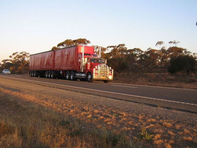
The Sturt Highway is an Australian national highway in New South Wales, Victoria, and South Australia. The Sturt Highway is an important road link for the transport of passengers and freight between Sydney and Adelaide and the regions situated adjacent to the route.
Contents
- Map of Sturt Hwy Australia
- Route
- South Australia
- Significant route changes
- Victoria
- Major river crossings
- References
Map of Sturt Hwy, Australia
Initially an amalgam of trunk routes, the 947-kilometre (588 mi) Sturt Highway was proclaimed a state highway in 1933 and was named in honour of Captain Charles Sturt who explored the area in 1829 and opened it up for agriculture. In 1955, the Australian Government gazetted the highway as a national route and upgraded as a national highway in 1992, forming the Sydney-Adelaide Link. The Sturt carries the National Highway 20 shield for its entire length, the majority of which is a single carriageway and freeway standard and 6-lane arterial road standard towards its western terminus, north of Adelaide.
Route
The highway runs generally east-west, roughly aligned to the Murrumbidgee River in New South Wales, then, following that river's confluence with the Murray River, aligned to the Murray in north-western Victoria and eastern South Australia, generally towards the northern outskirts of Adelaide. The highway is the shortest and highest standard route between Sydney and Adelaide.
The eastern terminus of the Sturt Highway is at a junction with the Hume Highway at Tarcutta, near Gundagai. Heading west, the Sturt passes through the city of Wagga Wagga and the towns Narrandera, Darlington Point, Hay, Balranald, Euston, leaving NSW by crossing the Murray River into Victoria from Buronga to Mildura. The highway continues more or less due west through the northwest of Victoria before entering South Australia. This section of road was built in 1927 as part of the Murray Valley Road to provide a shorter, and all-weather, road connection between Mildura and Renmark. In South Australia, the Sturt Highway passes Renmark, Monash, Barmera, Waikerie, Blanchetown, Nuriootpa and Gawler where it reaches its western terminus, although Gawler is bypassed.
The original route of the highway, proclaimed in 1938, took a course from Wentworth to Renmark, on the northern side of the Murray River.
The highway carries the National Highway shield A20 on its entire route. At its western terminus, the route changes to the M20 on the Max Fatchen Expressway and continues from the Gawler Bypass Road south towards the A1. At its eastern terminus, the route changes to the M31 on the Hume Motorway.
South Australia
None of the Sturt Highway was originally constructed as dual-carriageway, however work commenced in January 2007 to upgrade the highway to two lanes each way dual carriageway between the Gawler Bypass and Greenock in the Barossa Valley. The project was completed in 2010 with budget savings directed towards further Sturt Highway improvements.
The Northern Expressway, renamed as the Max Fatchen Expressway in 2013, was built at the south-western end of the Sturt Highway, extending Route A20 by 22 km from Gawler southwest to meet Port Wakefield Road (National Route A1) at Waterloo Corner as part of an AusLink/South Australian Government project to build a new dual-carriageway/freeway standard road as part of the North–South Corridor project. This will provide better access for road transport to Port Adelaide and the industrial areas west and northwest of the city. Now completed this has essentially made the Sturt Highway dual-carriageway/freeway standard between Adelaide and the Barossa Valley.
Other projects in South Australia include: a number of overtaking lanes have also been added in recent years to help make it safer with the high volume of traffic. Major 'S'-bend curves near Waikerie were realigned, and further upgrades to the road were performed up to 2012.
Significant route changes
The original route of the Sturt Highway in the Riverland passed through Berri and Glossop instead of the current route through Monash. The former alignment is now known as the Old Sturt Highway, route B201. The original route also passed through the middle of the Barossa Valley along what is now the Barossa Valley Way. This first changed to a route passing to the north of Nuriootpa around to the north and west of Gawler on the Gawler Bypass Road and Main North Road to Gepps Cross. It later changed to use the Max Fatchen Expressway instead. The more recent road duplication led to it bypassing Daveyston and Shea-Oak Log instead of passing through these small towns.
Victoria
There is also the proposed Mildura Truck Bypass, to be funded by Auslink 2.
Major river crossings
From east to west, the Sturt Highway follows much of the course of the Murrumbidgee River, on its southern banks, from the Sturt's eastern terminus with the Hume Motorway. At Balranald the Sturt Highway crosses the Murrumbidgee, carrying the highway to the north of the river via the Balranald Bridge. To the west and south-west, the Sturt Highway crosses the Murray four times; between Buronga and Mildura, carrying the highway to the south of the Murray over the George Chaffey Bridge, a high concrete-girder bridge that was opened in 1985; between Paringa and Renmark, carrying the highway to the north of the Murray over the Paringa Bridge, a lift-span bridge which used to have a railway through the middle as well as the road carriageway on each side; between Cobdogla and Kingston On Murray, carrying the highway to the south of the Murray over the Kingston Bridge, a high bridge from an embankment on the right bank to the cliffs on the left bank; and at Blanchetown, carrying the highway from east to west over the Murray (as the river flows south) over the Blanchetown Bridge, another high bridge to cliffs on the river's western bank.
The bridge at Blanchetown was originally opened in 1964. It replaced cable ferries, and was itself replaced in 1998 in response to concern about its ability to continue to carry B-double trucks. The bridge at Kingston On Murray was opened in 1973 also replacing a very busy ferry crossing.