
Area 5,237 km² | Time zone EST (UTC-5) Area code 705 | |
 | ||
Postal code FSA P0A 1C0, P0A 1J0, P0A 1L0, P0A 1M0, P0A 1P0, P0A 1X0, P0A 1Y0, P0A 1Z0, P0H 1A0, P0H 1H0, P0H 1J0, P0H 1N0, P0H 1S0, P0H 1W0, P0H 1Z0, P0H 2L0, P0H 2R0 | ||
almaguin highlands thisiswhywereawesome
The Almaguin Highlands Region (colloquially known as Almaguin, also referred to as 'the Highlands') in Ontario, Canada, covers approximately 5,200 km2 (2,000 sq mi) comprising the eastern half of Parry Sound District. It is bounded by Muskoka in the south, and by Lake Nipissing and Nipissing District in the north. The eastern edge abuts the western boundary of Algonquin Provincial Park, whereas the western boundary of the Almaguin Highlands is generally regarded to be the mid east-west point of Parry Sound District. Originally derived from the words, Algonquin, Magnetawan, and Seguin. Almaguin is now used to describe the marketing region of East Parry Sound.
Contents
- almaguin highlands thisiswhywereawesome
- Subdivisions
- Outlying areas
- Demographics
- Geography
- Armour
- Ballantyne
- Callander
- Joly
- Kearney
- Laurier
- Loring Port Loring and District
- Lount
- Machar
- Magnetawan
- McMurrichMonteith
- Nipissing
- Perry
- Powassan
- Restoule
- Ryerson
- Strong
- Rivers
- Highways
- Rail
- Air
- Economy
- Politics
- Education
- Near North District School Board
- Nipissing Parry Sound Catholic District School Board
- Healthcare
- Information Centre
- Activities
- Museums
- Provincial parks
- Notable people
- References
Subdivisions
The region includes fifteen incorporated municipalities, three local service boards (LSB) across eight unincorporated geographic townships, and one unincorporated geographic township without a local services board, which can be grouped into three subregions.
Outlying areas
Demographics
According to the Canada 2011 Census, there are 23,570 residents living in the Almaguin Highlands, accounting for approximately 56% of the population of the District of Parry Sound (population 42,162 in 2011). By comparison, the Almaguin Highlands has a larger population than that of Haliburton County (population 17,026 in 2011) by over 6,500 residents, and encompasses an area approximately the same size.
Geography
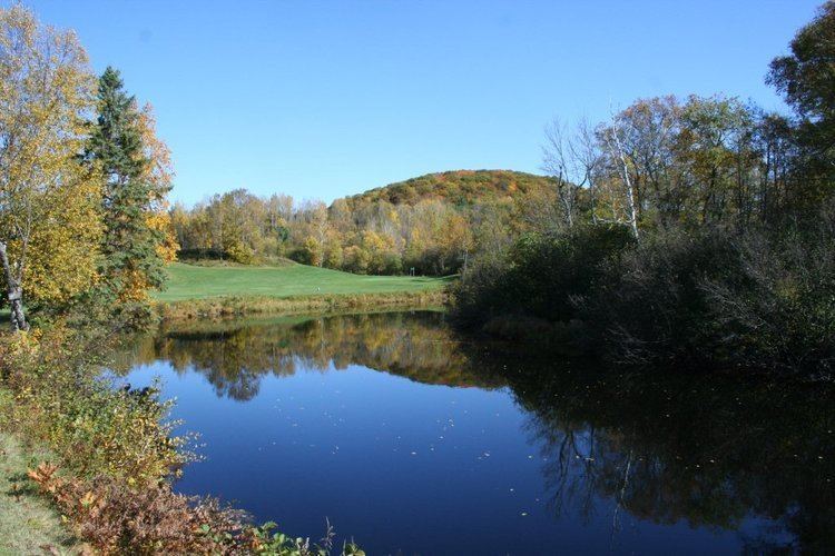
The Almaguin Highlands are the westerly extension of the Algonquin Highlands of Central Ontario and form part of the Canadian Shield geological formation. Almaguin is situated in the Eastern forest-boreal transition ecoregion, which is predominately mixed woodlands, while the topography is hilly and dotted with crags, and interspersed with hundreds of lakes and rivers.
Armour
Ballantyne
Callander
Joly
Kearney
Laurier
Loring, Port Loring, and District
Lount
Machar
Magnetawan
McMurrich/Monteith
Nipissing
Perry
Powassan
Restoule
Ryerson
Strong
Rivers
Several rivers flow through the region and they include; Amable du Fond River, Magnetawan River, Mattawa River, Pickerel River and Restoule River
Highways
Rail
Air
Economy
The economy of the Almaguin Highlands is centred on its agricultural base and the businesses that are associated with this sector. There exists a small forestry sector, however, like much of the forestry sector in Ontario, it is in decline. Mining and aggregates form part of the local economy as well. The service industry in the region mainly consists of resorts and lodges that focus on family vacationing and fishing. The local economy depends heavily on and is focused on its tourism sector. Some of the largest employers of Almaguinites are construction contractors, as a result of the expansion of Highway 11 through the region starting in the late 1980s and finishing in 2012.
Municipalities in the region have formed economic development associations to promote, attract, and develop business in the region. These include, among others, the Central Almaguin Economic Development Association and the Almaguin Highlands Economic Development Partnership Committee.
Politics
Historically, the entire region was part of the Parry Sound—Muskoka federal electoral district and the Parry Sound—Muskoka provincial riding. With the 1996 readjustments of the federal riding boundaries, and the subsequent pairing of them at the provincial level, Callander (then North Himsworth), the Township of Nipissing, and Powassan (then the Town of Powassan, the Township of South Himsworth, and the Town of Trout Creek) were transferred to the federal riding of Nipissing (now Nipissing—Timiskaming) and provincial riding Nipissing.
Education
Public education is administered by the Near North District School Board through ten elementary schools and one secondary school, while separate Catholic education is administered by the Nipissing-Parry Sound Catholic District School Board through two elementary schools.
Near North District School Board
Nipissing-Parry Sound Catholic District School Board
Healthcare
Family Health Teams are located at health centre's in both Powassan and Burk's Falls, a medical clinic is located in Callander, and a nursing station is located in Loring. There are two ambulance stations, one in Powassan and the other in South River. However, there are no emergency medical facilities in the region. Hospitals in Parry Sound, Huntsville, and North Bay, all of which are located outside of the Almaguin Highlands, are utilized in emergency situations.
The region is served by the Almaguin News, a weekly newspaper published in the Highlands.
Information Centre
The Almaguin Highlands are serviced by an information centre located near Emsdale along Ontario Highway 11 at the south end of the region.
Activities
Tourism activities include ATVing, camping, fishing, geocaching, hiking, horseback riding, hunting, mountain biking, snowmobiling, and other outdoor pursuits. There are numerous beaches located in the Highlands, including those found on Doe Lake, Eagle Lake, Lake Bernard, and Restoule Lake, to name a few. In addition to the beaches, there are many trails that can be found in the Almaguin Highlands, including the historic Nipissing-Rosseau Colonization Road, part of the Forgotten Trails.
The Almaguin Highlands experiences an increase in population during the summer months as a result of cottagers and other outdoor enthusiasts arriving in the region, and many of the businesses in the area are geared toward the tourism industry. In addition to the summer amenities, the winter getaway industry is growing in the Highlands.
Museums
There are six museums located in the Highlands: Callander Bay Heritage Museum in Callander; Clark House Museum in Powassan; Commanda Heritage Centre (Commanda General Store) in Commanda (Gurd), Nipissing Township; Emsdale Pioneer Museum in Perry Township; Magnetawan Heritage Centre in Magnetawan; and, Nipissing Township Museum in Nipissing Village.
Provincial parks
There are two provincial parks located within the Almaguin Highlands: Mikisew Provincial Park, and Restoule Provincial Park. In addition, the Almaguin Highlands acts as a portal to western Algonquin Park at the access points of Kawawaymog (Round) Lake Access; Tim River Access; Magnetawan Lake Access; and Rain Lake Access.
Notable people
Peter Camani is a retired teacher, Almaguin Highlands Secondary School. He is also an artist and sculptor who has created Midlothian Castle, an unusual residence, castle, and sculpture garden on an old farm near Burk's Falls. His artwork can be found at the Vatican and Buckingham Palace and Midlothian Castle has been featured on several television shows.
Hawksley Workman is a rock singer-songwriter who has garnered critical acclaim for his blend of cabaret pop and glam rock. He was born in Huntsville and attended Almaguin Highlands Secondary School and later moved to Toronto.